Utah’s Five National Parks
Utah is home to five amazing national parks and I spent five weeks last spring touring them all. I was struck by their diversity, considering they’re all in the southern half of the state. They each feature fascinating rock formations but they’re different at each park. I started in southwest Utah at Zion and moved eastward to end at Arches.
ZION NATIONAL PARK – Apr. 8-15, 2021
On April 8, I arrived at the KOA campground near Hurricane, Utah. From here, it was a 33-mile drive to Zion National Park. Many national parks are dealing with overwhelming crowds this year and an inability to accommodate everyone so some have resorted to selling tickets for specific days of entry. This is in addition to the usual entry fees. At Zion, they were not allowing visitors to drive into the park but to park at the visitor center and take a shuttle bus to various stops along the park road.
I was only able to enter the park on one day of my week-long stay but I found plenty of other places to go. The park has two other little-known roads with limited access to remote areas of the park. Neither gets you to the main park drive but they offer beautiful scenery, nonetheless. There is also the Red Cliff Conservation Area across the interstate from the campground where I found some nice hiking trails.
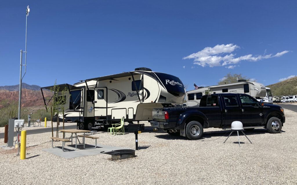
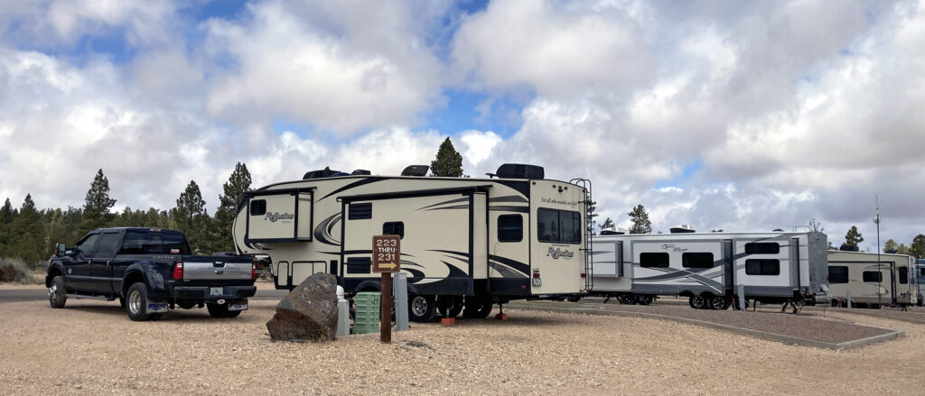
My campsite at Hurricane KOA. You can see Red Cliff Conservation Area in the background on the left.
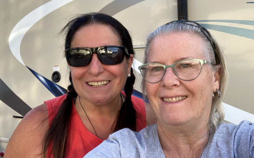
I made friends with fellow full-timer Christine at the campground.
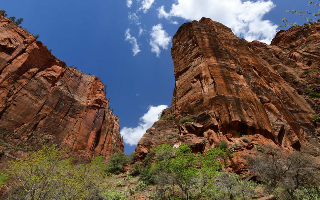
Kalob Canyons Road
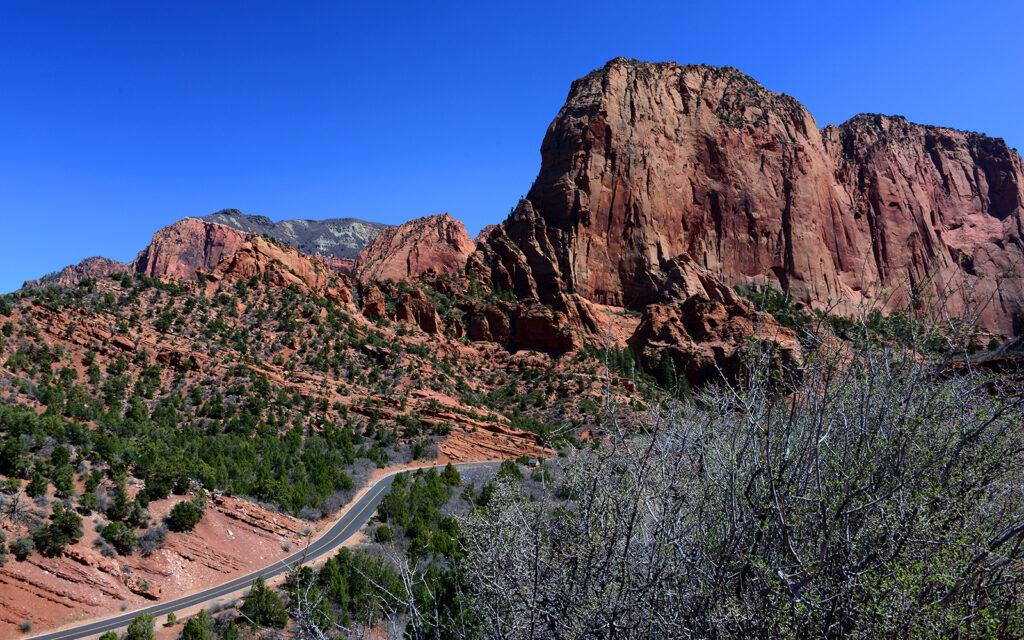
Twenty miles north of my campground on I-15 is Kolob Canyons Road, which offers a scenic five-mile drive into the northern part of Zion National Park.
View along Kolob Canyon Road in northern Zion National Park.
Zion
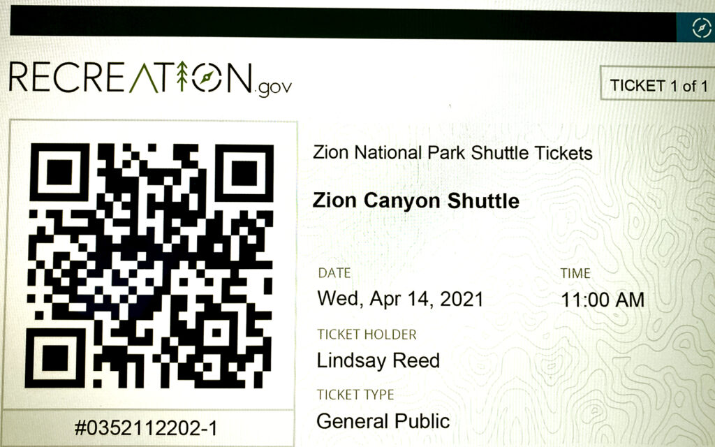
My ticket to enter Zion National Park and utilize the shuttle bus. I also needed to show my park pass for entry.
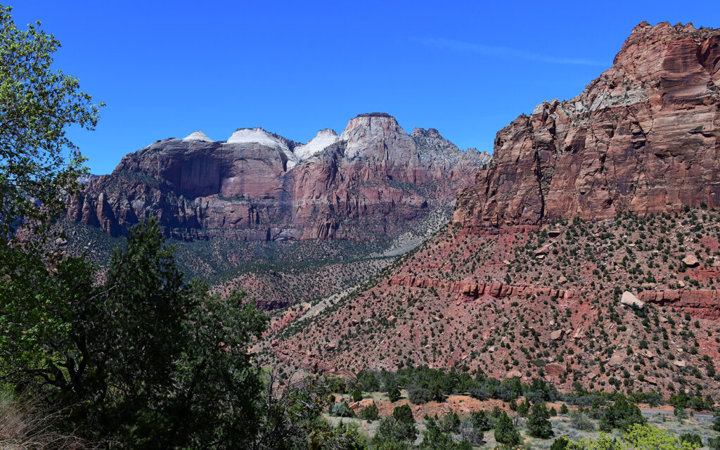
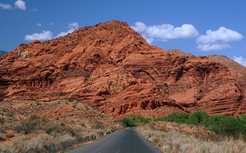
Scene from the road leading to Zion National Park.
I hiked for two hours on the Kayenta Trail and had lunch at this overlook.
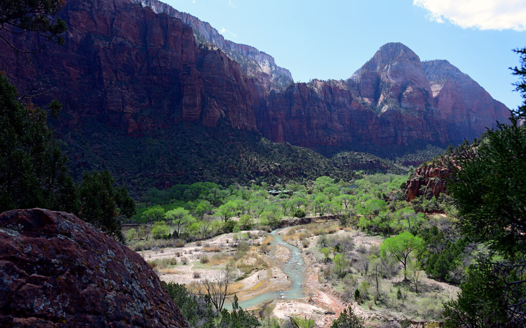
The view from behind the visitor center.
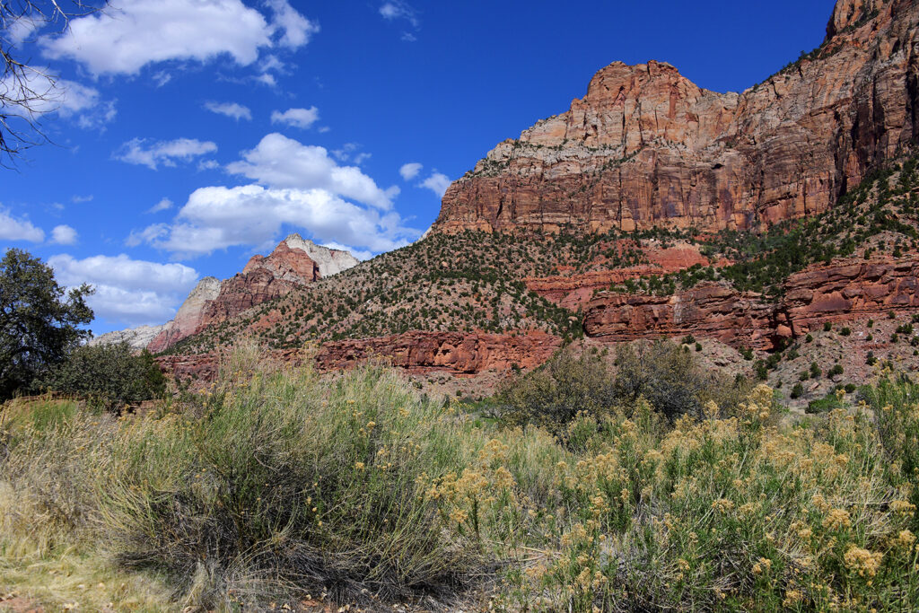
More hiking.
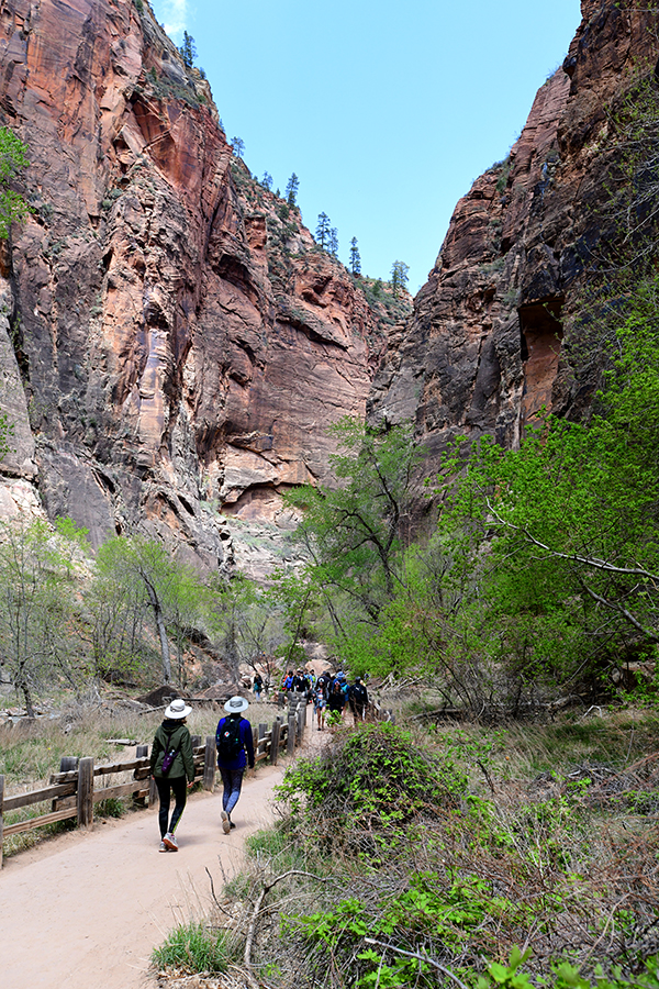
The Riverside Walk takes visitors to The Narrows, a tall, narrow river canyon where hikers must enter the water to continue their trek.
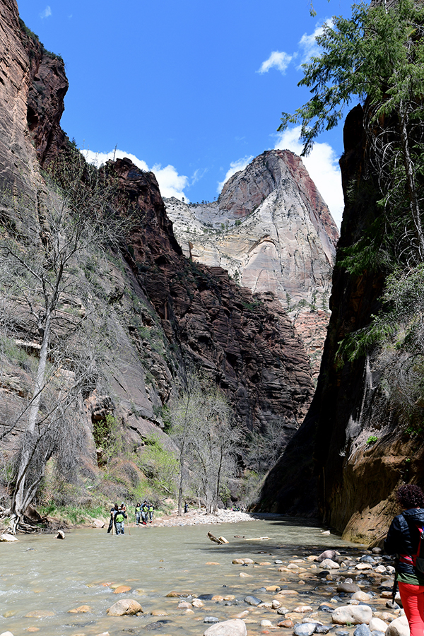
Hikers exiting The Narrows wearing special wet suits the park rents for this hike due to the cold water temperature. This can be a very dangerous hike due to unpredictable storms that can cause the river to change into a raging torrent. In September 2021, a storm changed the river flow from 52 cubic feet per second to 4000 and a hiker drowned.
Another alternate route to see more remote areas of the park is by way of Kolob Terrace Road. I drove twenty miles up this road before turning around when I reach an area that did not allow vehicles as big as my F-350 dually.
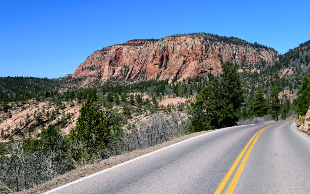
Kolob Terrace Road
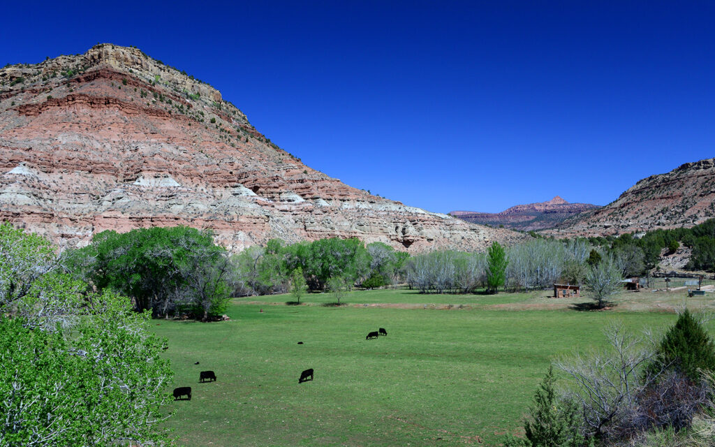
A cattle ranch on Kolob Terrace Road.
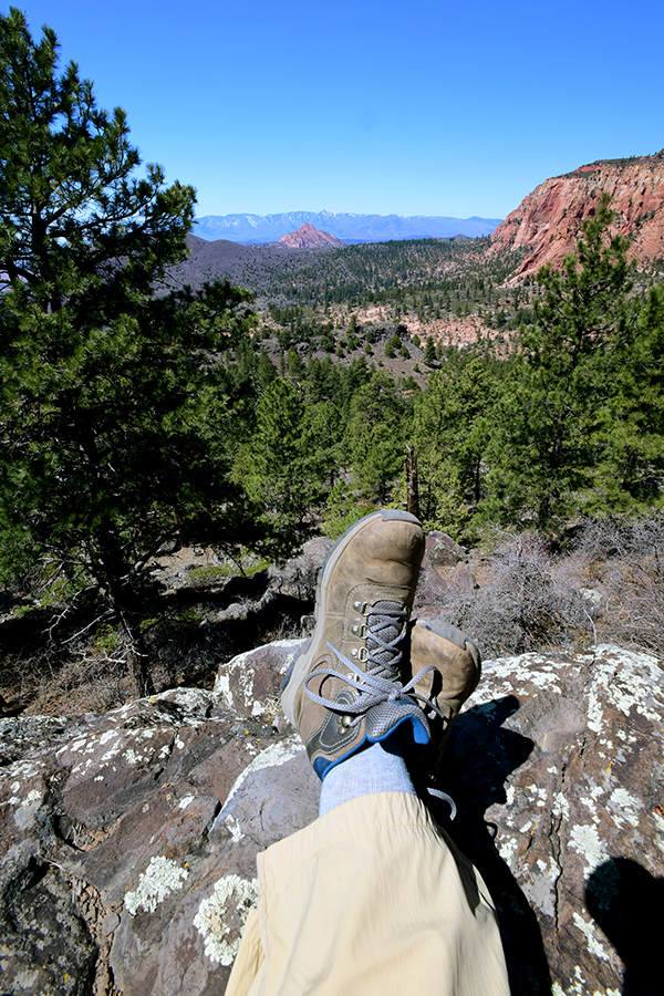
I took my lunch break at the edge of this cliff. What a view!
On the west side of I-15, directly across from my campground was Red Cliff Conservation Area with several hiking trails.
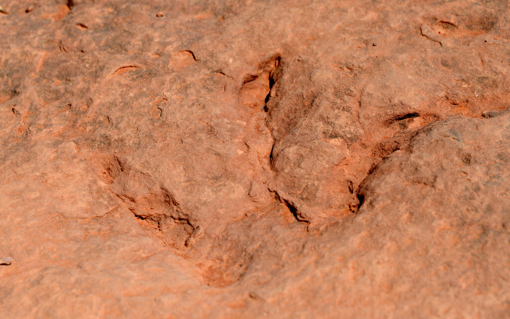
There are several dinosaur footprints left in stone.
BRYCE CANYON NATIONAL PARK – Apr. 15-23, 2021
On April 15, I moved to Bryce Canyon National Park and stayed a week at Ruby’s Inn RV Park. Bryce Canyon is a very easy park to get around. There’s only one entrance and one road through the park with well-marked side roads to the numerous scenic overlooks.
My spacious end site at Ruby’s Inn RV Park, just outside the entrance to Bryce Canyon National Park.
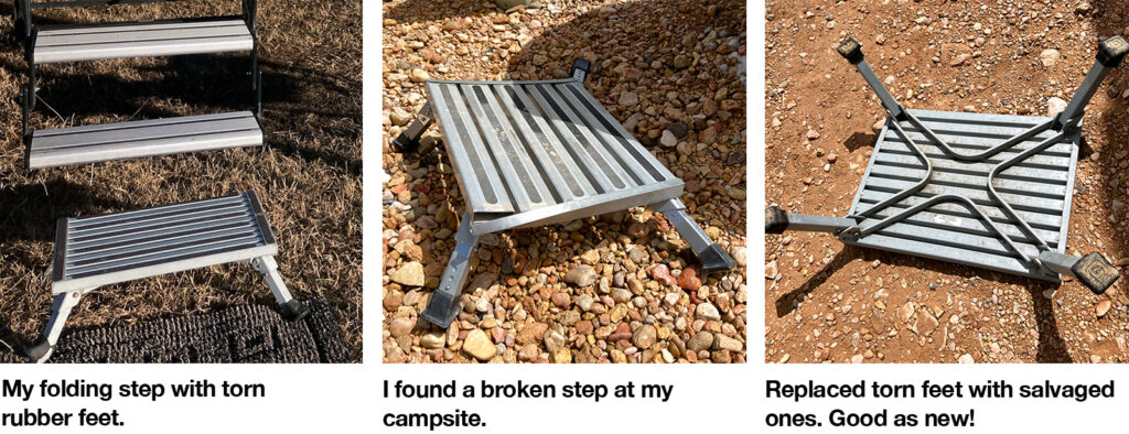
I have an auxiliary step that I use when my bottom step is too high (almost always) for comfort. It’s so well-used that the rubber feet had split and wouldn’t stay on anymore. I was planning to look online for replacement ones when I discovered an identical step left behind at my campsite because the legs were broken. The rubber feet, however, were in perfect condition so I used them to replace mine then tossed the broken step in the dumpster. Normally I hate when campers don’t leave their site clean and I’m surprised the staff hadn’t gotten rid of it but it worked to my advantage so I won’t complain.
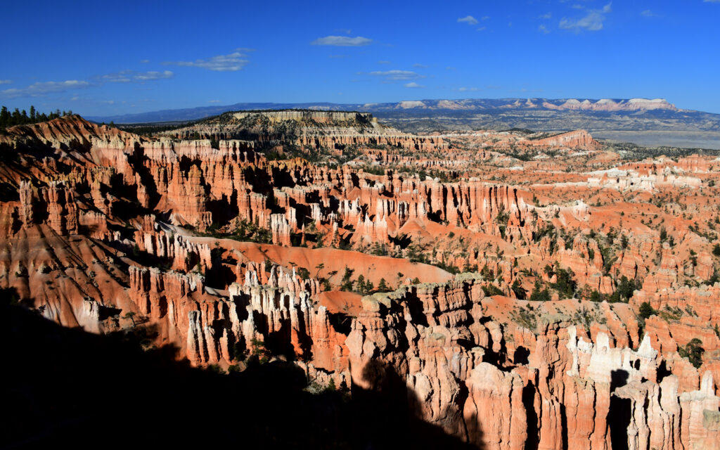
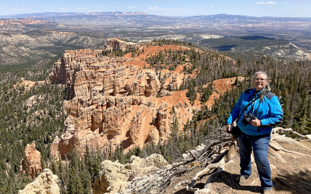
Bryce Canyon is a truly unique place with other-worldly rock spires called “hoodoos” that are so fascinating I’d say this is my favorite Utah park. There were no entry restrictions and I visited the park four times, choosing different times of the day for a change in lighting conditions. I found afternoons to be the best time to visit since all the viewing areas face east.
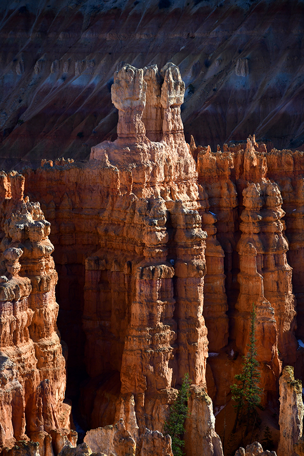
These bizarre rock formations are known as “hoodoos.”
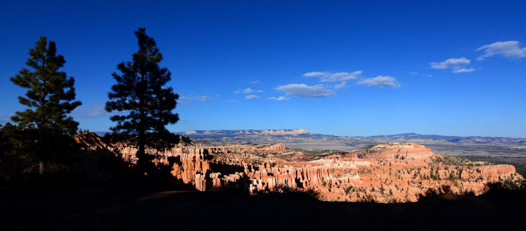
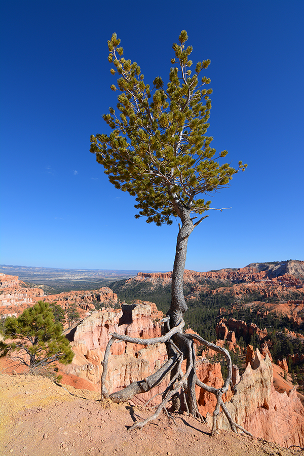
Trees have a difficult time growing in this environment. Those that do have developed unique ways to survive.
On my drive to Torrey, Utah for my next stop at Capitol Reef National Park, I came upon the boyhood home of Butch Cassidy with a couple of well-preserved buildings and a picnic area. There is a spacious parking lot that includes designated RV spots.
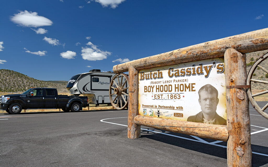
Easy RV parking at this free roadside attraction near Panguitch, Utah.
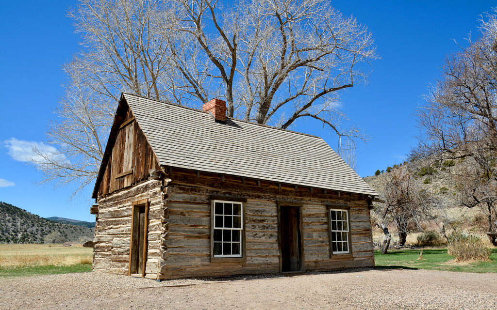
The house where Butch Cassidy grew up.
CAPITOL REEF NATIONAL PARK – Apr. 23-30, 2021
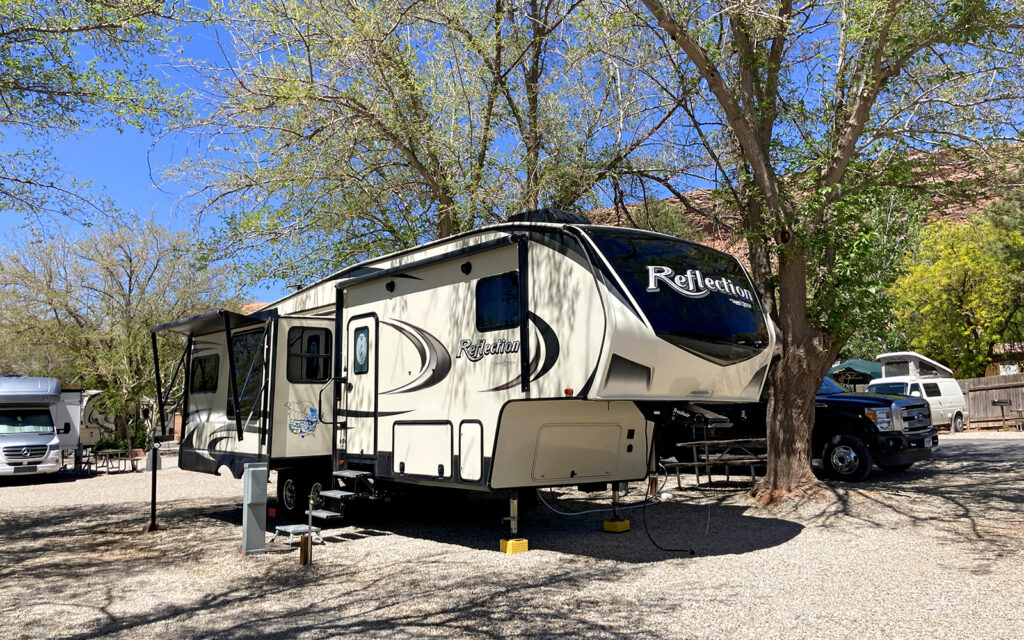
On April 23, I moved to Torrey, Utah, and the Thousand Lakes RV Park, although I didn’t see any lakes. This campground put me just a couple of miles outside Capitol Reef National Park.
My site at Thousand Lakes RV Park n Torrey, Utah.
Foggy morning behind the RV Park after a light snowfall.
There were no entry restrictions at Capitol Reef National Park, making it easy to drive through a few times during the week.
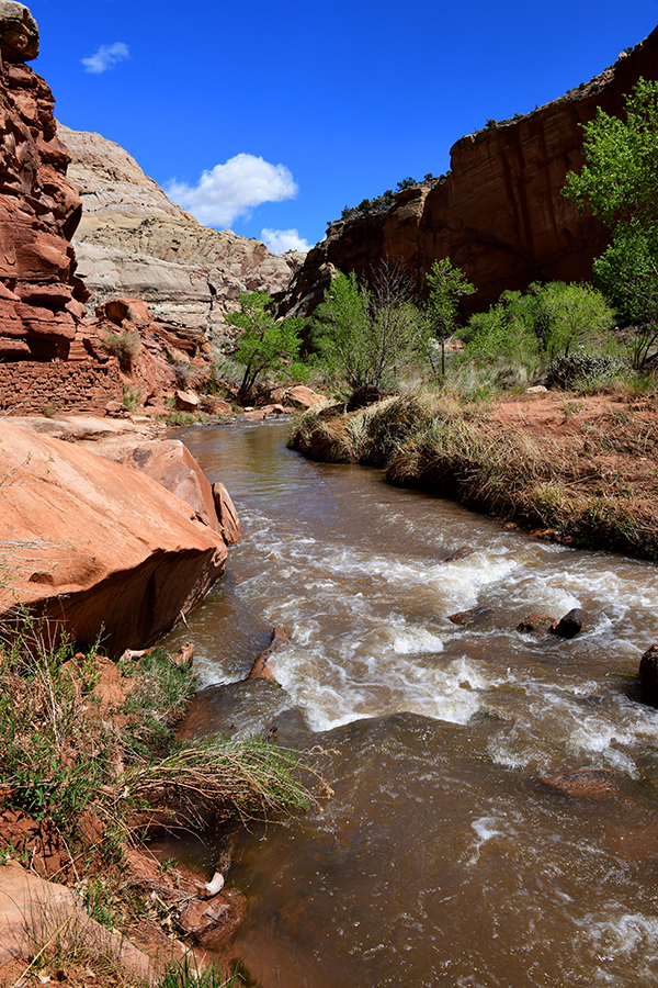
The Fremont River in Capitol Reef National Park.
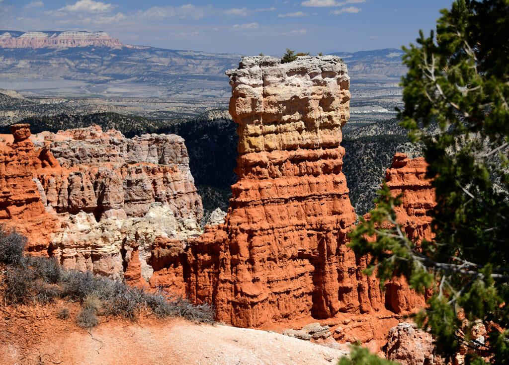
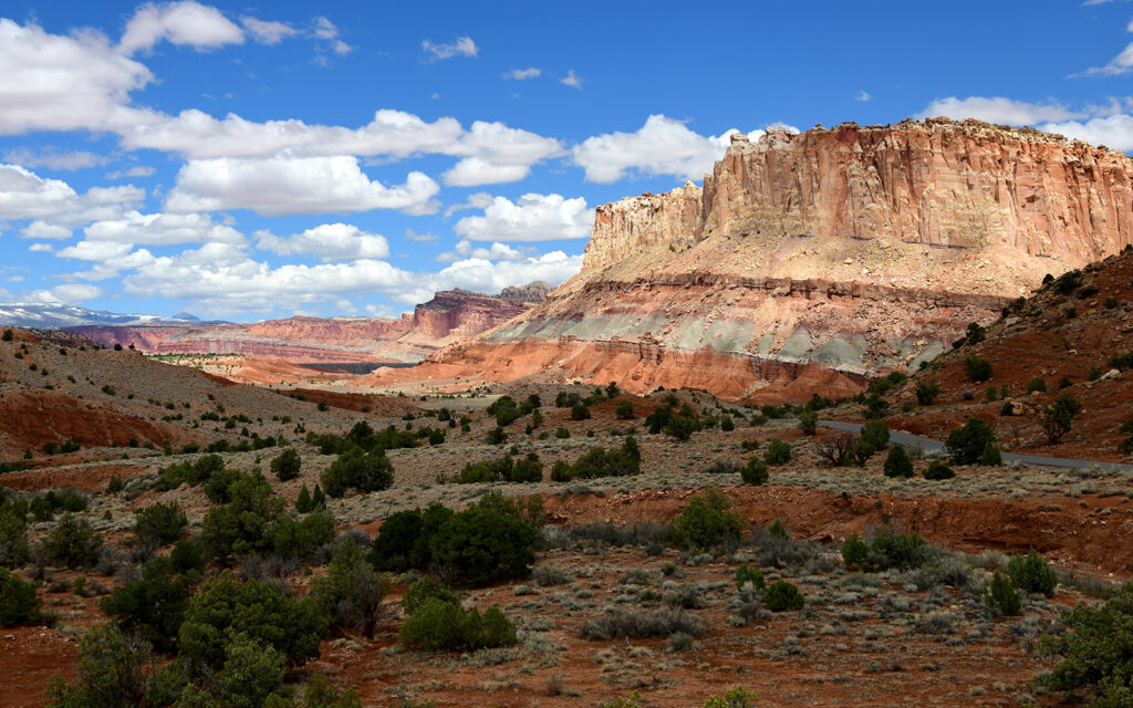
This spectacular red rock formation looks amazing against the Azure blue sky.
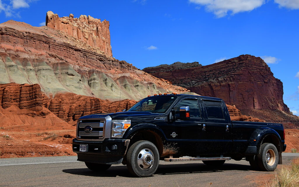
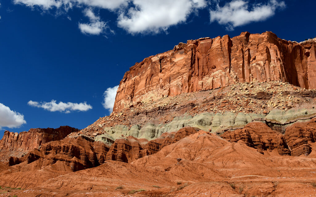
“Big Ass Truck” posing next to a rock formation that clearly exhibits the different layers of sediment dating back millions of years.
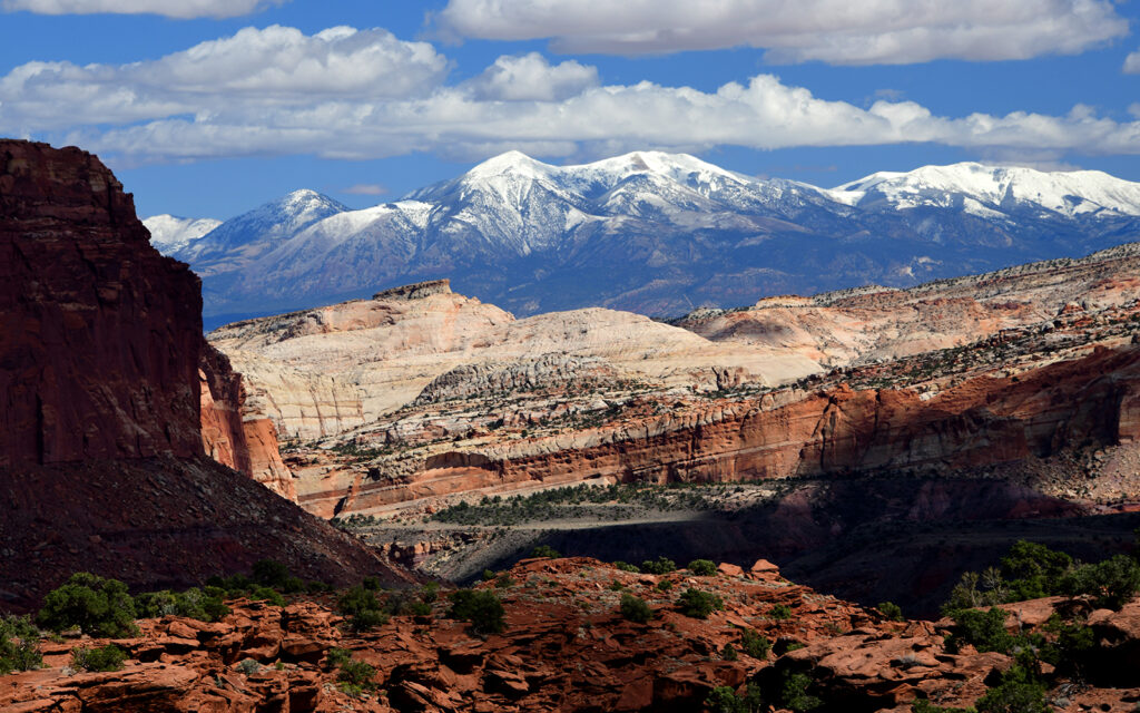
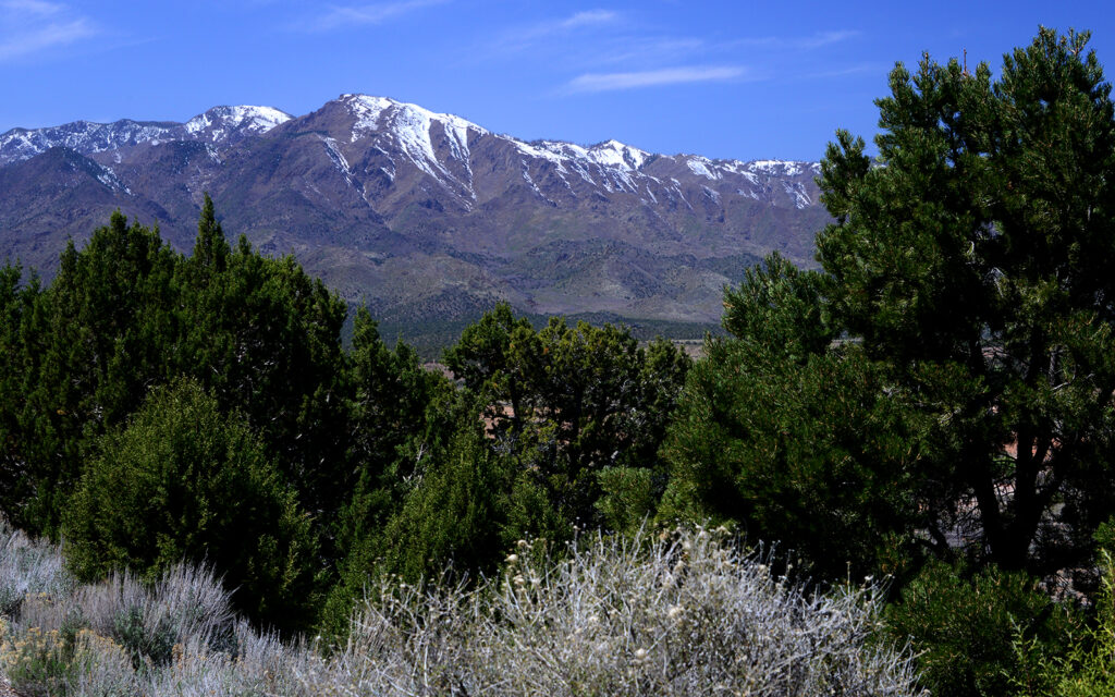
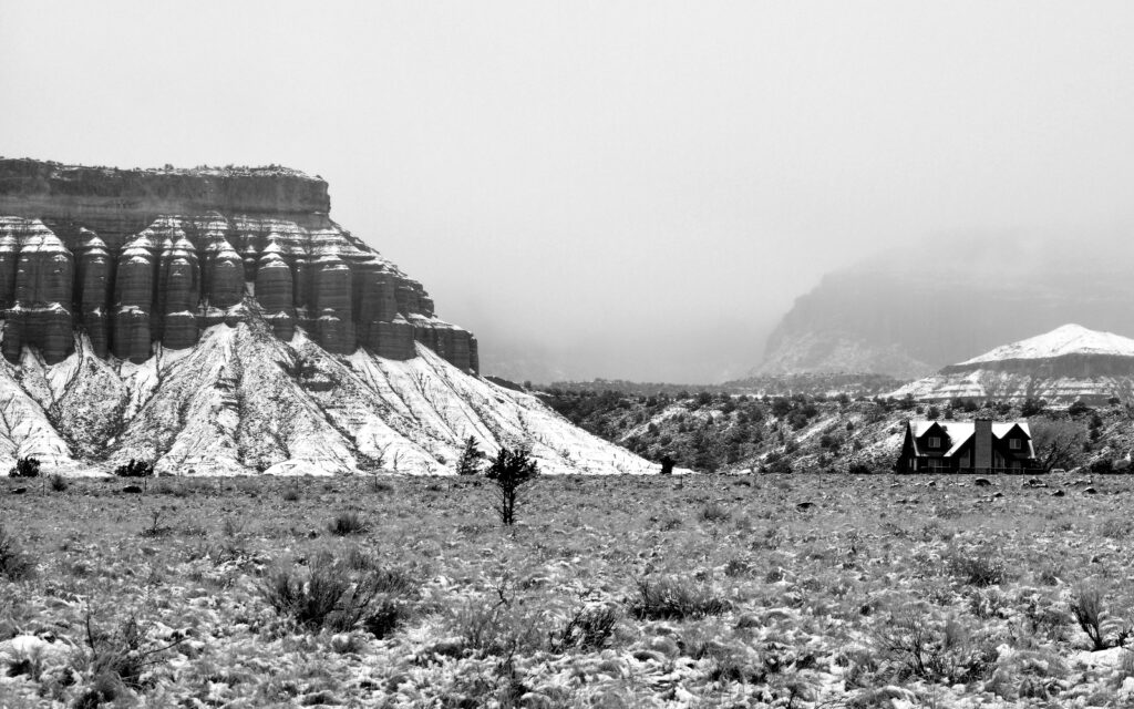
A beautiful view of snow-capped mountains beyond the park.
CANYONLANDS and ARCHES NATIONAL PARKS – Apr. 30-May 10, 2021
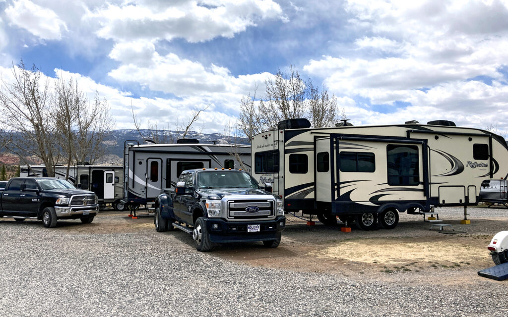
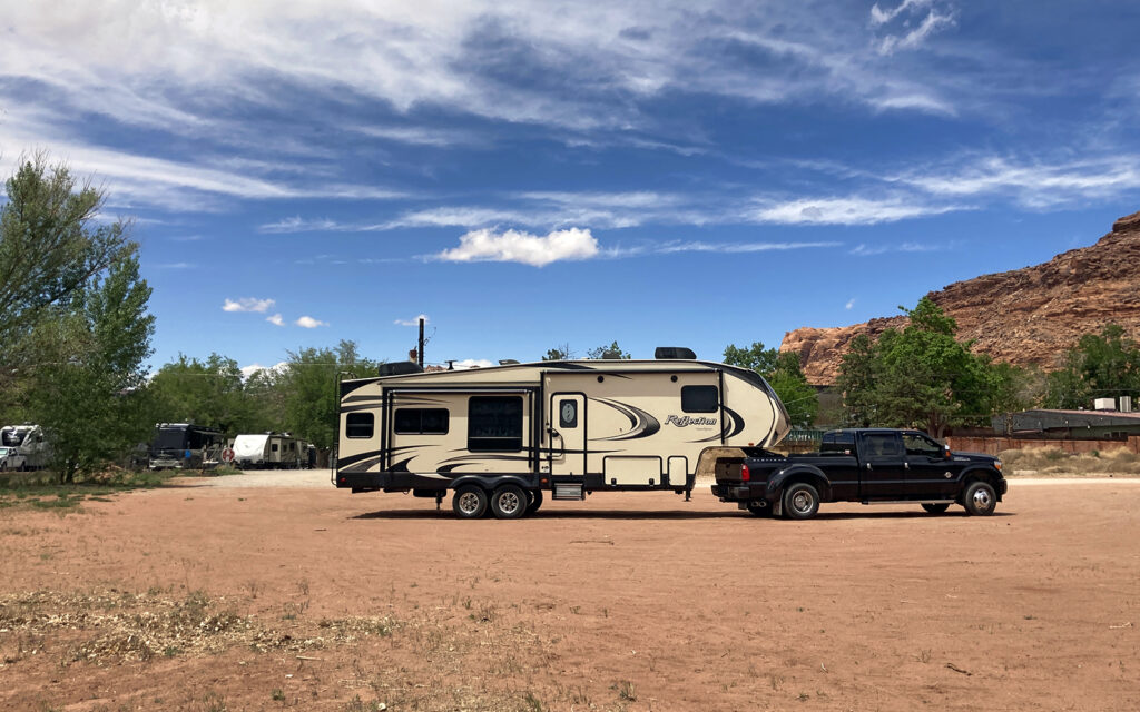
On April 30, I moved to Moab, Utah from which I could visit both Canyonlands and Arches national parks. I stayed at Slickrock Campground for ten days then moved two miles down the road when my photography friends arrived for a workshop in Arches. A neighboring couple were new to RVing and had questions about how a few things worked so I, along with another neighbor, lent a hand after which we all became quick friends. John and Georgia were the newbies with a Forest River Class C and hailed from Idaho. Sergio and Kathy were from Florida and had a Coachmen Chapparal Fifth Wheel with a floorplan nearly identical to my Grand Design Reflection. We had lots of laughs getting to know each other over cocktails
My site at Slickrock Campground was very tight with a tree branch nearly touching a slide-out and the neighbor’s sewer hookup right at the bottom of my steps. In spite of that, I enjoyed my stay and would stay here again.
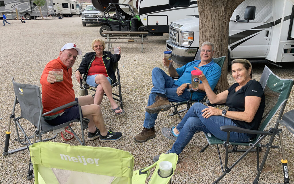
Left: John and Georgia from Idaho. Right: Sergio and Kathy from Florida.
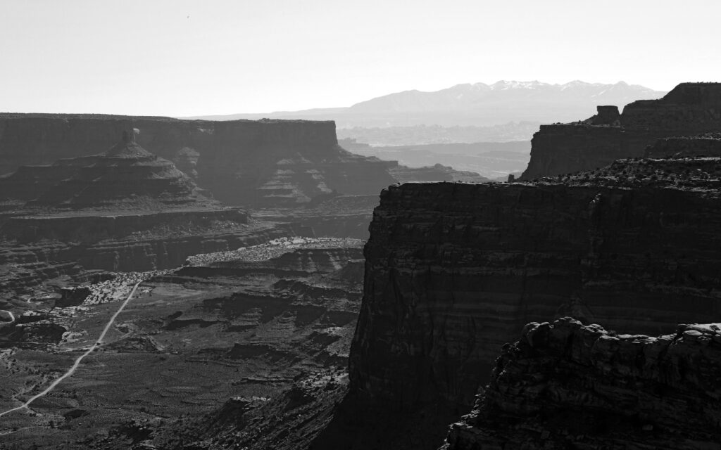
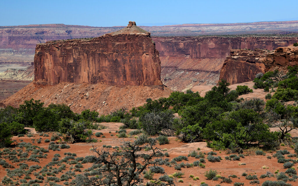
I would describe Canyonlands National Park as a mix of Grand Canyon, Monument Valley, and the surface of the moon. Running through the park is the Colorado River on its way to the Grand Canyon.
This was my view while waiting in line at the park entrance.
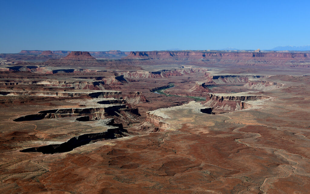
The Colorado River runs through the park.
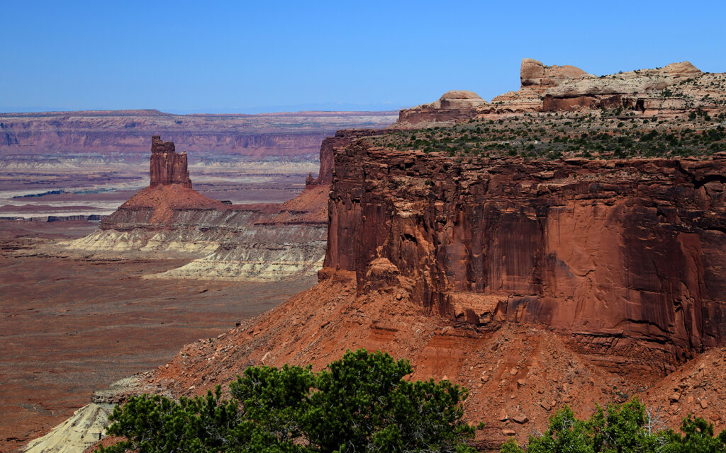
Candlestick Tower is similar to what is seen at Monument Valley.
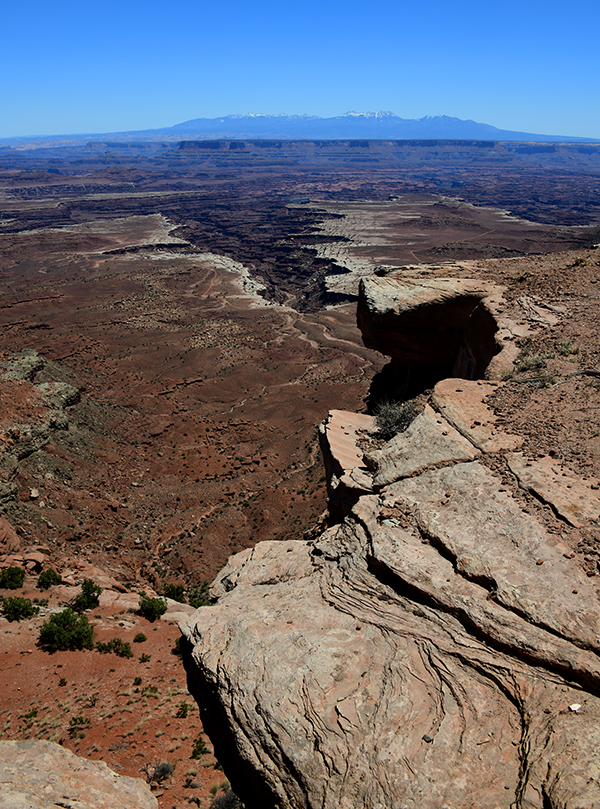
The view of the multi-layered canyon from Grand View Point Overlook.
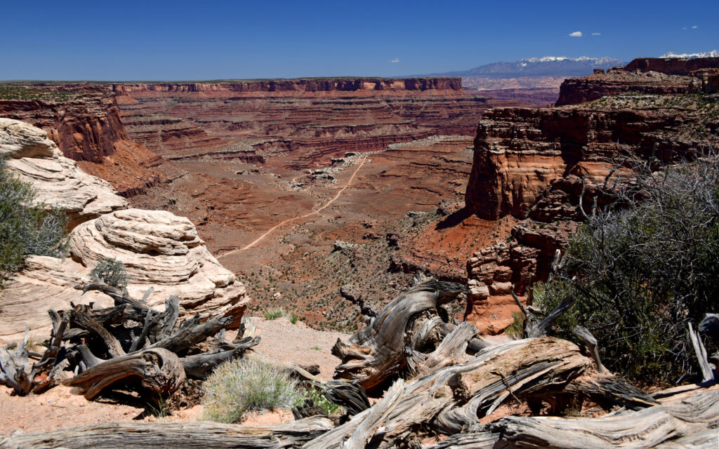
From Shafer Canyon Overlook, you can see the trail used by 4x4s and cyclists to descend into the canyon.
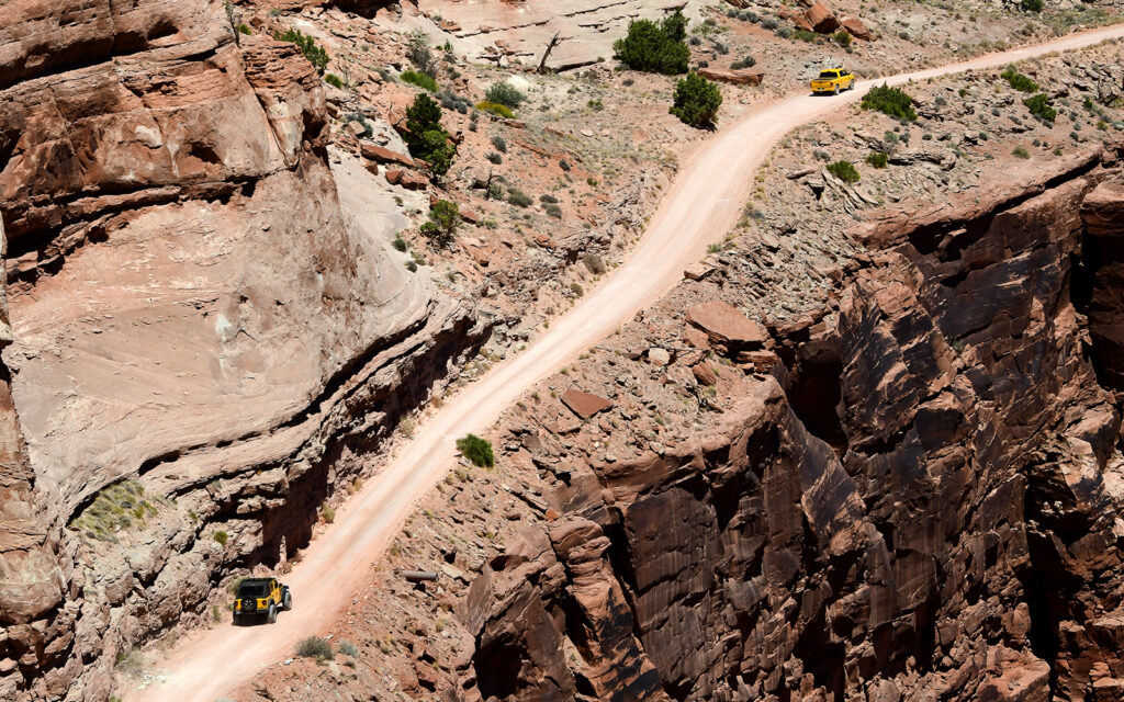
Four-wheel drive vehicles descend into the canyon.
What a fascinating place Arches is. A million years of erosion and just the right composition of sandstone have exposed these amazing structures. This park is home to the world’s largest concentration of natural arches with over two thousand documented arches ranging in size from tiny cracks to 300-foot spans. Some are at risk of collapsing but there are new ones being formed every day.
This park had trouble handling the influx of visitors so they closed the park every day from about 10:00 a.m. to 3:00 p.m. A big problem for many national parks is the amount of parking available. When the parking areas fill up, people begin parking on the shoulder or off the road, which damages the delicate ecosystem. This year’s record attendance levels have forced the parks to find ways of limiting traffic. Each park handles it differently, but with a little advance planning, no one should have a problem seeing their favorite places.
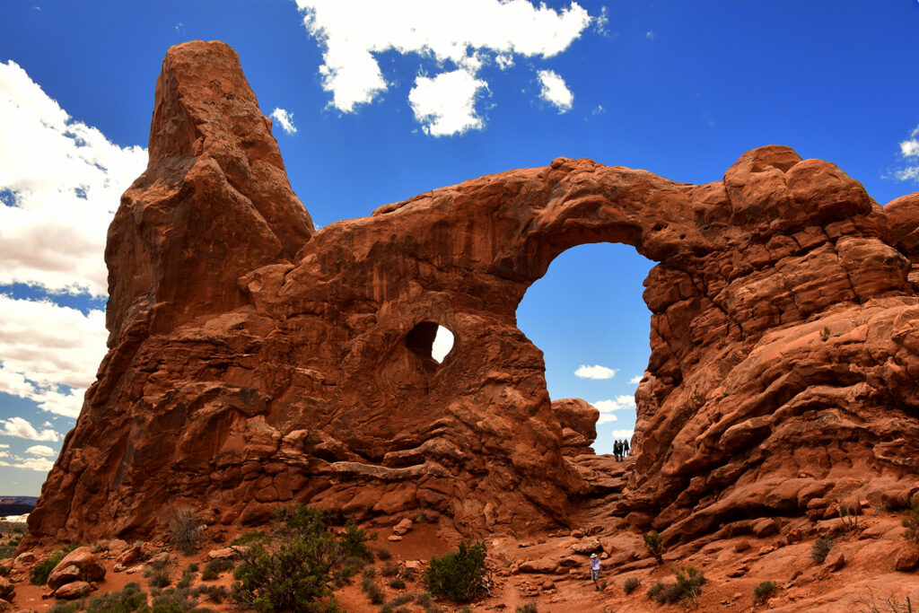
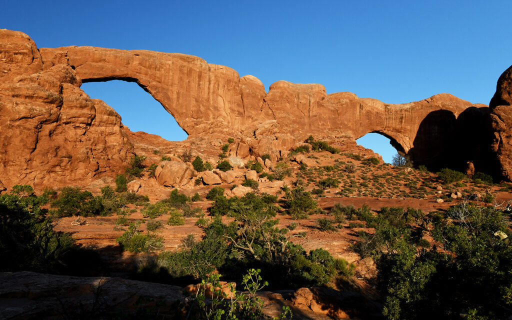
Turret Arch at The Windows Section.
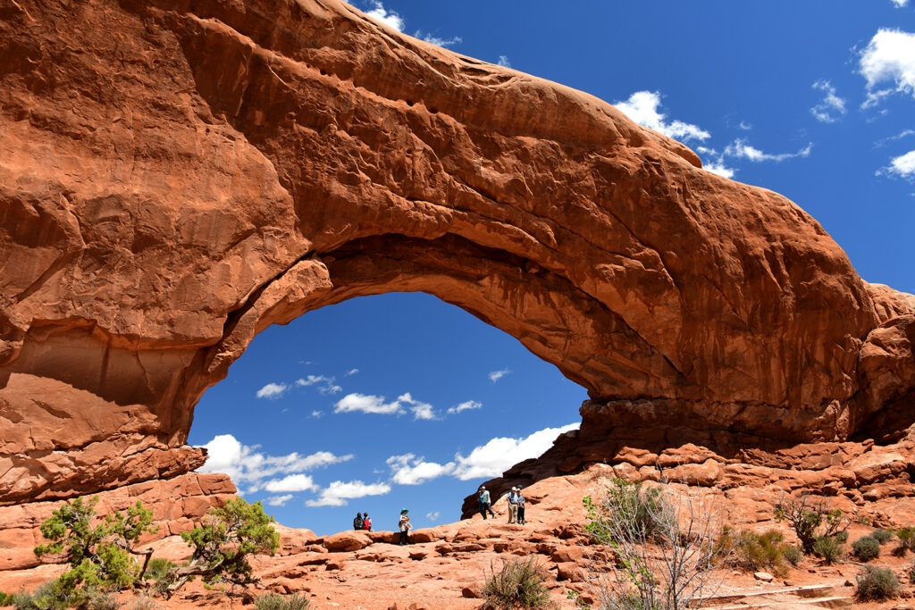
North Arch at The Windows Section.
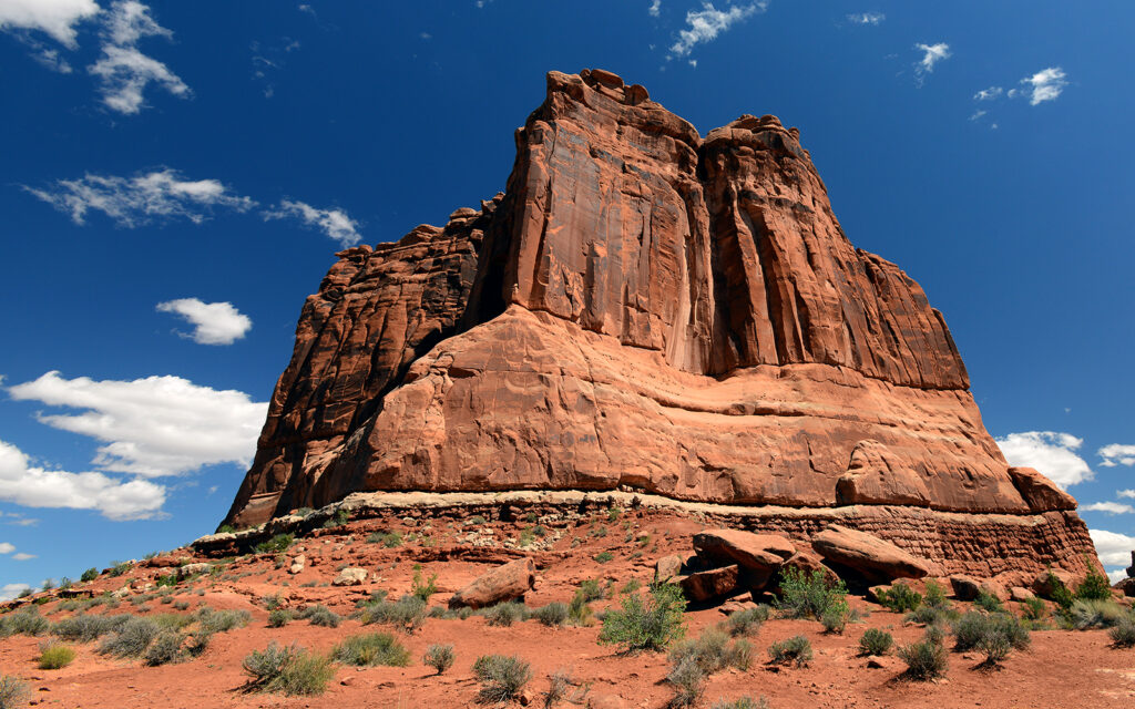
Courthouse Towers.
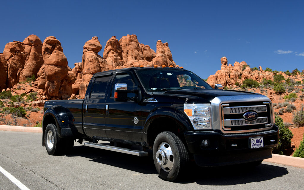
“Big Ass Truck” at Garden of Eden.
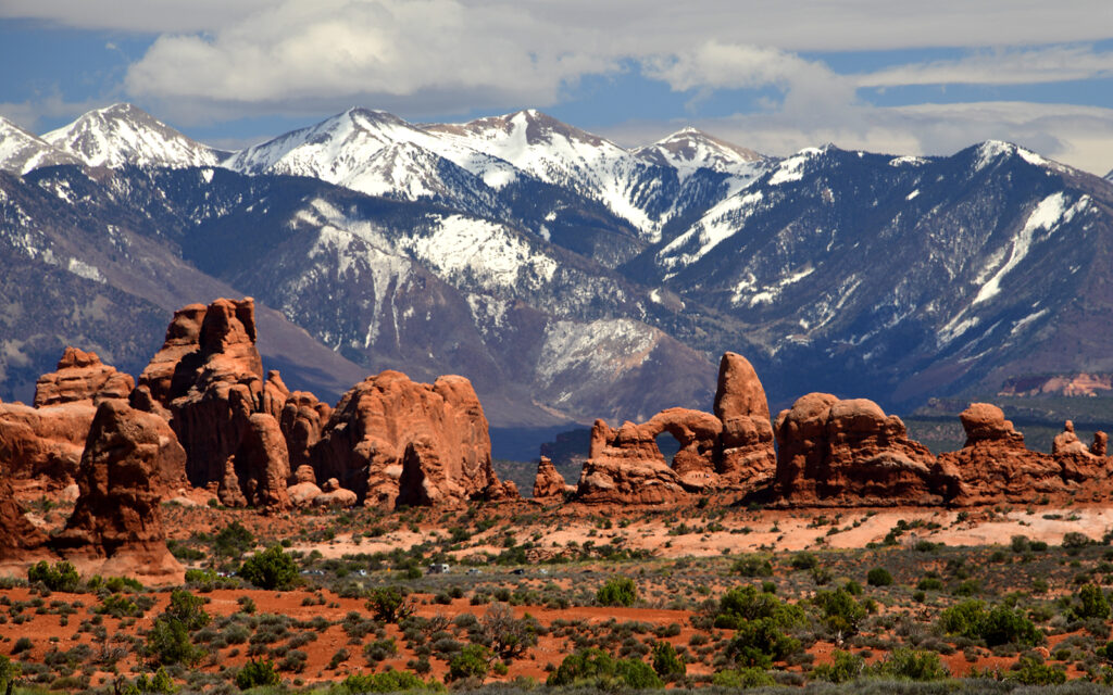
View of The Windows Section with Turret Arch in the center and the La Sal Mountains in the background.
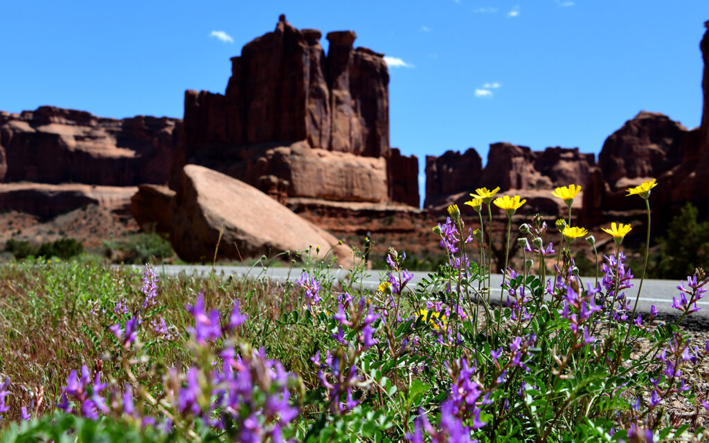
Wildflowers near Courthouse Tower.
ARCHES PHOTOGRAPHY WORKSHOP – May 10-14, 2021
On May 10, my photography friends arrived for a four-day workshop in Arches National Park. They had booked tent sites at Canyonlands RV Resort, two miles down the road from where I had been staying so I moved to be close to them. Most campgrounds have check-out at 11:00 a.m. and check-in around 2:00 or 3:00 p.m., which isn’t usually a problem when traveling a long distance from one location to another. In this instance, I was only moving five minutes down the road but the place I was moving to wouldn’t let me check in early so I had to spend three hours parked in an empty lot next to the campground I was leaving.
Biding my time in a vacant lot waiting to check into my new campground.
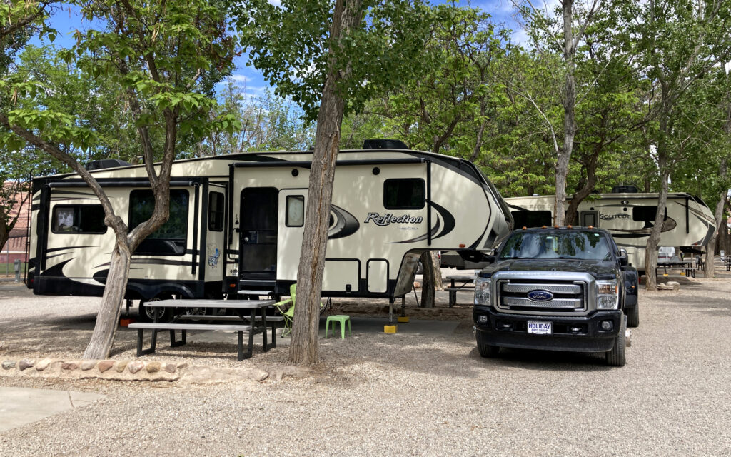
My site at Canyonlands RV Resort. My friends stayed in tents on the opposite side of the campground.
I discovered Lerro Photography Workshops back in 2014 when I signed up for a trip to Maine to photograph lighthouses. Ever since then, I’ve tried to attend at least two workshops per year—mostly lighthouses—but this year I’ve attended a couple of landscape trips. In February, we were scheduled to go to Yosemite National Park but a combination of COVID restrictions and a large snowstorm forced us to cancel. We went to Death Valley instead. This trip to Arches was originally planned for April 2020 but COVID interfered and it was postponed to May 2021. From here we were scheduled to go to Monument Valley for several days of western-themed photography on the Navajo Reservation but continuing COVID restrictions have kept the Tribal Nations off-limits to visitors.
Here are photos from the workshop:
BALANCED ROCK
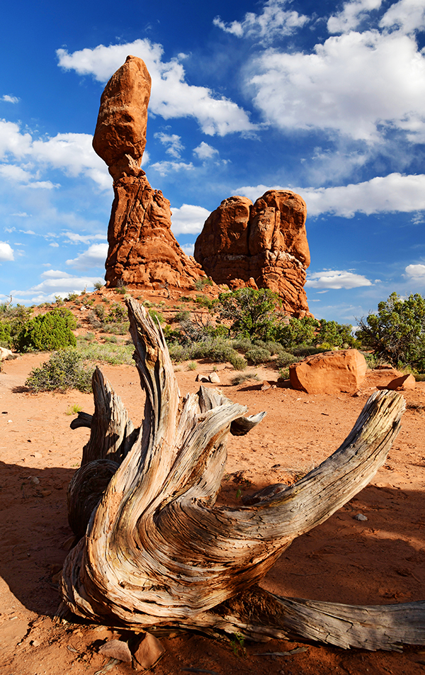
Balanced Rock with an old weathered tree root.
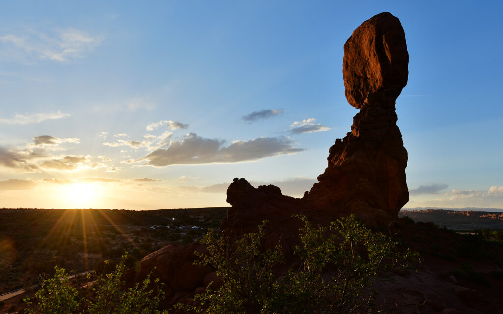
Balanced Rock at sunset.
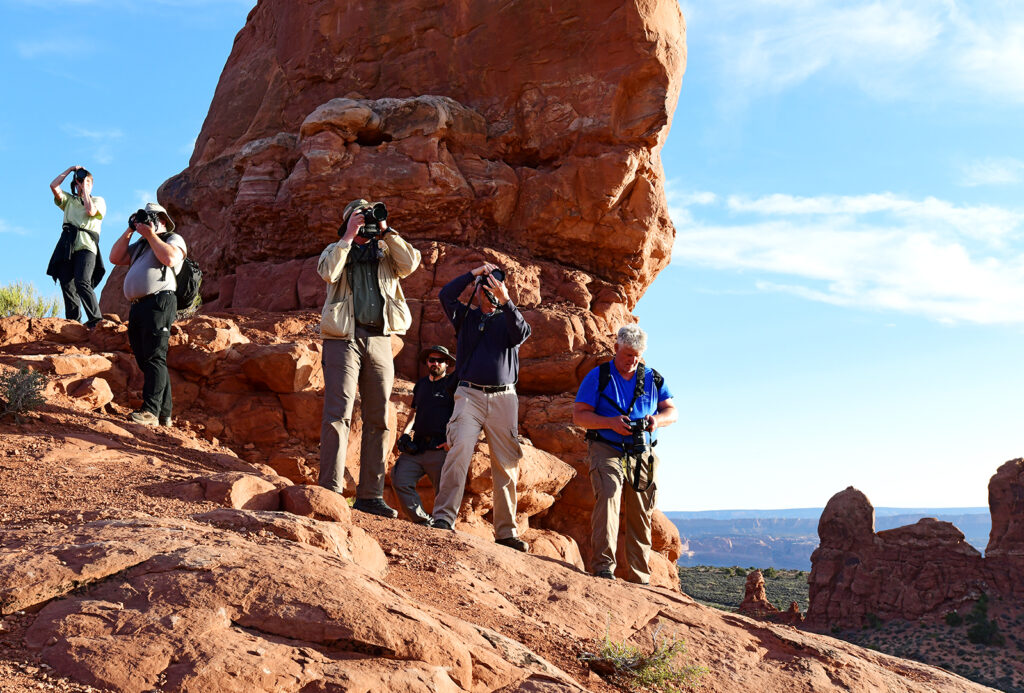
Workshop attendees photographing Balanced Rock.
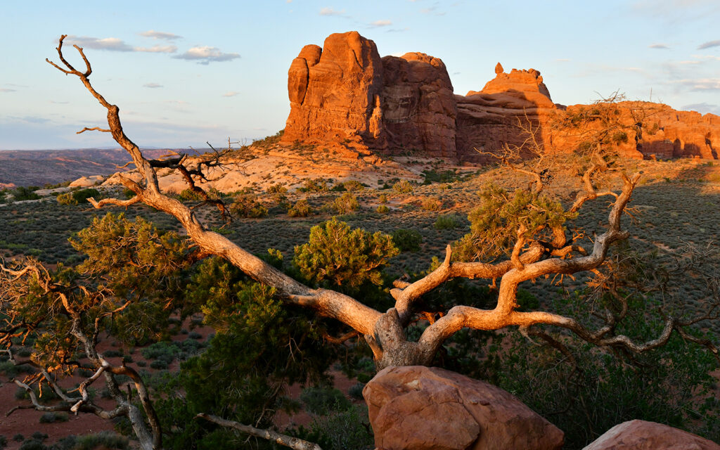
The view looking east from Balanced Rock.
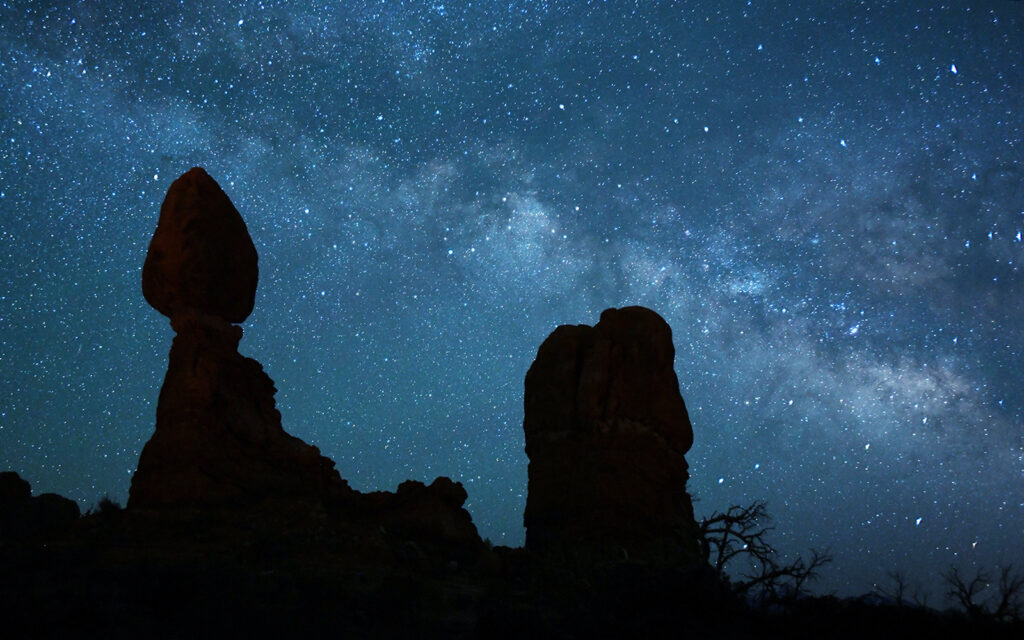
This photo of the Milky Way behind Balanced Rock was taken at 12:30 a.m.
THE WINDOWS SECTION
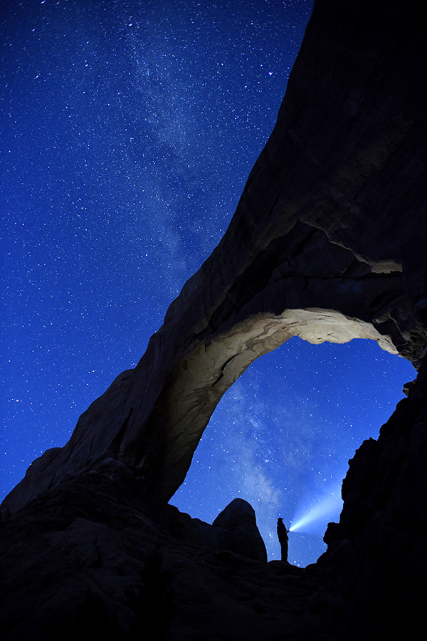
The South Arch with the Milky Way and a nighttime explorer, taken at 4:50 a.m.
The north and south arches at sunrise.
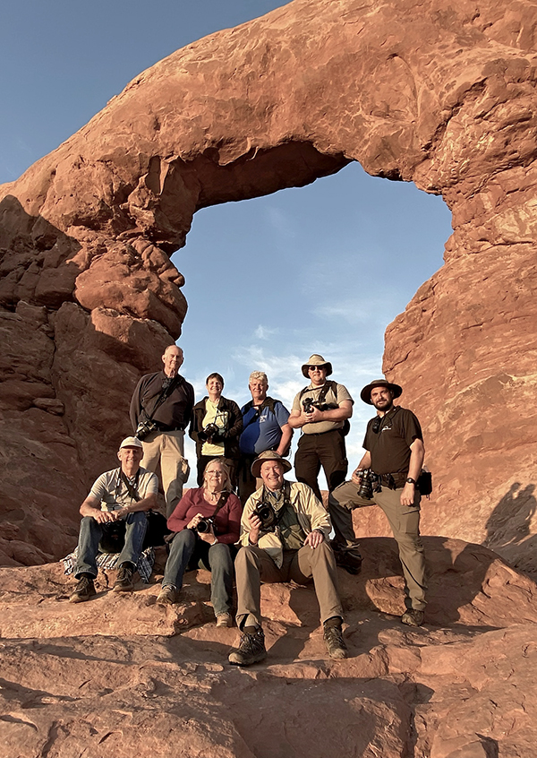
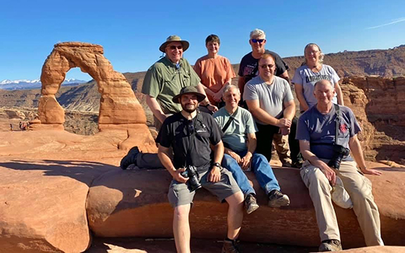
The gang at Turret Arch.
DELICATE ARCH
Delicate Arch is the most iconic formation in the park. It is also the most difficult to get to. The trail is 1.5 miles from the parking lot to the arch with a gain in elevation of almost 500 feet. That might not seem like much but trust me, it’s grueling. With steep inclines over smooth slickrock with no shade, this hike is exhausting and took about two hours. We were staying there all night and returning the next morning so I needed to pack food, water, and enough layers of clothes to keep me warm when the sun went down. Oh, and plenty of camera gear, too! I was only able to carry my pack for a short distance and our group leader, Pete carried it the rest of the way along with his own gear. He’s like a pack mule!
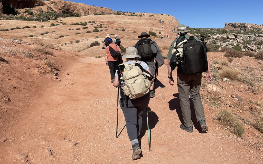
Getting started on the trail to Delicate Arch.
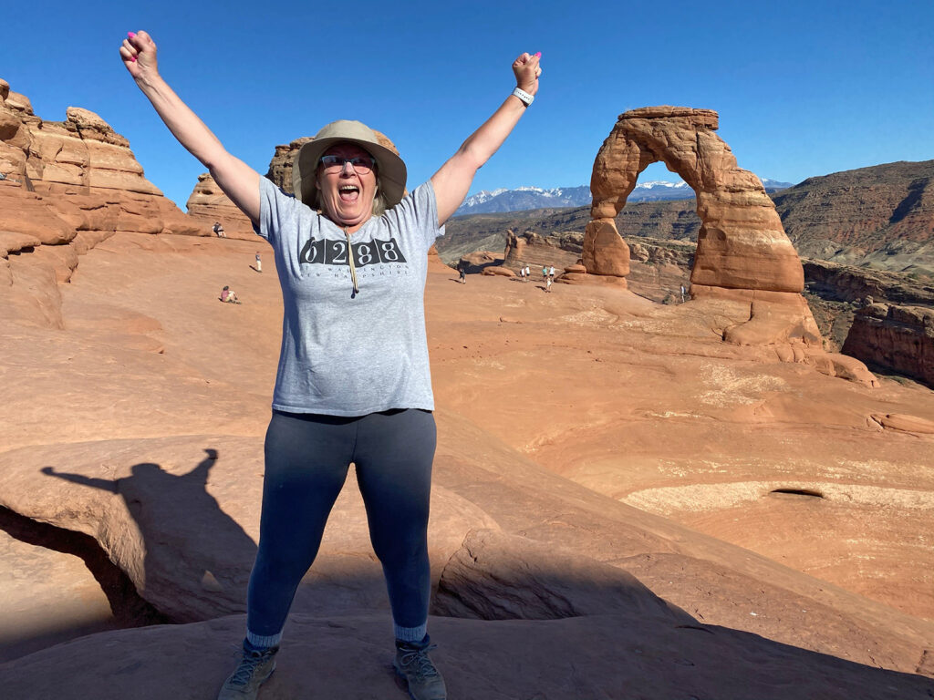
Two hours later, I had made it to the summit, feeling awfully proud of myself.
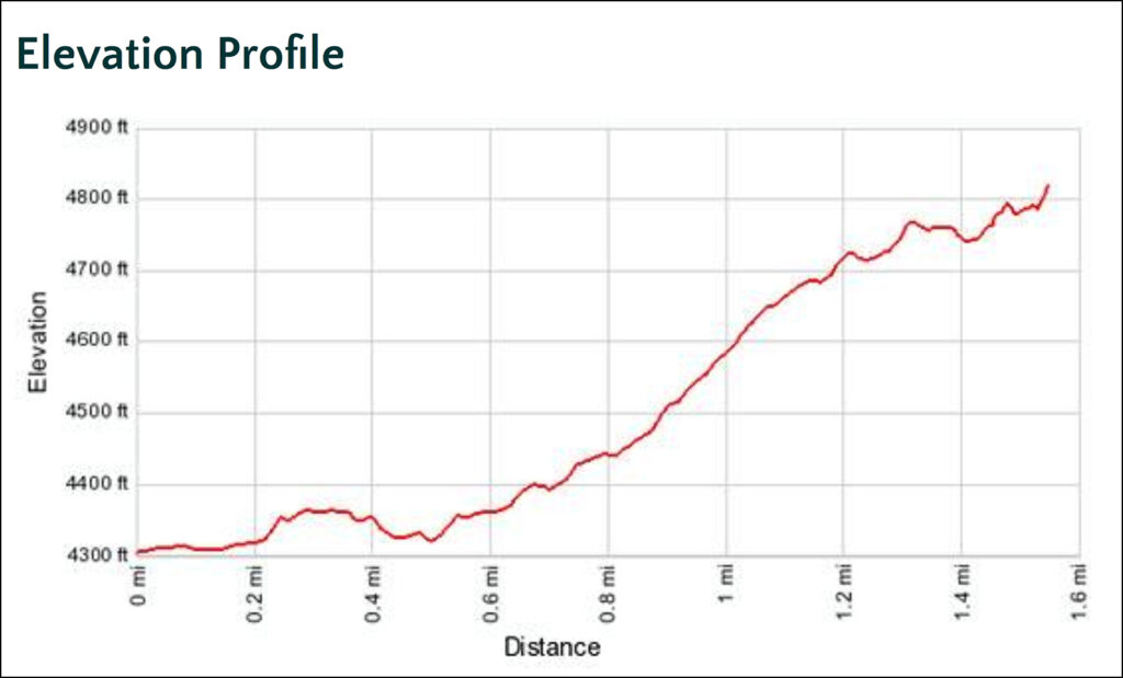
This graph shows the angle of ascent up to Delicate Arch.
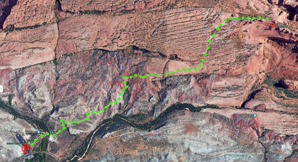
Aerial photo of the trail to Delicate Arch.
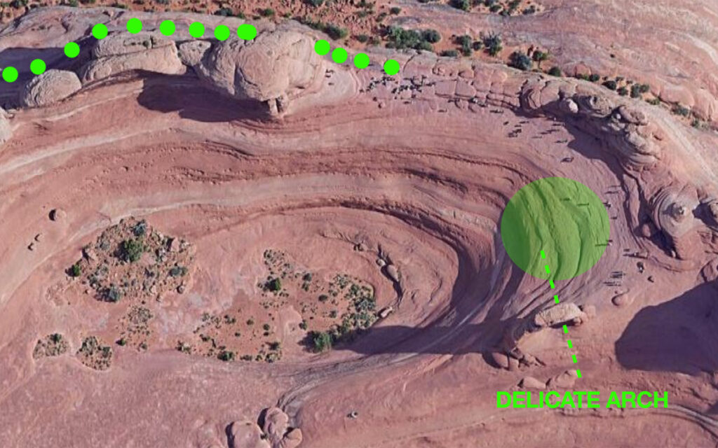
This aerial photo shows where the trail ends at the edge of a bowl with the arch on the opposite side. The dashed line shows the angle of the arch opening. The area highlighted with the circle is where we spent most of the night photographing the Milky Way while clinging to the 45° angle of the bowl. Several lens caps and a tripod were lost in the hole that night. None of them were mine, thankfully.
The group resting after the hard hike and waiting for sunset.
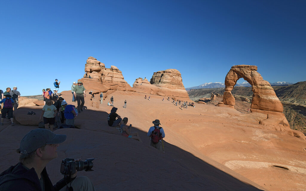
Delicate Arch is always crowded, even in the middle of the night.
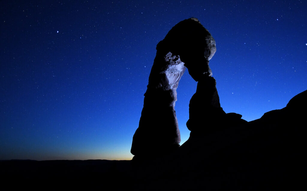
Delicate Arch at dusk with a crystal clear sky filled with stars. This photo was taken at 9:35 p.m.
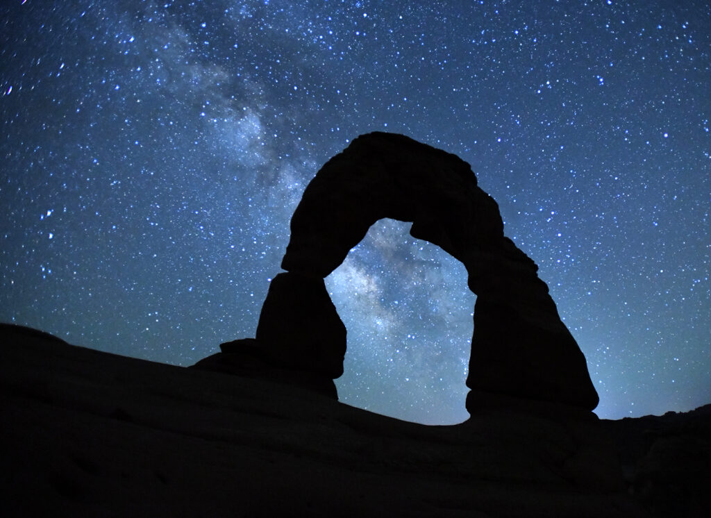
The Milky Way behind Delicate Arch. This photo was taken at 3:15 a.m.
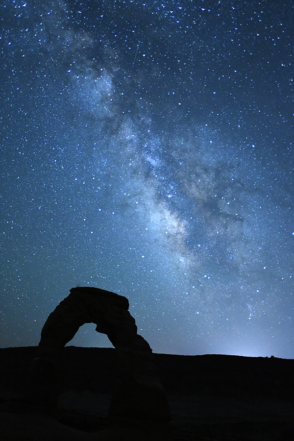
A dramatic view of the Milky Way with Delicate Arch in the foreground. This photo was taken at 3:20 a.m.
DOUBLE ARCH
At Double Arch we worked on time-lapse and star trail photography techniques.
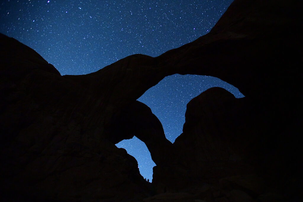
This photo shows the tremendous number of stars visible in Utah with the silhouette of Double Arch.
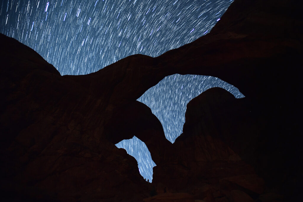
This star trail image was created by taking numerous consecutive photos and sandwiching them in Photoshop to show the movement.
LANDSCAPE ARCH
Our last morning brought us to Landscape Arch at the northern end of the park. This arch is best photographed in the morning for the best light.
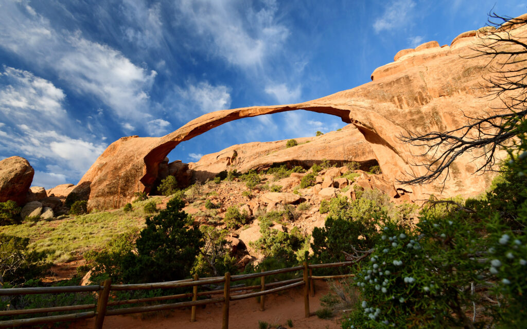
Landscape Arch about 40 minutes after sunrise.
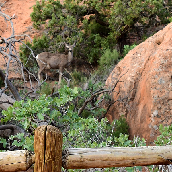
We were treated to sightings of several deer as they moved to higher ground in anticipation of growing crowds of people after sunrise.
When we finished at Arches and we couldn’t go to Monument Valley as planned, the group split up and headed in different directions. Since I had a week to fill before my next reserved location, I went to Colorado to visit a childhood friend.
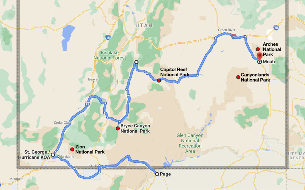
My 540-mile route from Page, Arizona to Moab, Utah. All five of Utah’s national parks are in the southern half of the state.
Next post: Bouncing around the mountain states.
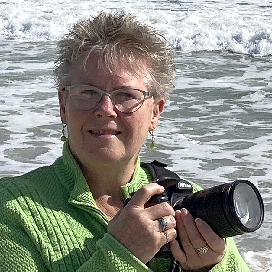
My name is Lindsay Reed. I’m a photographer and retired graphic artist with a passion for both lighthouses and road trips. I am living as a full-time solo RVer in my 33 foot Grand Design Reflection Fifth Wheel trailer and have been traveling the U.S. and Canada since May 2017 photographing not only lighthouses but everything else there is to see in this wonderful land. I hope you enjoy my blog and will follow my adventures in the months and years ahead.
One thought on “Utah’s Five National Parks”
Pictures look great Lindsay! Living your best life. I have finally retired for good. Happy traveling!!