Death Valley Photo Workshop
NEVADA
Valley of Fire State Park
On February 6, 2021, I moved from Kingman, Arizona to Valley of Fire State Park north of Las Vegas, Nevada. This would be my home base where I could leave the trailer and my cat while I set off on a four-day photography workshop adventure in Death Valley National Park. There are no RV hookups inside Death Valley and the cat would need both heat and air conditioning while I was away. Besides, our photography group was coming here for a couple of days after Death Valley so it was the perfect location.
There are a couple of campgrounds in Valley of Fire State Park but only one—Atlatl Campground—has water and electric hookups for RVs. The sites are first-come, first-served and you need to arrive early to grab a site the minute someone pulls out. There was nothing available when I first arrived so I circled around for nearly an hour until I saw someone getting ready to leave. I pulled up next to their site and waited so no one else could get it before me. It reminded me of looking for a parking spot at the mall at Christmastime.
This was a spectacularly beautiful campground, surrounded by the red rocks that give the park its name.
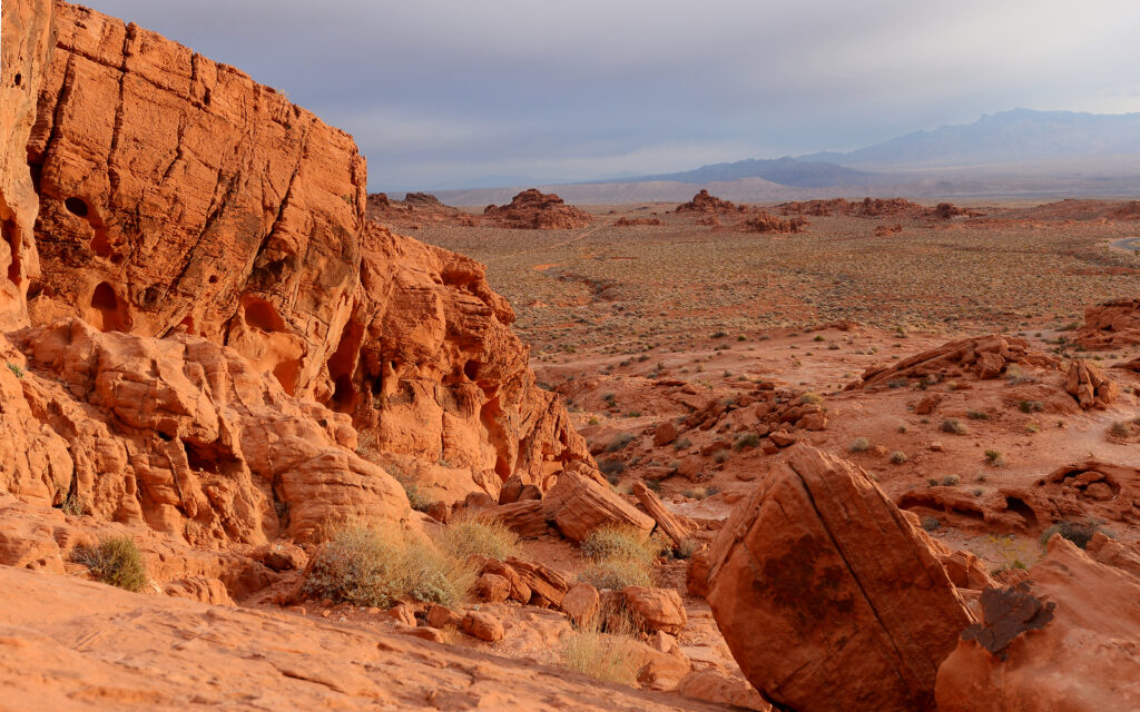
Valley of Fire State Park in Nevada.
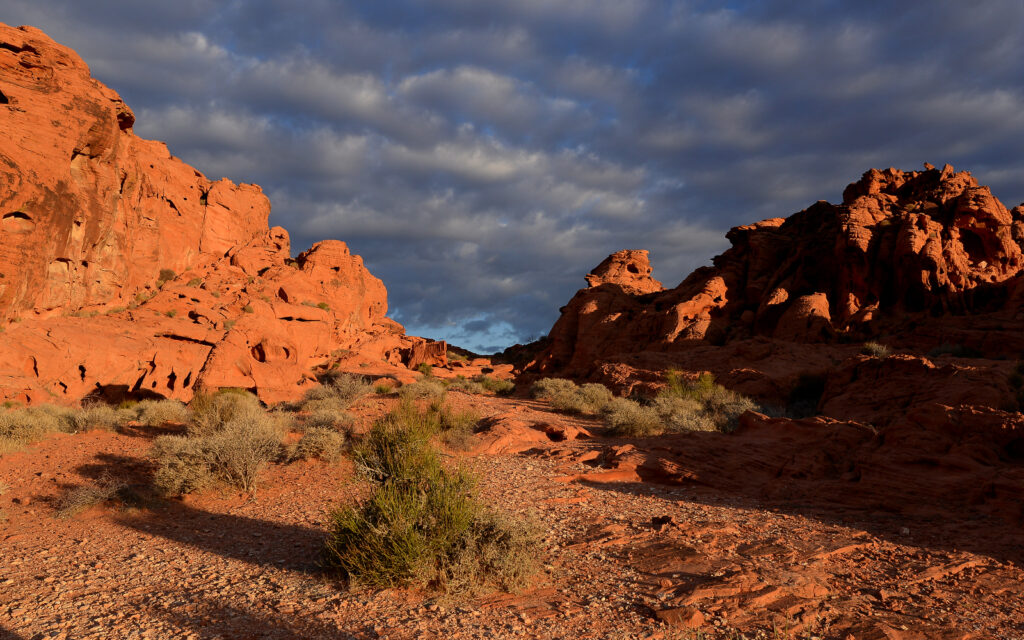
Valley of Fire State Park in Nevada.
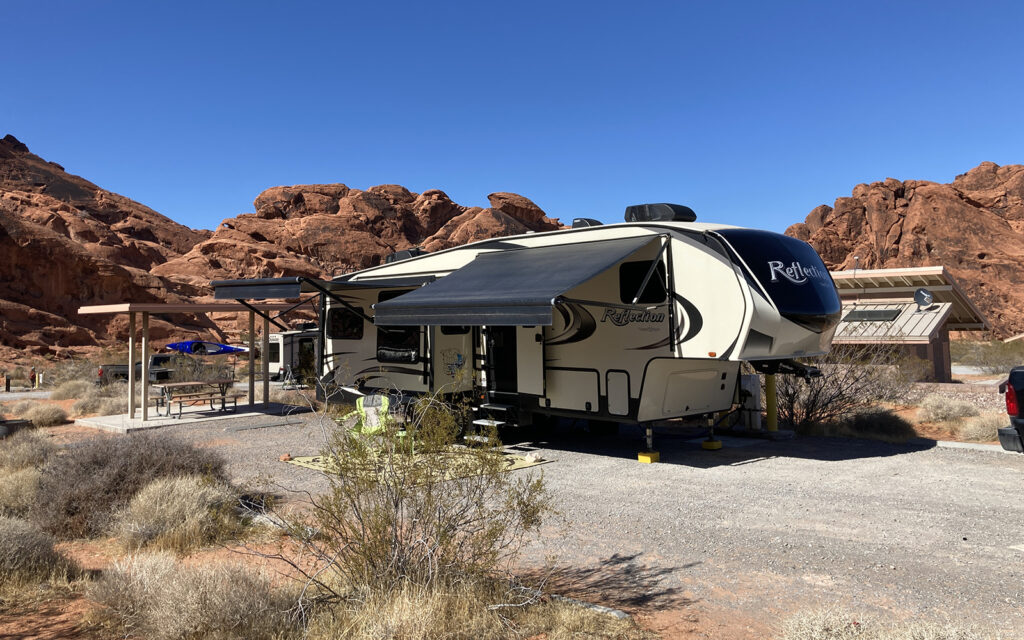
My site at Atlatl Rock Campground in Valley of Fire State Park, Nevada.
CALIFORNIA
Death Valley National Park
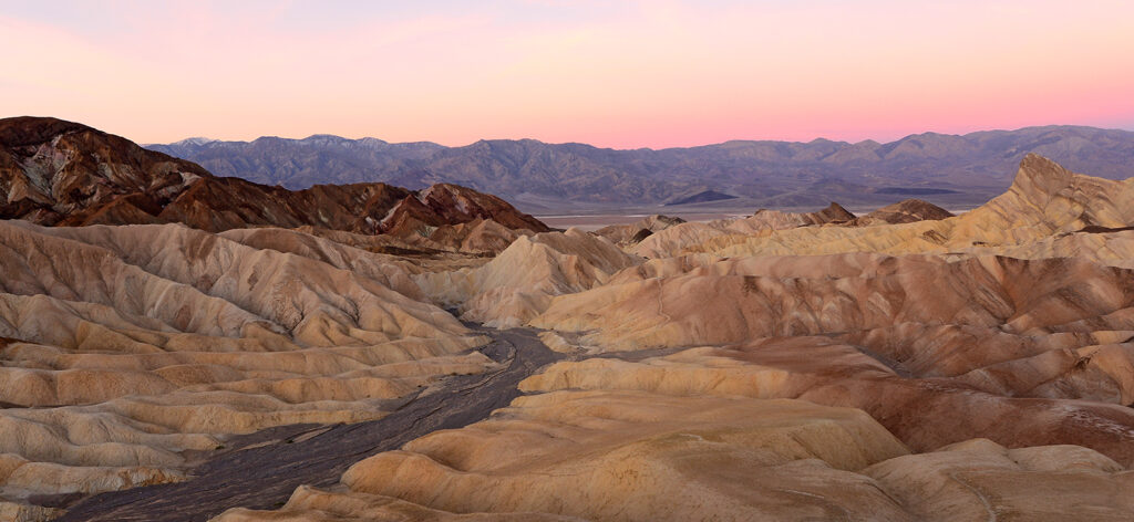
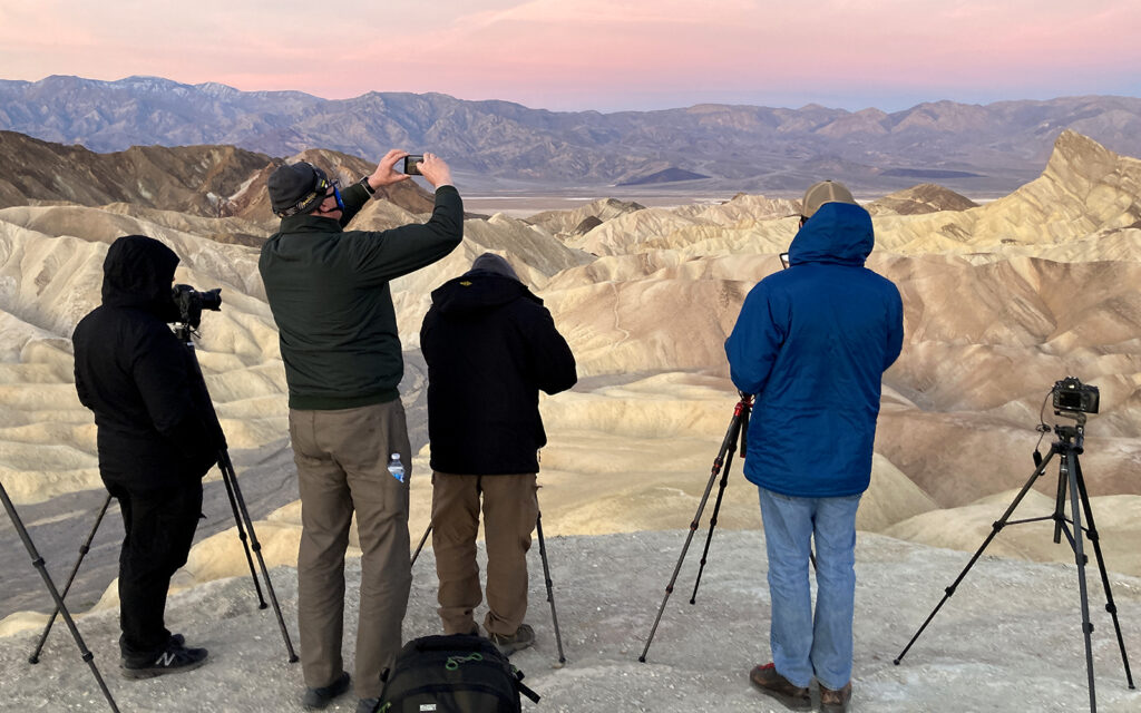
The next night, I set off to meet the four men in our photography group around midnight. We were all arriving from different directions so we met up at a gas station in Pahrump, near the California border then caravaned into Death Valley, arriving around 1:00 a.m. We stopped at the overlook at Zabriskie Point to view the stars. It was mind-blowing to see so many stars! There were layers upon layers of them, taking on a 3-D effect. Unfortunately, I couldn’t get any photos of it so the experience will have to stay inside my mind. We pulled into a campground to sleep in our cars for a few hours and then back to Zabriskie Point for sunrise.
Death Valley is known as the hottest place on earth and recorded a temperature of 134º in July 1913 and 130º in August 2020. There are likely hotter places in the Sahara but they’re so remote that it’s impossible to get accurate data. Death Valley is certainly the hottest, driest, and lowest (282 feet below sea level at Badwater Basin) place in the United States. The national park covers approximately the same square miles as the state of New Jersey. Imagine that… a park the size of a state! Everything is bigger out west.
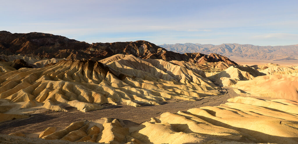
DAY 1
Sunrise at Zabriskie Point:
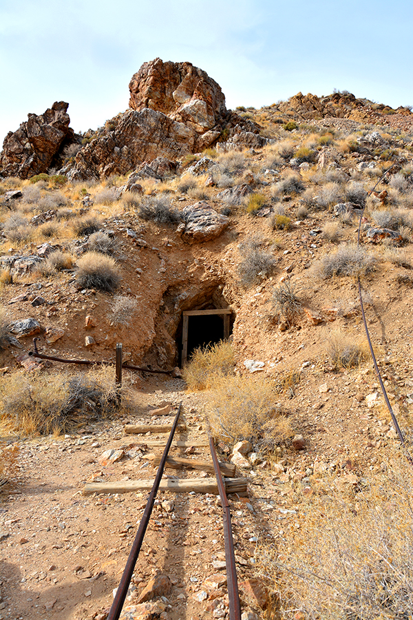
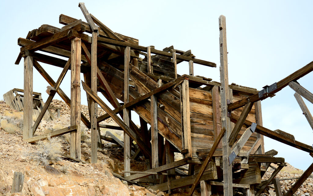
Eureka mine:
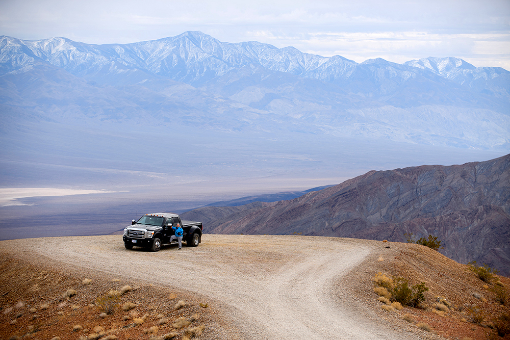
Badwater Basin: lowest elevation in North America at 282 feet below sea level.
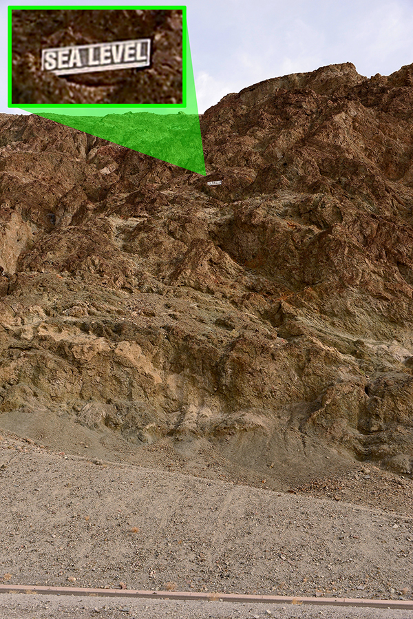
At Badwater Basin, there’s a sign high up on the mountain above the parking lot that indicates where sea level is.
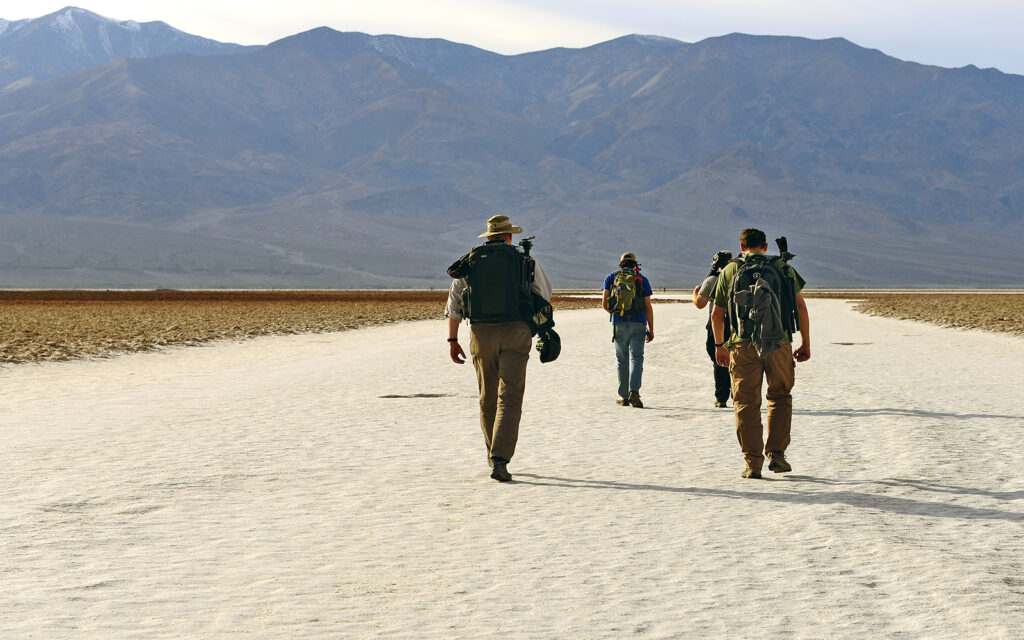
Following the boys out onto the salt flat at Badwater Basin.
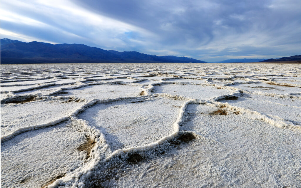
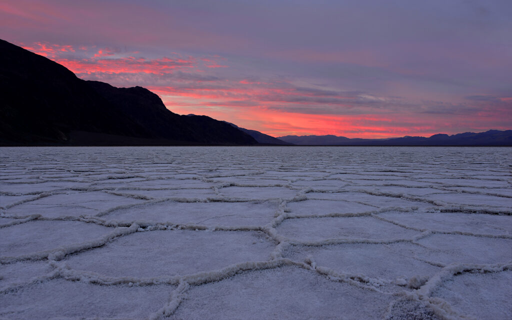
The salt deposits form geometric ridges. This one looks like New Jersey.
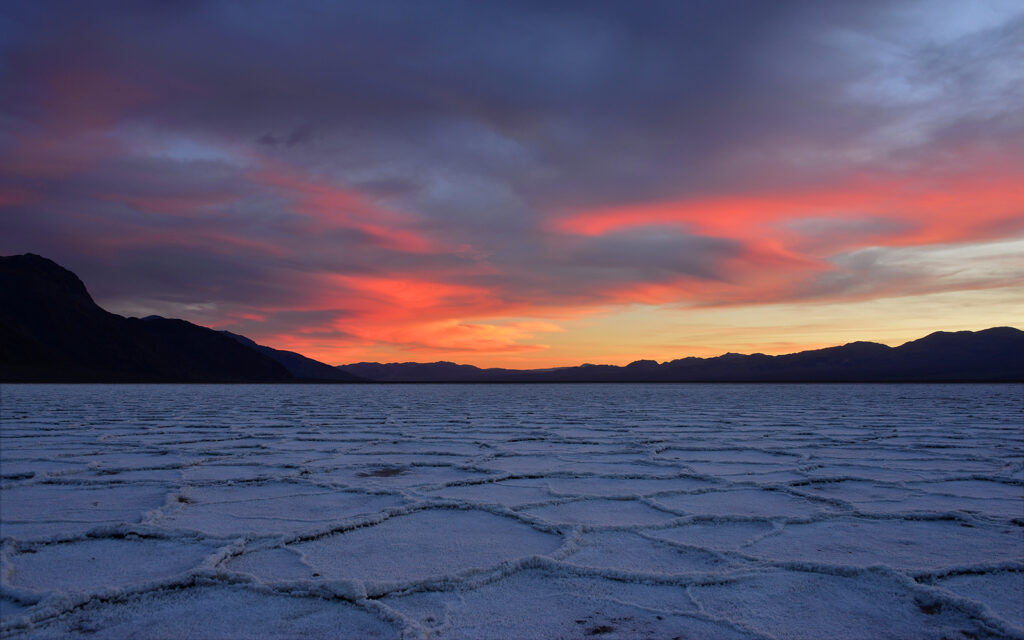
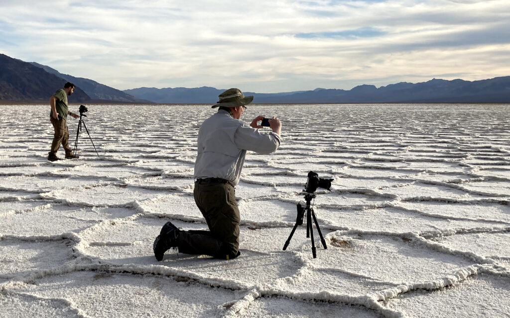
Sunset on the salt flats.
We had dinner at the saloon at the Oasis (formerly Furnace Creek). Because of Coronavirus, we had to eat outside and our meals were served in disposable cardboard boxes with cheap plastic utensils. I ordered a Filet Mignon, which I couldn’t cut with the plastic knife so I ate everything with my hands. At $67, this was the most expensive box meal I’ve ever had. The steak was delicious though as well as the asparagus and baked potato.
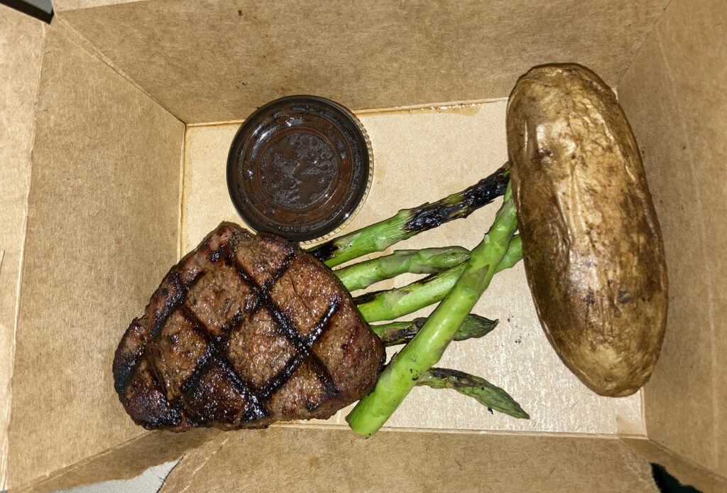
My $67 dinner served in a cardboard box was delicious despite how it was presented.
DAY 2
Badwater Basin
After another night sleeping in our cars in the campground, we went back out on the salt flats for sunrise.
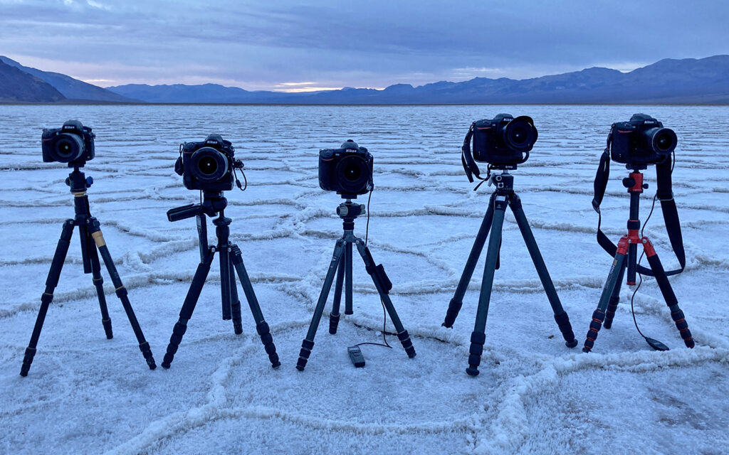
All five of us were shooting with Nikons.
Father Crowley Vista Point
We exited the west side of the park and drove north almost 200 miles to Mono Lake. The drive offered breathtaking views of the Sierra Nevada Mountains and the farther north we went, the more snow we encountered. This trip was supposed to include several days in Yosemite National Park (located just west of Mono Lake) but it had closed due to heavy snowfall and we were forced to cancel our reservations.
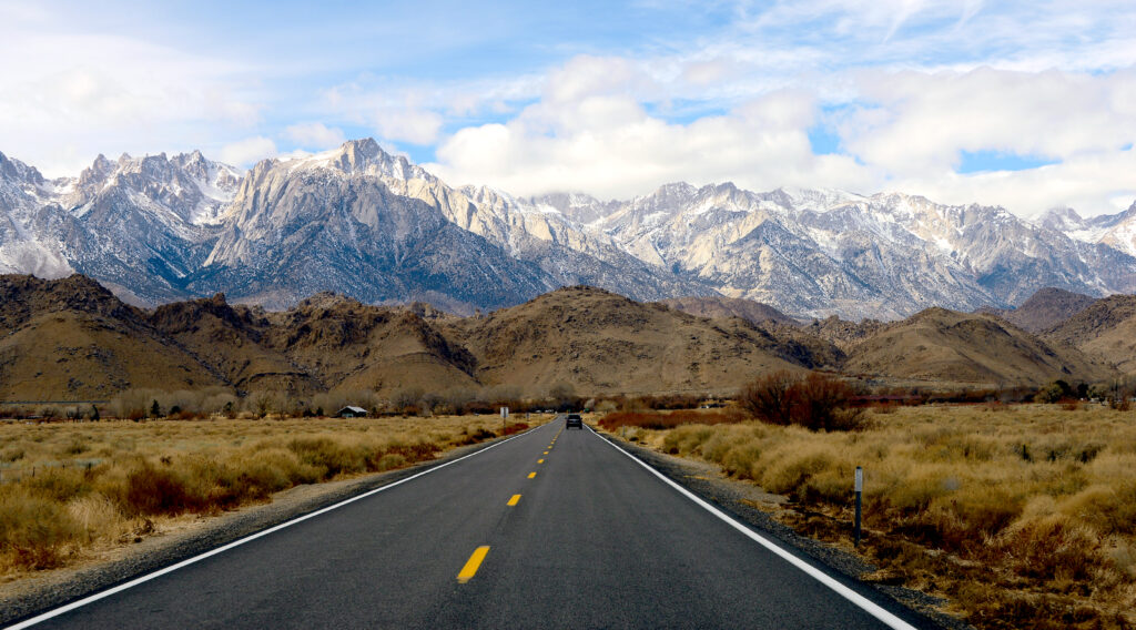
My first view of the Sierra Nevada Mountains in Southern California.
Alabama Hills, Lone Pine, California
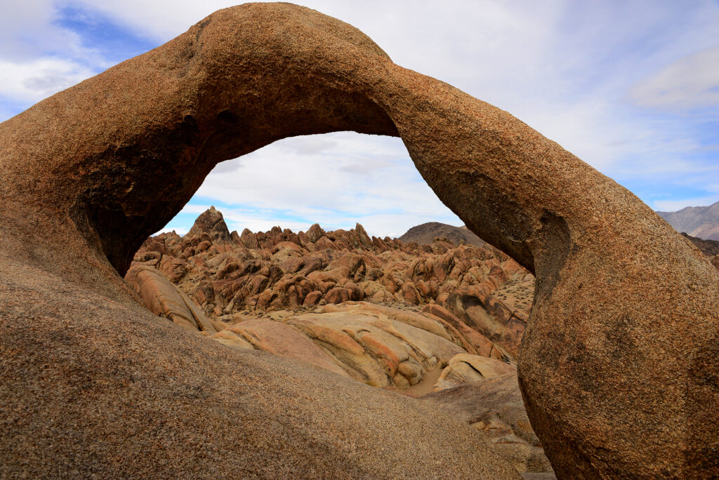
Arch at Alabama Hills in Lone Pine, California.
Mono Lake
Nearly 200 miles north of where we exited Death Valley and just east of Yosemite National Park is Mono Lake, known for its mirror reflections. There was quite a bit of snow on the ground, making it impossible to get very far down the entrance road. We all piled into one 4×4 and gave it our best shot. We only got about a hundred yards and didn’t want to risk getting stuck so we walked to the edge of an overlook and got a few shots. Hardly worth the 400-mile round trip but pretty pictures, nonetheless.
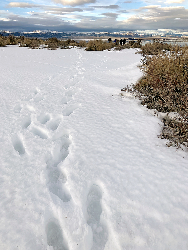
Walking through the snow to get a couple of pretty photos.
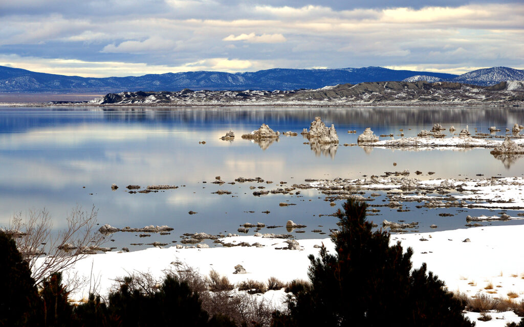
Mono Lake.
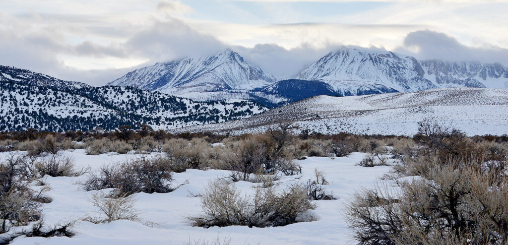
Looking west from Mono Lake towards the Sierra Nevada Mountains.
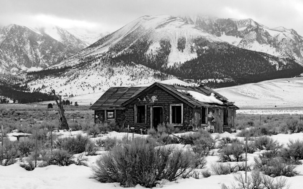
We just had to pull over when we spotted this shack on the side of the road. What a setting!
Back to Death Valley
We got back to the park in the middle of the night and found another campground to sleep for a couple of hours then to the sand dunes to get in position before dawn.
DAY 3
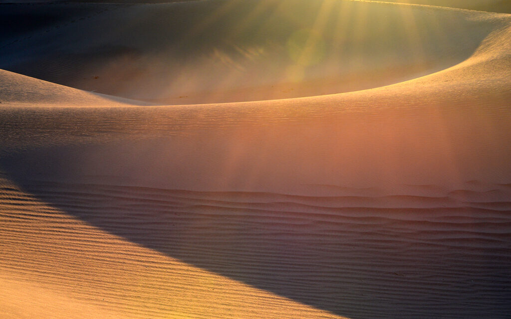
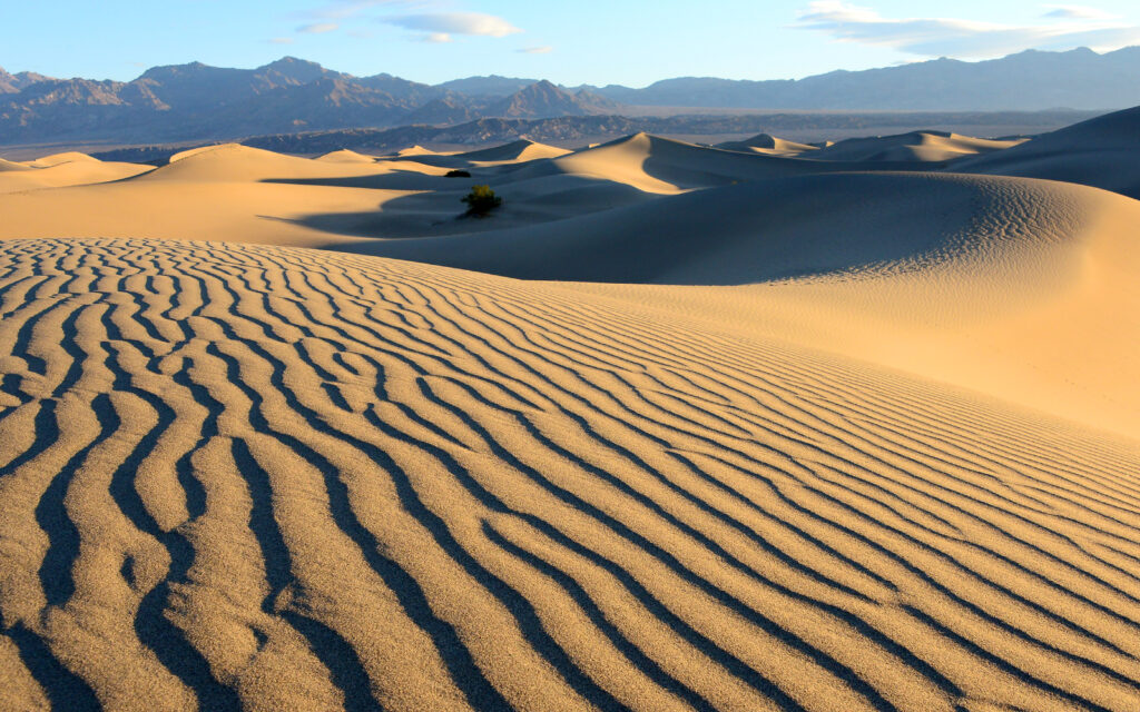
Mesquite Flats Sand Dunes
The hike across the sand dunes in the dark was quite strenuous. All that up and down! We were searching for a spot without footprints for our sunrise photos.
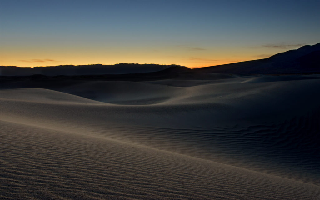
Dawn on the dunes.
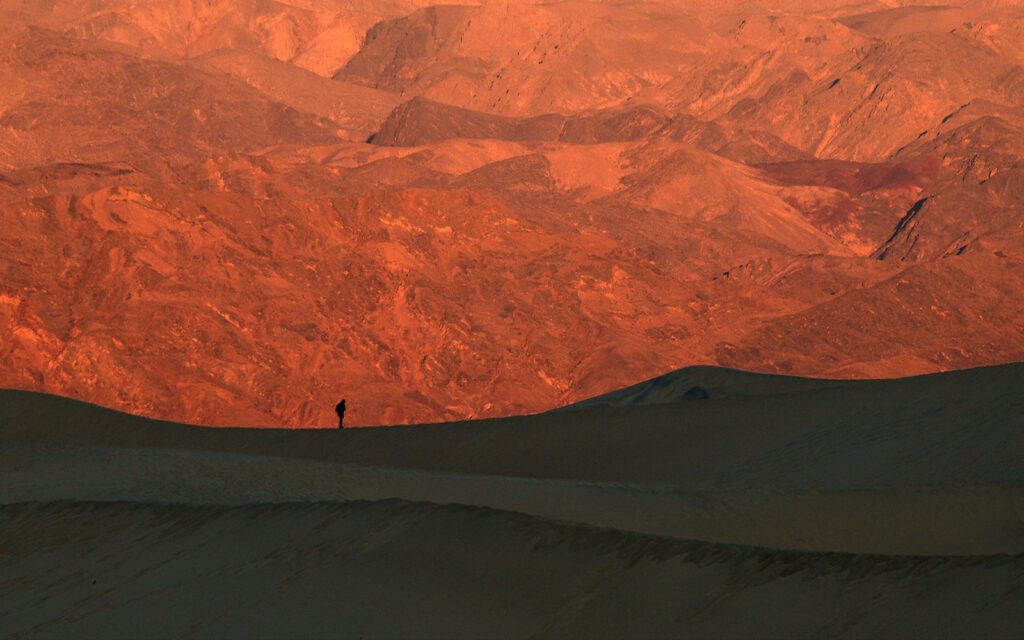
The sand dunes in shadow at the bottom with a hiker silhouetted against the glowing red hills in the background as the rising sun hits them.
Wind-blown ripples with dramatic side light early in the morning.
Ubehebe Crater
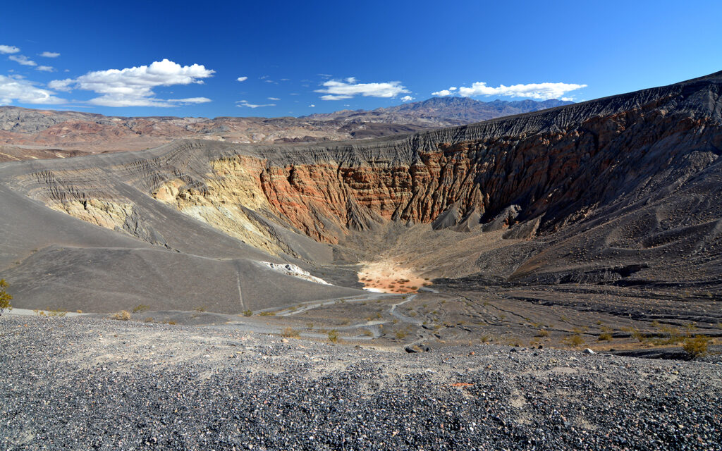
Ubehebe is a volcano crater at the north end of the park.
The Racetrack
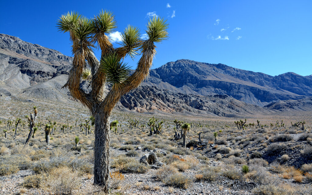
Joshua Tree “forest” on Racetrack Road.
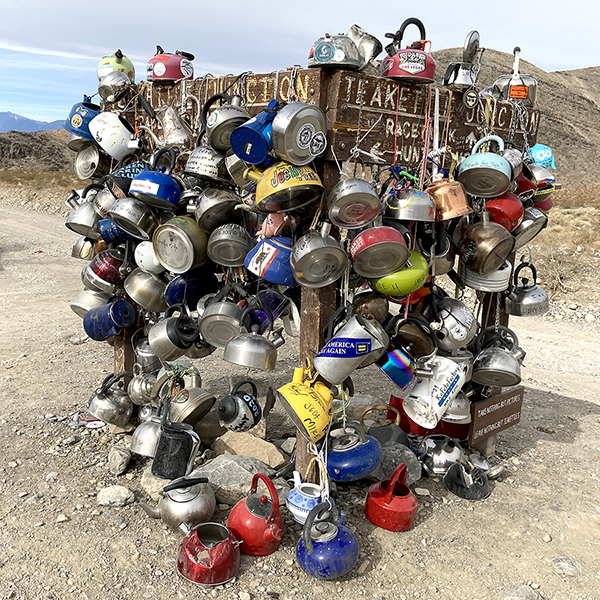
Teakettle Junction on the road to The Racetrack is quite a sight. Visitors leave decorated teakettles on the road sign.
The Racetrack is a dry lake bed found at the end of a 30-mile terrible gravel road. It took nearly two hours to drive this road but there was a great payoff at the end. The Racetrack gets its name from the “Sailing Stones,” stones that move across the lake bed. This phenomenon has puzzled scientists for many years and the mystery was finally solved in 2014 when scientists placed time-lapse cameras and weather equipment on the hill above the lake.
Here’s what they discovered: rocks fall off the hill and roll onto the dry lake bed. In winter, if it rains, the small amount of water will freeze on the surface at night but will warm during the day, creating a slick layer between the lake bed and the layer of thin ice with the rocks surrounded by the floating sheet. Then, if there’s a strong wind coming off the mountain, it will push the rocks like the stones in the sport of curling. The ice ultimately thaws and the rocks have left trails on the hard surface of the lake.
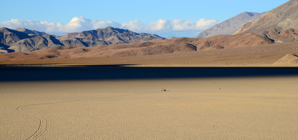
The dry lake bed is known as The Racetrack. On the left, you can see the tracks left when the stone in the center was moved by unique weather conditions.
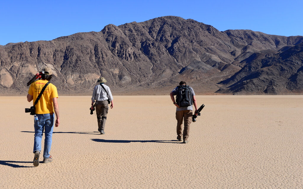
Searching for the best rocks to come back and photograph at sunset when the tracks are more visible.
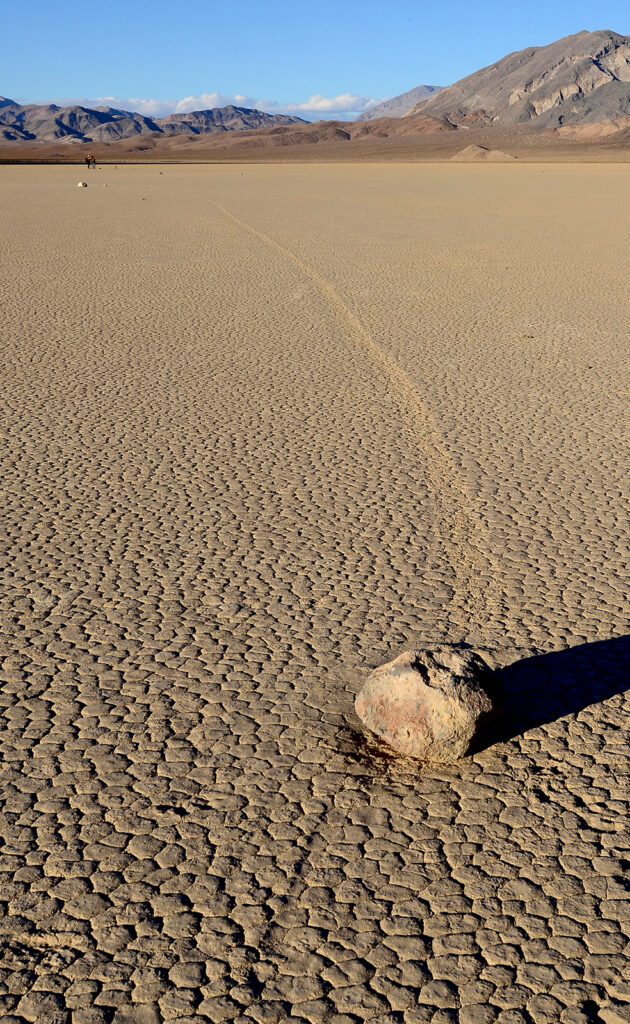
A good example of the track left by a moving rock.
DAY 4
The Racetrack
After getting some sleep in the truck on the side of the road, I got up to photograph the stones with the Milky Way just above the mountain ridge.
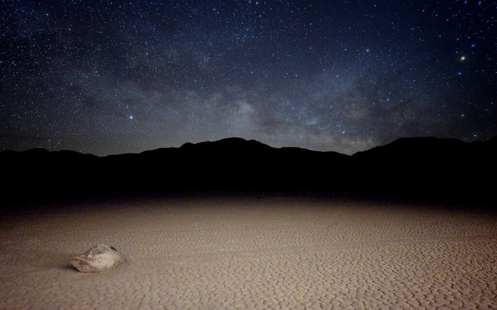
A “Sailing Stone” with its track leading off to the right and the Milky Way above the mountains in the background.
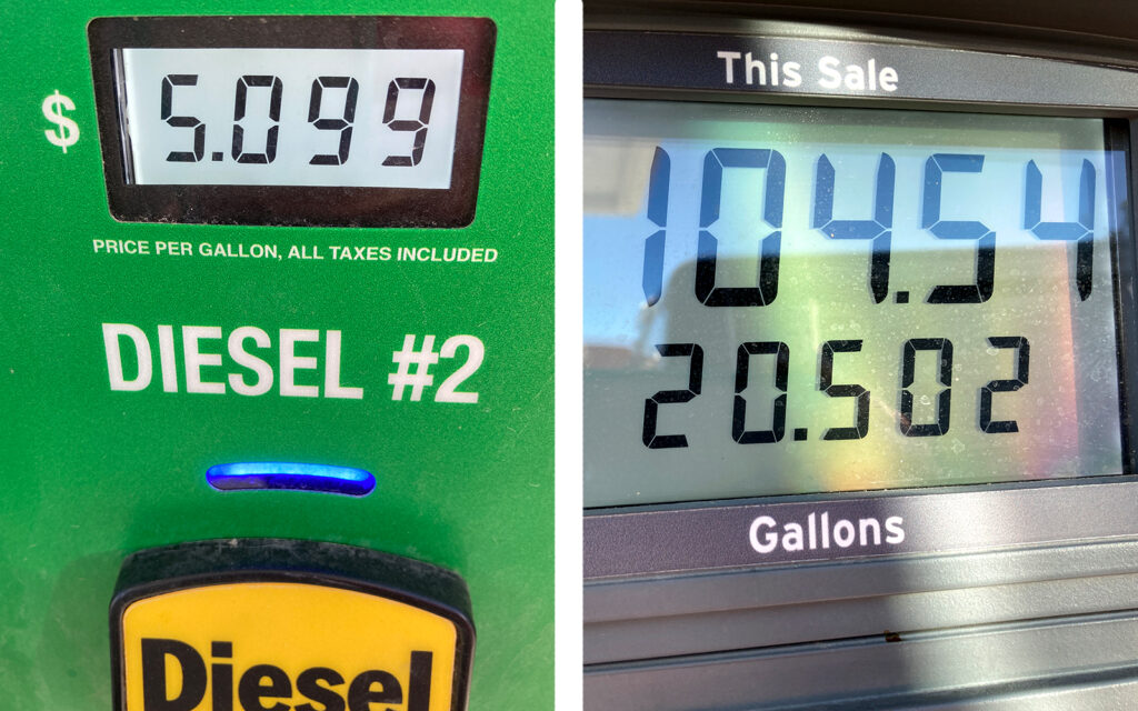
Before heading back to Nevada, I fueled up at this VERY EXPENSIVE gas station in the park. $104 for a half tank of diesel!!!
Rhyolite Ghost Town, Nevada
Exiting the park and returning to Nevada, we stopped at the Rhyolite Ghost Town. Unfortunately, everything was fenced off so all we could do was stand on the outside looking in.
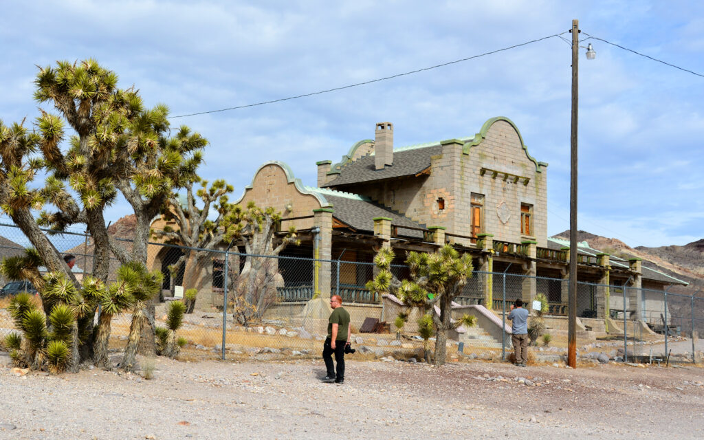
The old train station.
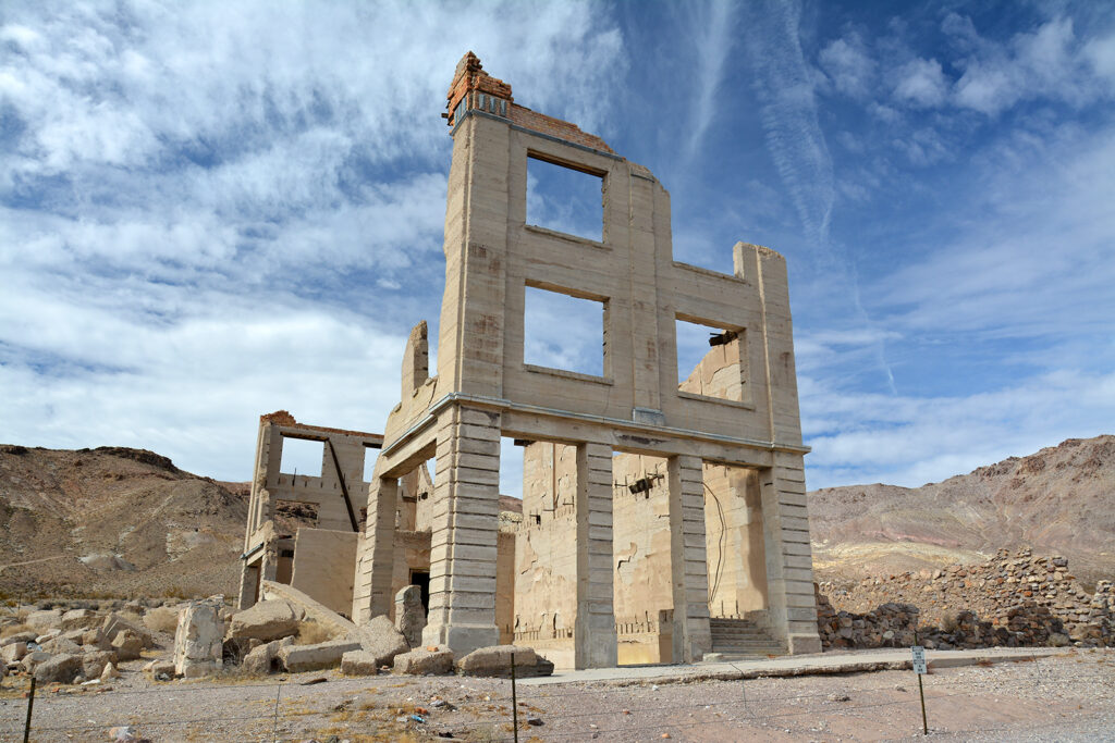
What’s left of the bank.
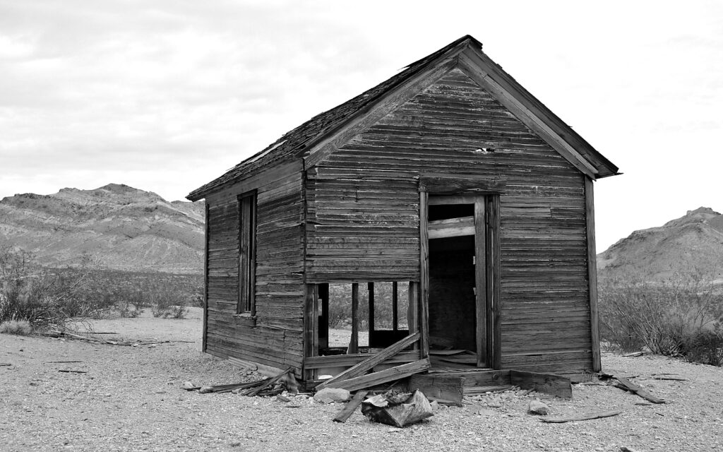
An old shack.
Return to Valley of Fire State Park, Nevada
On February 11, we drove 150 miles from Death Valley National Park back to my campsite at Valley of Fire State Park where we were able to fit the other two cars in my site along with my truck and trailer. It was a huge site! They each paid the dry camping rate for two nights, while I was paying the RV hookup rate for 10 nights.
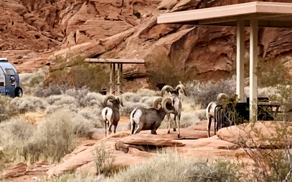
Entering the campground, we spotted these bighorn sheep wandering through.
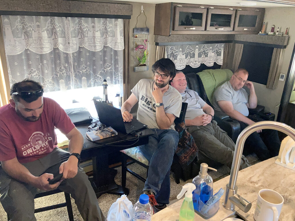
Hanging out with the guys in the trailer.
DAY 5
Elephant Rock at sunrise
After getting a good night’s sleep we got up early to photograph Elephant Rock at sunrise.
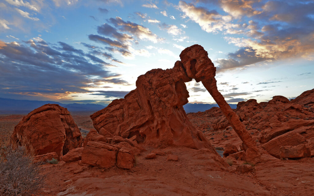
Elephant Rock.
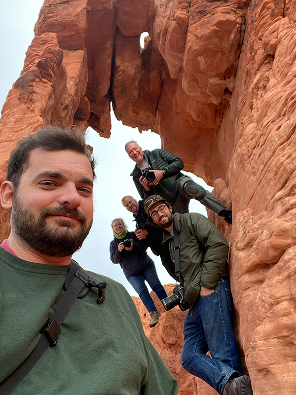
Pete took this selfie that looks like an album cover from a 60s rock band. We named our group “Lerro and the F-Stoppers.”
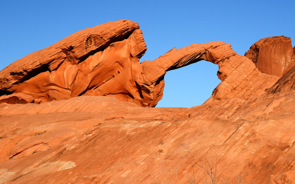
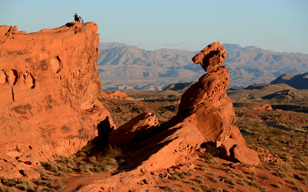
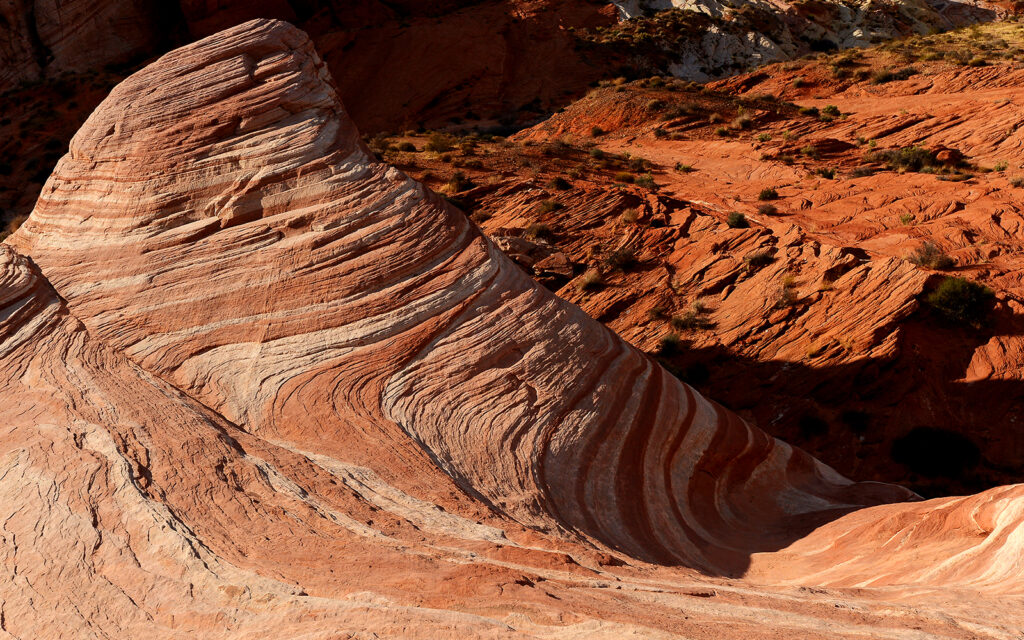
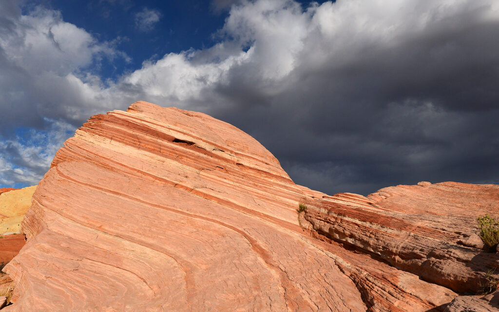
Scenes from around Valley of Fire State Park
This rock formation looks like a mini Crazy Horse Memorial.
This rock looks like a T-Rex eying those people for dinner.
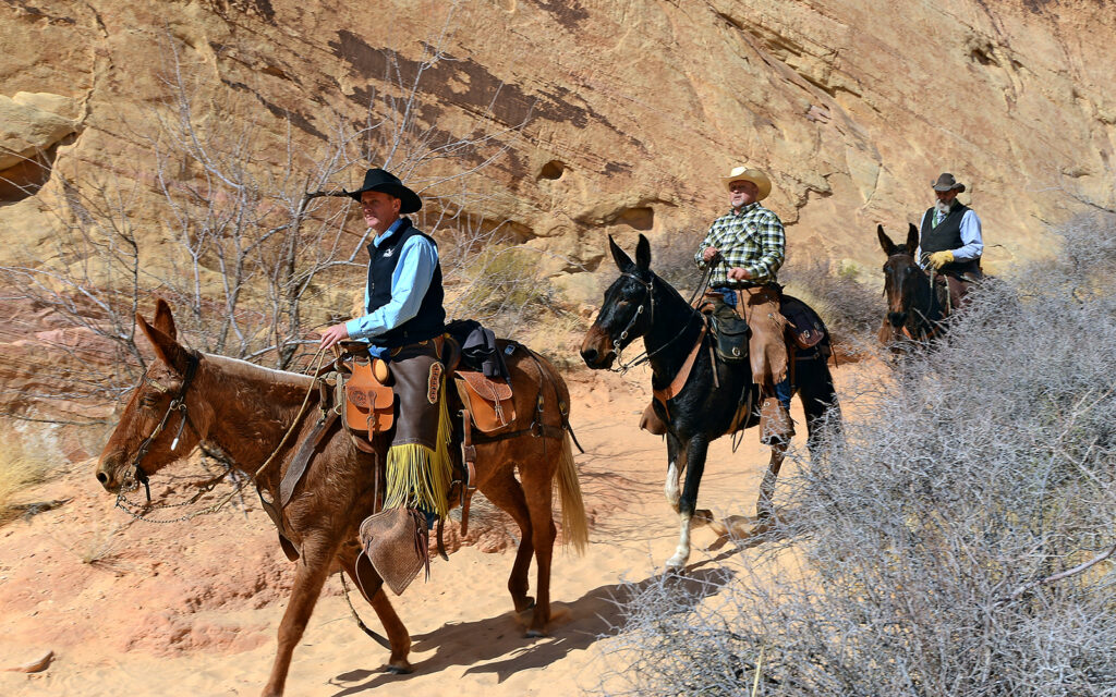
A group of mule riders heading down White Dome Trail into the slot canyon.
We returned to the campsite for dinner and a second night of sitting around the campfire and another good night’s sleep (unusual on a Lerro Photography Workshop).
DAY 6
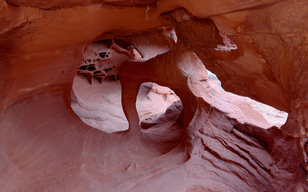
Pete found this interesting hollow in the rock that we photographed in the early morning light. I think it looks like the inside of a heart chamber.
Rainbow Vista AKA Bacon Rocks
The striping in these rocks makes them look like they’re wrapped in bacon.
This marked the end of our adventure and the guys all headed to Las Vegas where they would fly back east. I stayed another couple of days before moving to southern Arizona in search of some warm weather. I watched numerous RVs circling like sharks and remembering how hard it was for me to get a spot in this campground, I flagged down a couple in a van camper and offered to share my extra-large campsite with them. I was using the 50 amp outlet but there was also a 30 amp, which is what they used and there were two water hookups. They paid the RV hookup rate for one night and left the next morning.
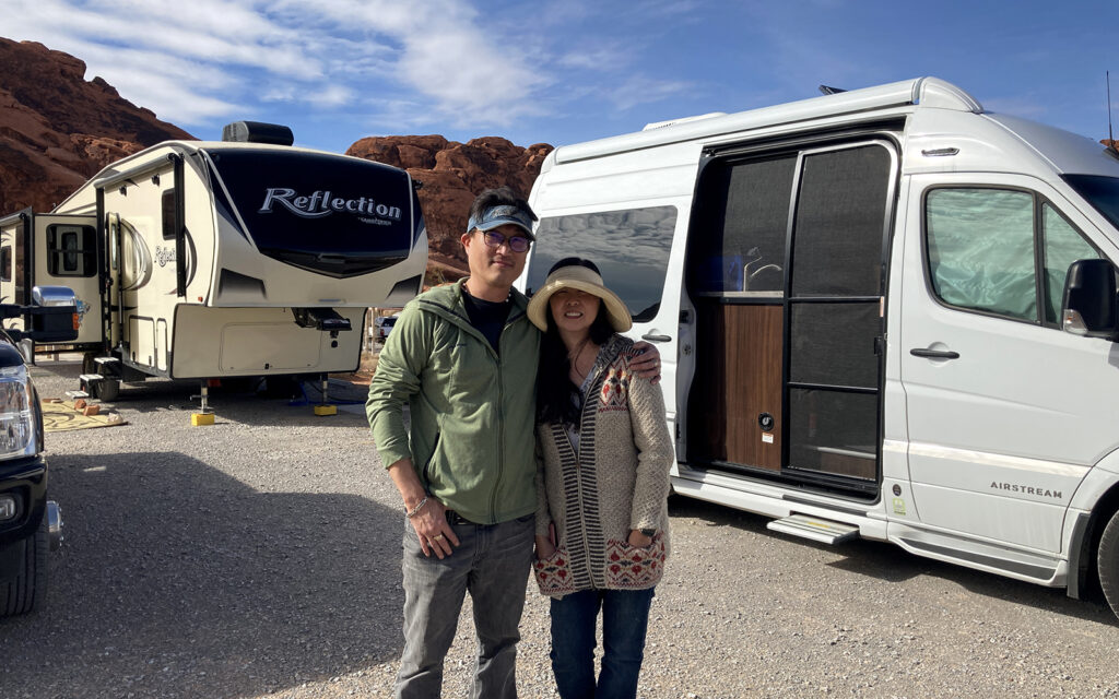
I shared my campsite with Peter and Betsy from California because RV sites fill up quickly.
On February 16, I packed up and moved to Bullhead City, Arizona where the weather was perfect.
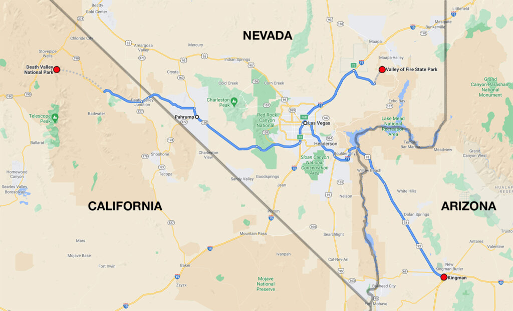
It was 150 miles from Kingman, Arizona to Valley of Fire State Park in Nevada, another 150 to get to Death Valley National Park in California, and then back to Valley of Fire.
Next post: Seven more weeks in Arizona.
My name is Lindsay Reed and I’m a photographer and retired graphic artist with a passion for both lighthouses and road trips. I am living as a full-time solo RVer in my 33 foot Grand Design Reflection Fifth Wheel trailer and plan to spend the next few years traveling the U.S. and Canada photographing not only lighthouses but everything else there is to see in this wonderful land. I hope you enjoy my blog and will follow my adventures in the months and years ahead.
4 thoughts on “Death Valley Photo Workshop”
Oh Lindsay, this seems like the best blog /trip (? ) EVER !! It’s overwhelming.
It’s amazing. I was so excited reading and viewing everything. The photos are fantastic!
How did the cat fare? Did she enjoy the extra company or just hide?
I’m so happy you took this trip and wonderful workshop and I love the name of your band 😅❗
I’m so glad you introduced me to your blog!!!!!!!!
What a treat.
Love,
Bunny
Thank you! I attended another workshop at Arches National Park a couple of weeks ago and you’ll be amazed when you see those photos in a future blog.
I love reading your blog, the pictures are wonderful. Keep sending and posting and I’ll keep following. Drive safe. !
Thanks, Debbie!