The back woods of Kentucky and West Virginia
KENTUCKY
By mid-June, I had made my way into the mountains of Eastern Kentucky and spent a week at Daniel Boone National Forest. The campground is located on Cave Run Lake, although I couldn’t see it from my site due to the thick forest. There was a bathing beach nearby that offered nice views of the lake.
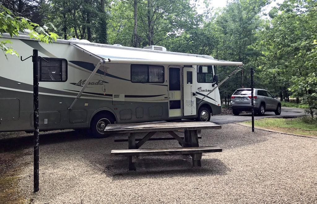 My campsite at Daniel Boone National Forest.
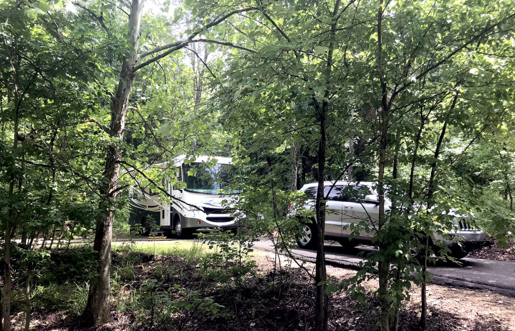 The campsites are tucked into the trees, providing plenty of privacy between neighboring sites.
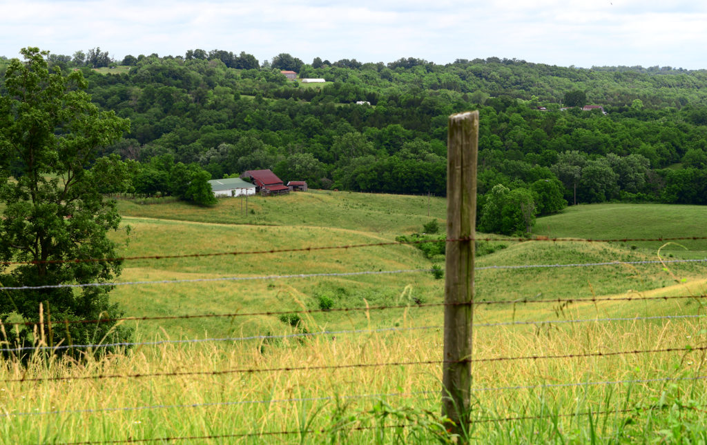 Kentucky countryside.
 A view of Cave Run Lake from an overlook on the 15-mile road through Daniel Boone National Forest to the campground.

Cave Run Lake bathing beach at the campground in Daniel Boone National Forest.
There wasn’t really anything to do here but enjoy the serenity of living in the woods with no one else around—other campers were only there on the weekend. I chose this location for the seclusion and quiet. Nailed it!
I’m a member of RVillage, an online RV community where I can chat with other RVers with similar interests. One of the people in my group is an author, William Whittom, from Kentucky who was in my area of the state to see his publisher so we agreed to meet for dinner at a Cracker Barrel in Mount Sterling, Kentucky. This was the first time I’d had an opportunity to meet anyone from the club and it was nice to make the connection. We would meet again at a rally in Hot Springs, Arkansas in October.

My RVillage friend, William Whittom, and I met for dinner at Cracker Barrel in Mount Sterling, Kentucky.
WEST VIRGINIA
From here I moved northeast to the mountains of eastern West Virginia. Actually, the entire state is covered with mountains so you can take your pick of places to be awed.
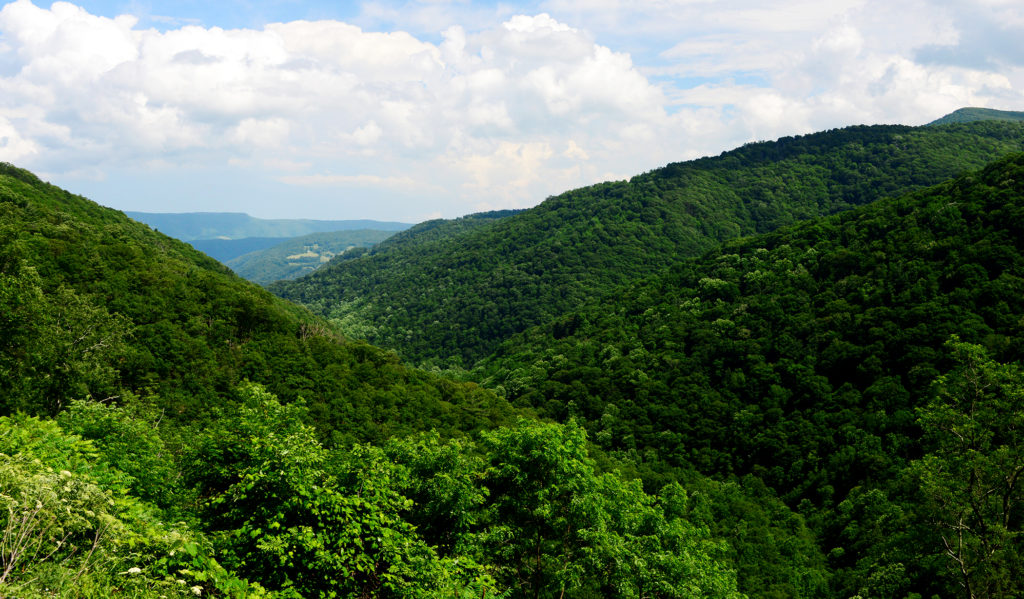 This is why West Virginia is known as The Mountain State.
I stayed at Ravelle’s River Resort near Elkins, WV for the following week with no phone service or internet at the campground so I was completely off the grid for awhile. But it was really beautiful here, so I didn’t care much.

My site backed up to a babbling brook that made for some nice photos but after several wild thunderstorms, the water rose considerably, spurring me to ask the management about flooding issues. Apparently, they’ve had the water rise enough a couple times to warrant waking campers in the middle of the night to move to higher ground. Luckily, it never got that bad during my stay.
![]() The brook behind my campsite looked like this when I arrived. Keep an eye on this one rock (it stood about two feet out of the water)…
The brook behind my campsite looked like this when I arrived. Keep an eye on this one rock (it stood about two feet out of the water)…
![]() After two days of heavy rain, all the other rocks are underwater.
After two days of heavy rain, all the other rocks are underwater.
![]() After four days of heavy rain, even the big rock is gone now.
After four days of heavy rain, even the big rock is gone now.
I chose this location because I’d seen photos of Seneca Rocks, a spot where the rock has been upended and rotated 90 degrees to form a spectacular outcropping of quartzite that stands out against the otherwise densely forested mountains in the Monongahela National Forest.
There’s a hiking trail up the left side that I wanted to do but it never stopped raining long enough. This shot was taken an hour before another violent thunderstorm rolled through.
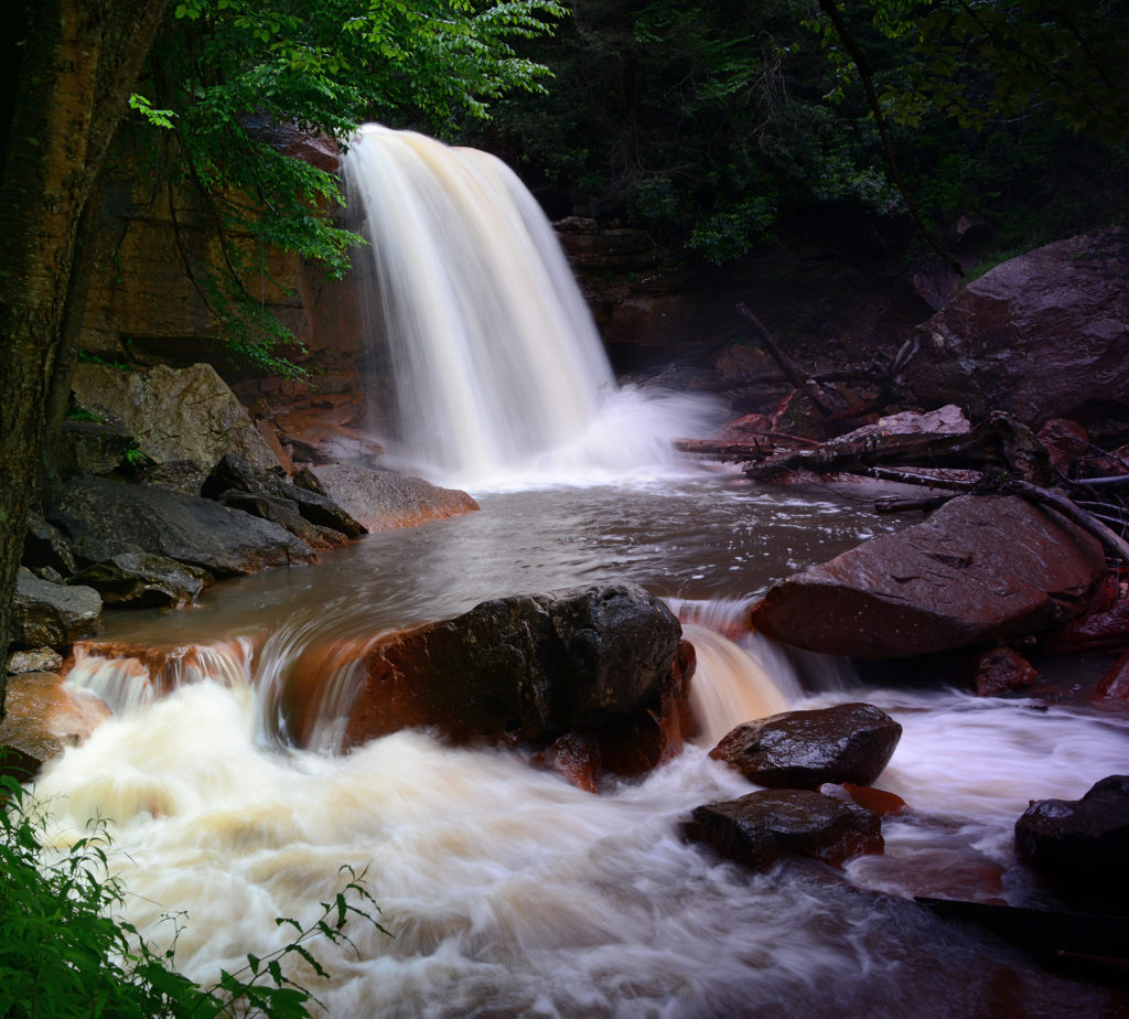
I also visited Blackwater Falls. Dropping 62 feet, this is considered the tallest above-ground waterfall in the state. There are taller ones in caves.
 Blackwater Falls was easily accessible in a state park.
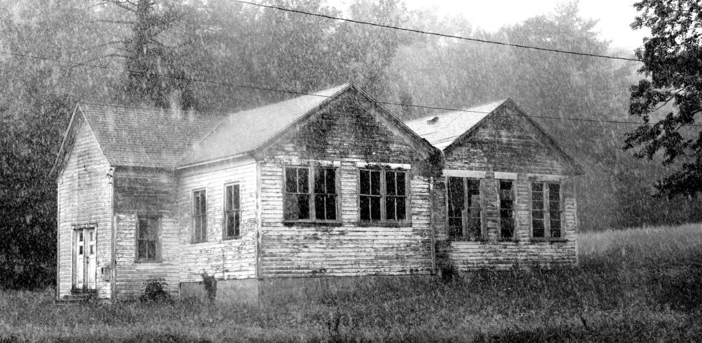 I spotted this old weathered house on a drive through the mountains and thought it was interesting, especially in the pouring rain.
I took a scenic train ride from Elkins, WV through the mountains of Monongahela National Forest to The High Falls of the Cheat. The train brings you to an easier access point to view the falls than if I drove there and had to hike nearly 8 miles round trip. The old coal mining train track runs parallel to Shavers Fork, a branch of the Cheat River.
 The New Tygart Flyer scenic train from Elkins, West Virginia to High Falls.
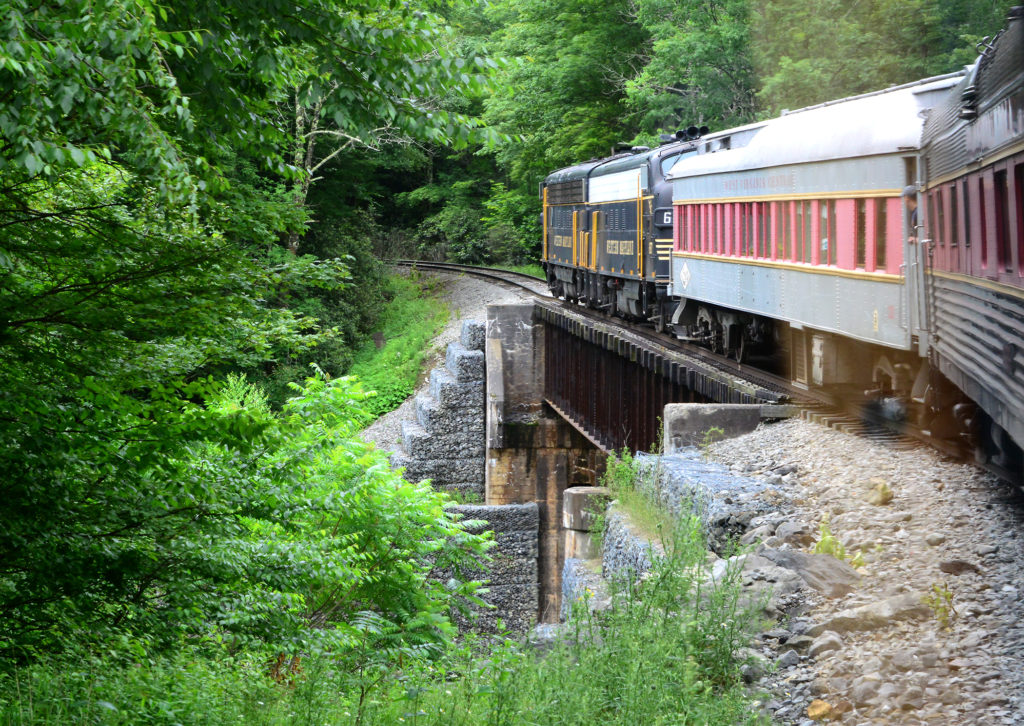 The train ride along an old coal mining track.
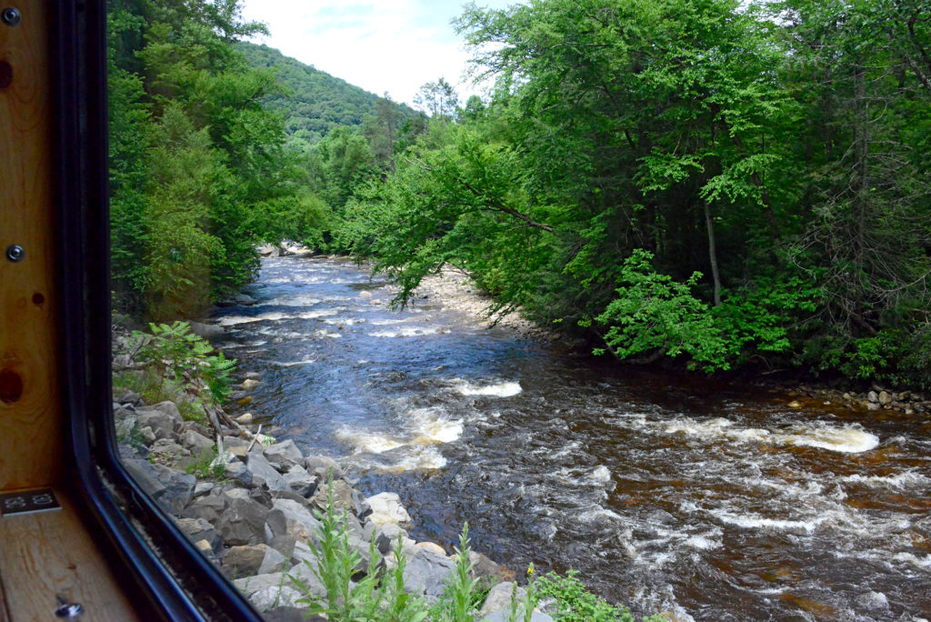 Shavers Fork, a branch of the Cheat River in West Virginia as seen from the train.
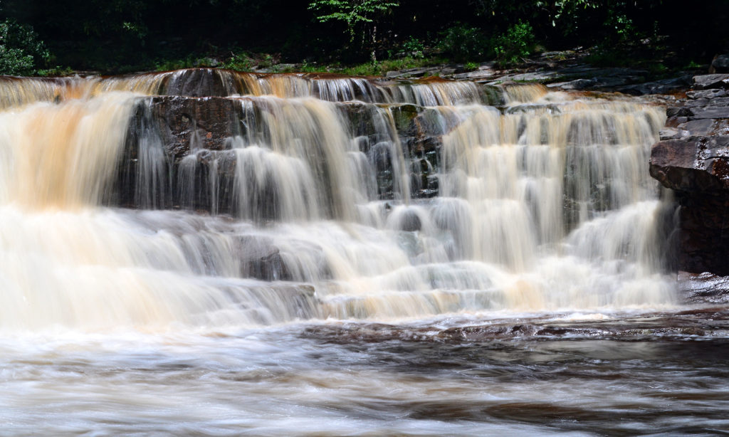 The High Falls of the Cheat River.
The High Falls of the Cheat River.
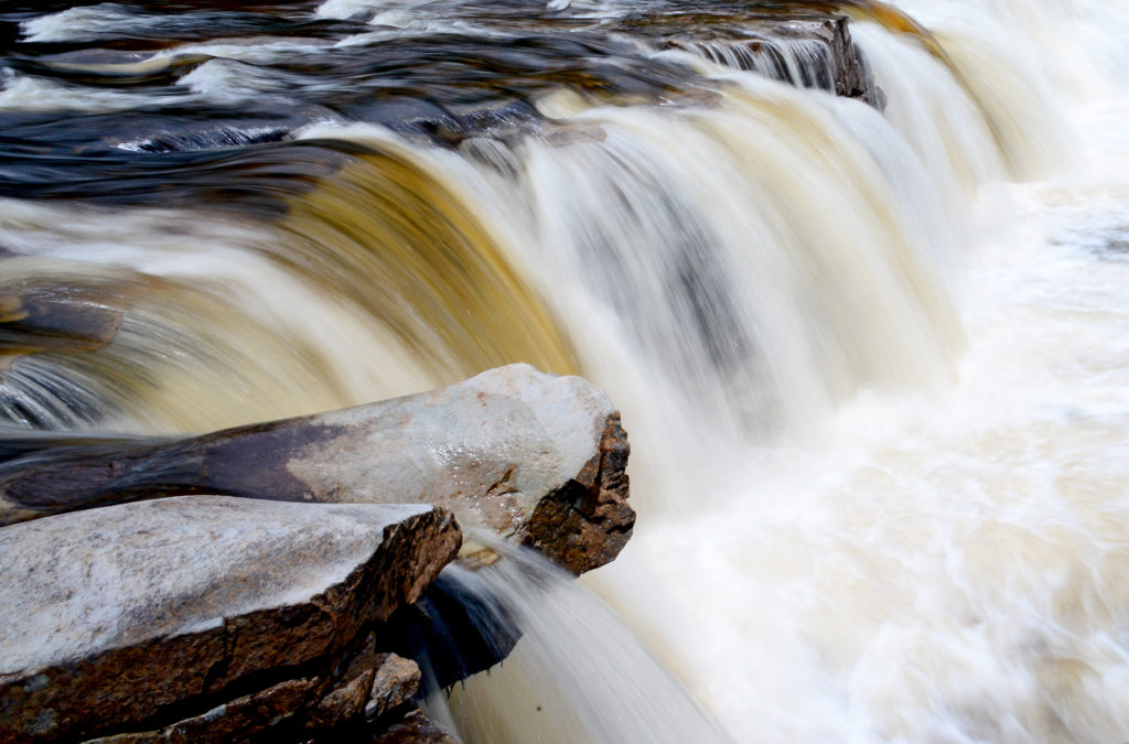
I prefer to photograph waterfalls with a slow shutter speed to soften the water as is spills over the rocks, giving it a “ribbon” effect. It helps the water stand out better against the rocks. Here you can see the difference between that and a fast shutter speed that “freezes” the action.
 A slow shutter speed softens the water for a “ribbon” effect.
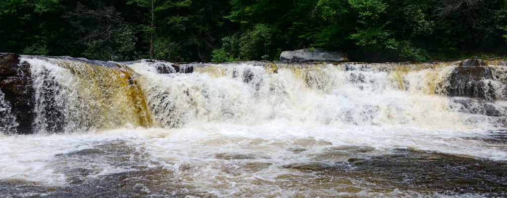
A fast shutter speed “freezes” the water.
Douglas Falls was the most challenging location here. There was a long drive on an unpaved road and I parked on the side of the road to go in search of the falls. There was a very steep, rocky climb down to the bottom. Someone has actually installed a rope to assist with the climb back up.
 The road to Douglas Falls.

Should I or shouldn’t I? Life is nothing without risks and my photography often gets me into some sketchy situations.
I was rewarded with a gorgeous setting that made for some great photos. There was trail that followed the creek but with all the rain, it was very muddy and slippery and I didn’t want to risk falling into the water with my camera so I didn’t explore as far as I would have liked.
 Douglas Falls.
 My travel route from Tennessee to West Virginia.
Next post:
Gettysburg and the Flight 93 Memorial.
2 thoughts on “The back woods of Kentucky and West Virginia”
Wow – America the Beautiful!
This must be an awesome experience for you! Thx for sharing!
Your photographs are stunning as usual. Have a good trip.