Eastern Montana
Normally, I would have gone to Canada for the month of August but with the border closed due to Coronavirus, I needed to fill some time. Since my future plans for visiting Montana only include the western mountain region, this was an unexpected opportunity to see the eastern portion, which is very similar to North Dakota except they grow beef cattle here instead of wheat. I stayed in five Montana towns in just over three weeks and found something surprising in each one. Consequently, this post is rather long with about a hundred photos but please bear with me and enjoy the journey.
This is why they call it “Big Sky Country.”
MILES CITY, MONTANA
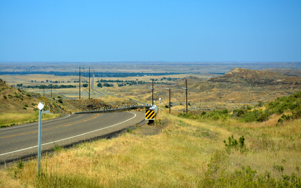
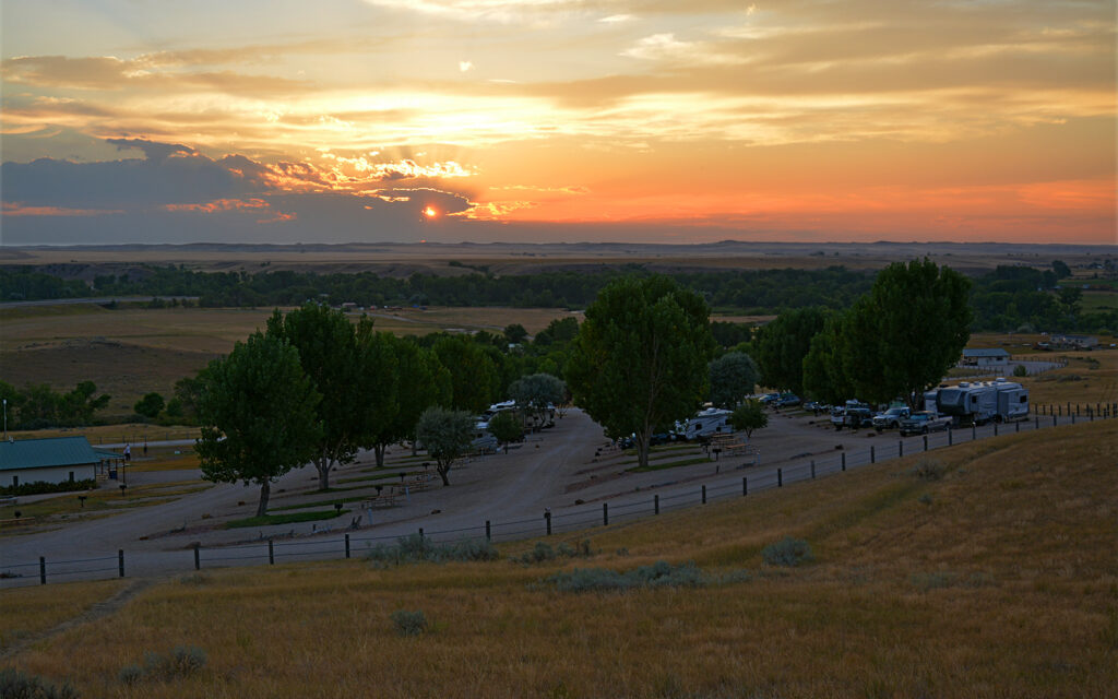
First stop was Miles City located on the Yellowstone River in Eastern Montana. In the 1880s, Texans brought large herds of cattle here to feed on the open grassland, fattening them up before shipping east for slaughter an has been known as “The Cow Capital of the World” ever since. I stayed a week at Big Sky Camp & RV Park where the owner was kind enough to bring me her newspaper each day. I love reading local newspapers to get a feel for the area I’m in. I took a couple of drives through the area to see the scenery and found a park to go hiking and an old bridge to cross that I probably shouldn’t have.

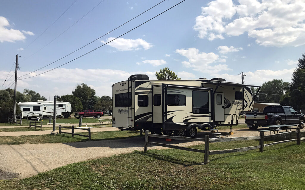
My campsite at Big Sky Camp & RV Park in Miles City, Montana.

The view from my campsite—every day brought interesting clouds over the hill.
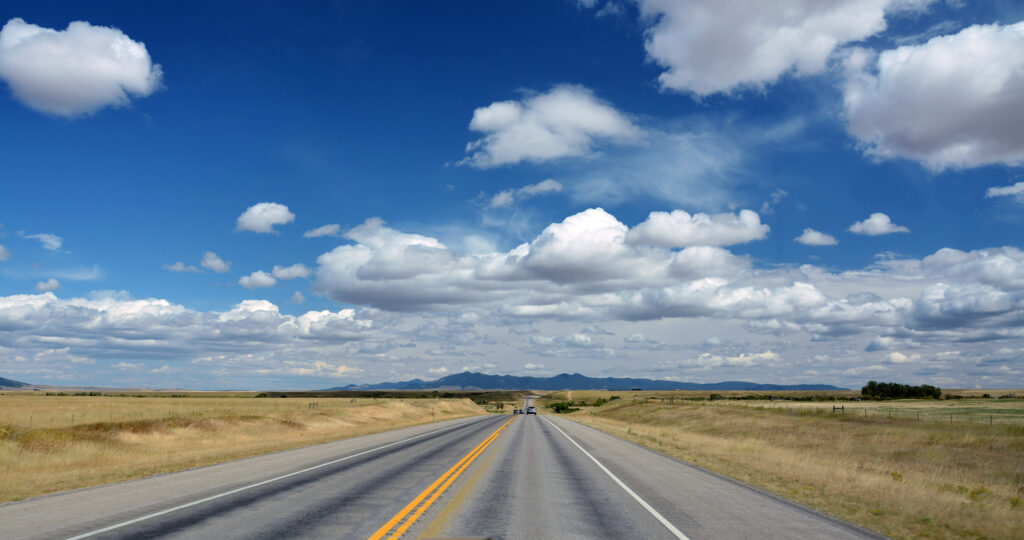
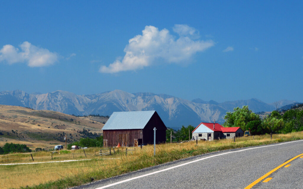
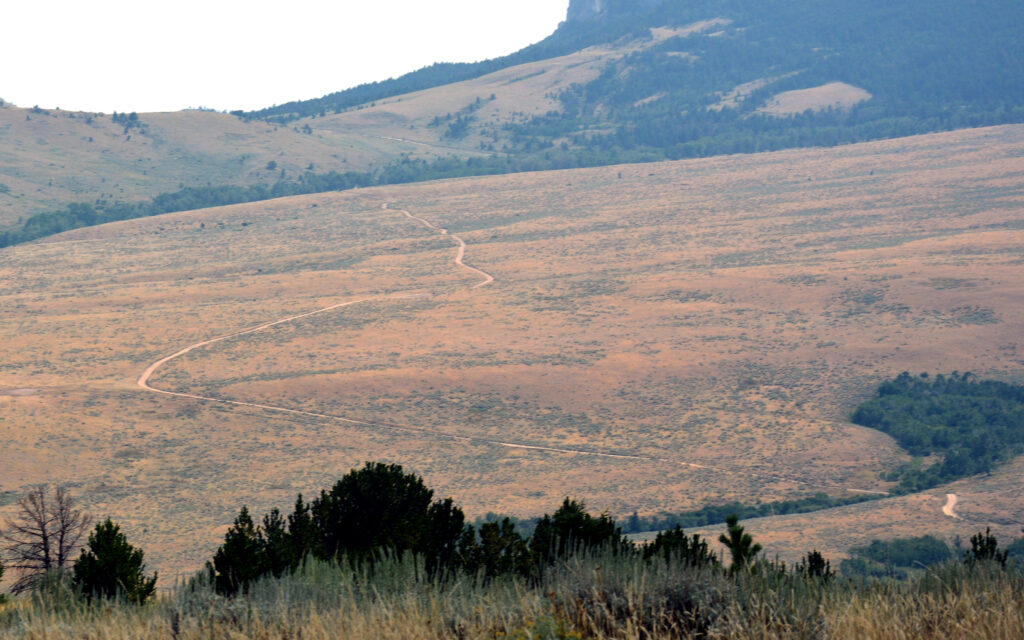
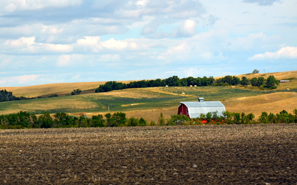
The road south of town offered some nice views.

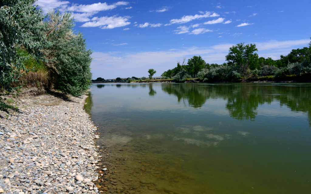
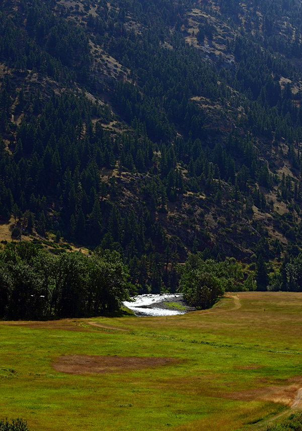
I hiked through Pirogue Island State Park to this nice spot on the Yellowstone River.
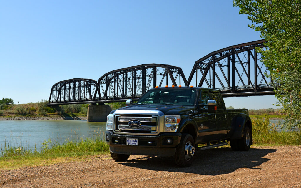
Kinsey Bridge crosses the Yellowstone River to a popular fishing spot. This steel through-truss bridge was built in 1907 and it’s single lane deck is 8.9 feet wide. My “Big Ass” truck is 8 feet wide, making it a tight fit and the metal plates covering the wood deck made quite a racket.
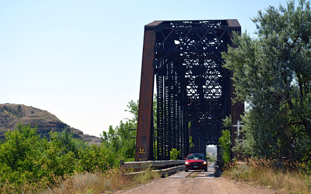
Waiting for another driver to cross the single-lane Kinsey Bridge.
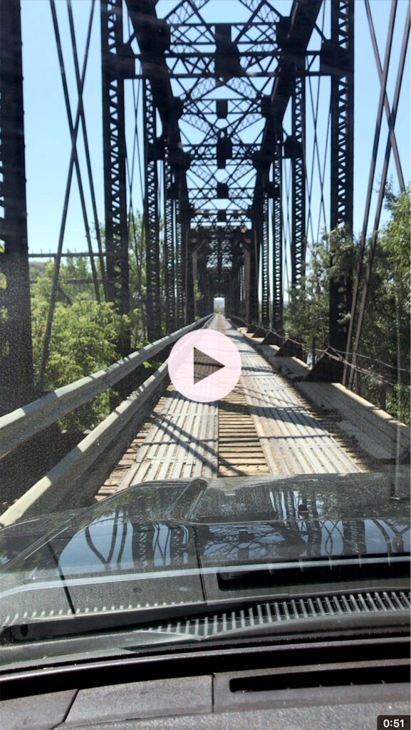
Click on image to experience my white-knuckle drive across Kinsey Bridge.
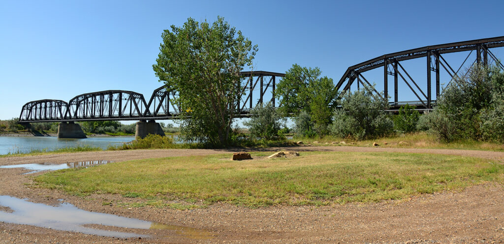
There are four bridge sections, totaling just over a thousand-foot span.
Ford ad.
GARRYOWEN, MONTANA
A hundred and fifty miles southwest of Miles City is Garryowen on the Little Big Horn River where George Armstrong Custer met his death at the hands of Sioux and Cheyenne Indians in what has come to be known as Custer’s Last Stand. Visiting the Little Big Horn Battlefield National Monument is the only thing there is to do here but its worth the trip. I stayed a week at 7th Ranch RV Camp, just a couple miles from the battlefield. The entire campground is on an incline with the campsites terraced into the slope and a larger hill beyond that made for great sunset views.

My site at 7th Ranch. I’m the second from the right.
Sunset view from the hill above the campground.

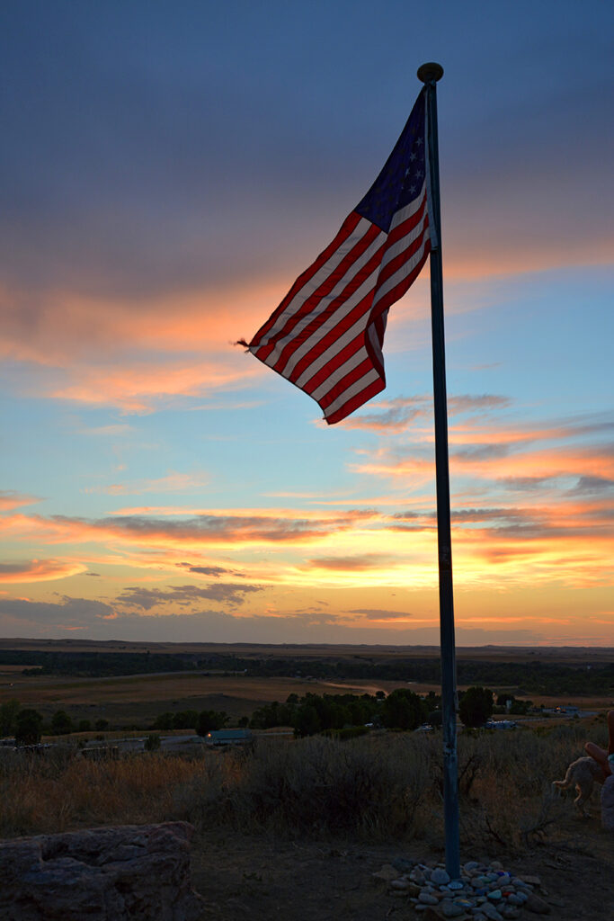
Nothing beats the American flag with a beautiful sky for a backdrop.
The self-guided driving tour of the battlefield is a beautiful drive through rolling hills and the interpretive markers are illustrations of the landscape you are looking at with the events added to help you visualize what was going on in 1876. The battle covered an area as large as 11,000 acres but most of that is Crow Indian Reservation or private land. The national monument consists of two separate pieces of land, totaling 765 acres where most of the meaningful action took place. The driving tour takes you through private land that is between the two government-owned properties.
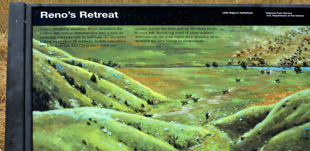
This illustration shows the location where the Indians chased the cavalry back across the river and up the steep hills.

This is the view of the same location today with trees now lining the riverbank.
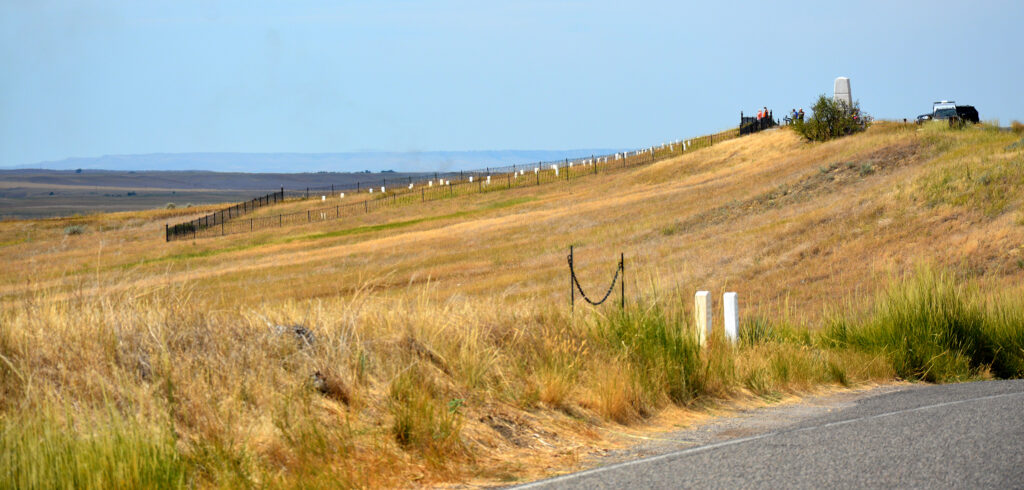
The hillside with the fenced-in markers is the location of the “Last Stand,” where Custer and his remaining soldiers were unsuccessful in fighting off the Indians.

These markers indicate where the men were found and originally buried. They were later dug up and moved to a group burial site and some were sent home to family cemeteries. George Custer is now buried at West Point Military Academy. There are markers throughout the 765-acre park identifying where soldiers and Indians fell.

Cattle getting a drink from the Little Big Horn River.
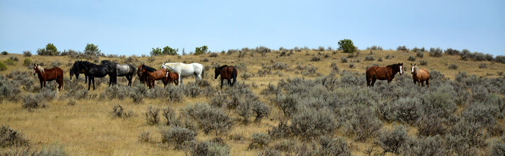
Horses grazing on private land between the two major battle sites at the park.
REED POINT, MONTANA
Next stop was the tiny town of Reed Point, which I chose simply because of the name. I found this town on a map back in 2015 and when I discovered it had an RV park, I decided right then that I had to come here. The town also boasts an Old West saloon that I was looking forward to frequenting while here but, alas, COVID shut that down, too. This was doubly unfortunate because there is nothing else to do here so I thought I’d at least have liquor to get me through the week.
But, have no fear—your intrepid travel guide found several surprising and stunning things to fill her time thanks to one of the camp hosts who gave me a couple great ideas. I found a Prairie Dog Town in Big Timber and an hour south of there was Natural Bridge Falls in Custer Gallatin National Forest. I found a company that does trail rides into the foothills just north of Yellowstone National Park and a breathtaking scenic highway. All-in-all, what I thought would be a boring five days turned into something truly wonderful.
The nearest town for shopping is Billings, the largest city in Montana, which is twice the size of Newark, New Jersey but half the population. It was an hour east so I combined all my shopping needs into one trip. Almost as far as Billings is Laurel, where I found a Ford dealer for an oil change for “Big Ass Truck.” This was the most beautiful car dealership I’ve ever seen, designed to look like a mountain lodge retreat with big timbers. I also met a salesman originally from Medford, New Jersey (of course I did) so we had a great time chatting while I waited.
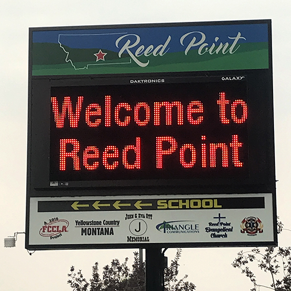
This sign was right behind my campsite, making me feel very welcome.
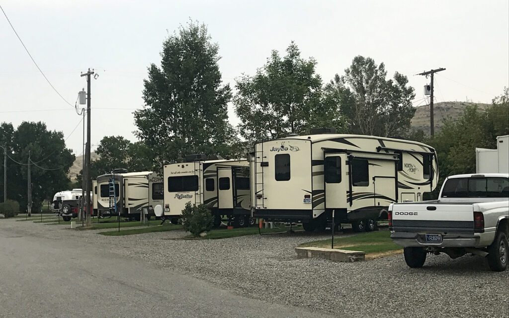
My site at Old West RV Park in Reed Point, Montana. I’m the beige trailer in the middle. It seems all RVs are beige these days.
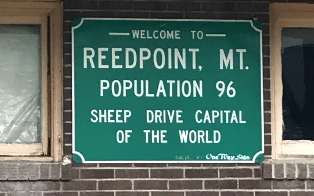
I didn’t see nearly this many people during my stay and the only sheep was a statue in front of the bank.

I missed the world famous sheep drive by about a week. Bummer.
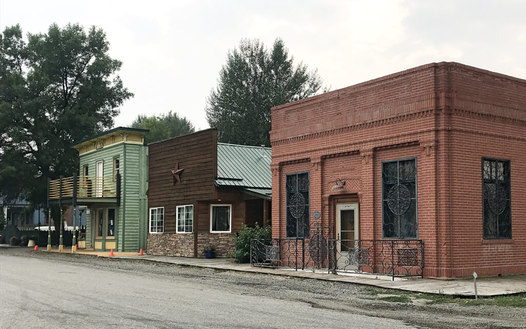
The town has a mix of well and poorly-maintained buildings on Main Street, none of which were open for business.
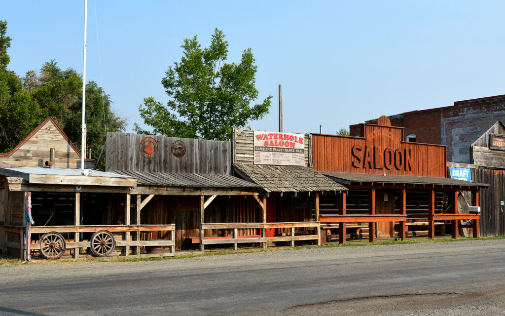
The saloon I had my hopes set on frequenting was closed due to COVID.
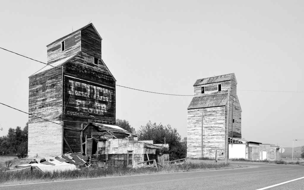
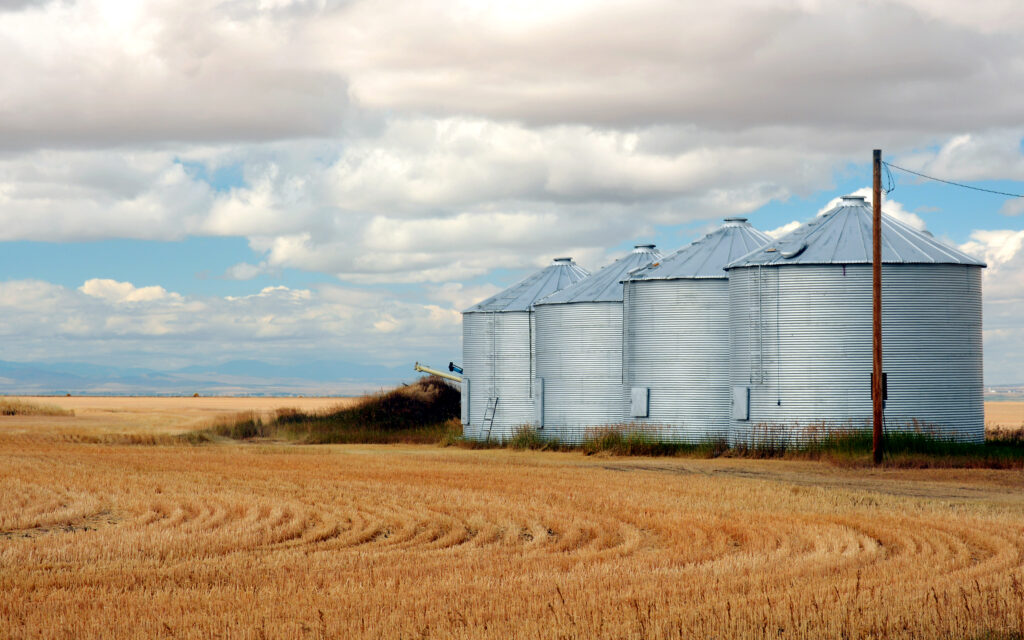
Old grain elevators at the railroad crossing.

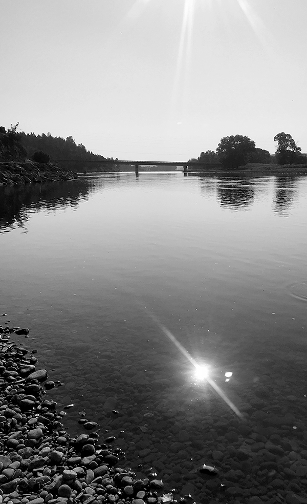
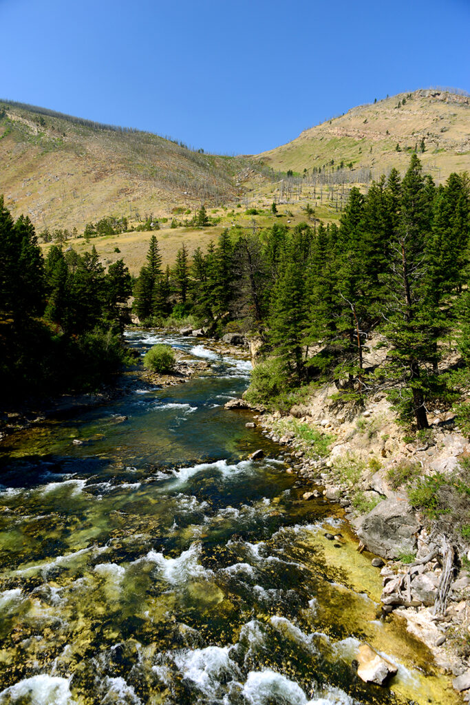
Like Miles City, this town sits right on the Yellowstone River, which I visited early one morning before the fishermen arrived.
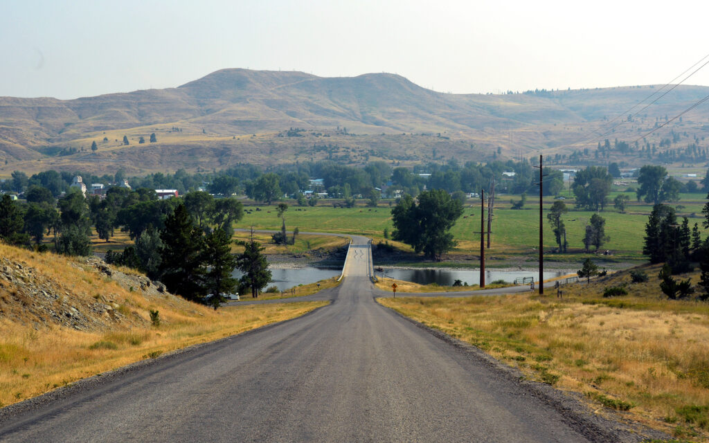
The view from above town, looking down at the bridge over the Yellowstone River and Reed Point beyond.

Spotted this family of deer near the river one morning.

Cattle pasture and grain elevators in Reed Point, Montana.

Thirty miles west of Reed Point is the tiny town of Big Timber.
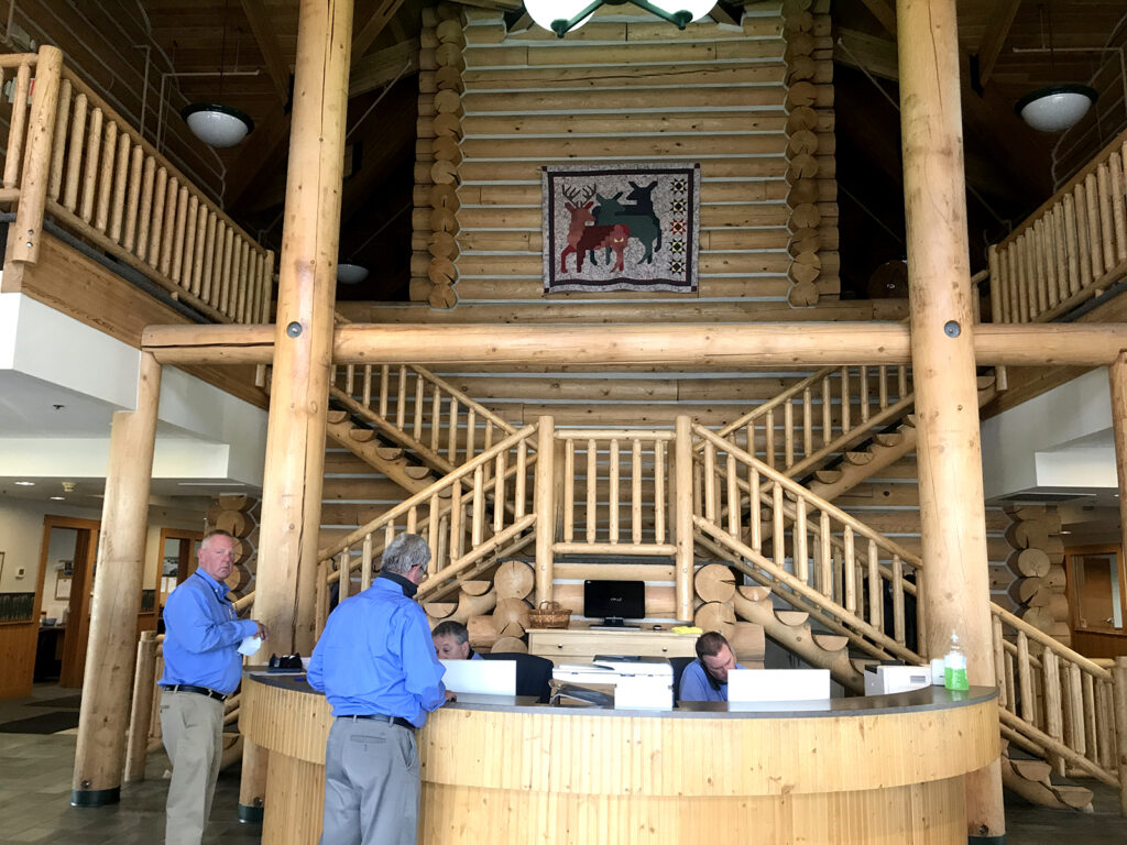
The Ford dealership in Laurel, Montana made me feel like I was at a mountain lodge.
Greycliff Prairie Dog Town
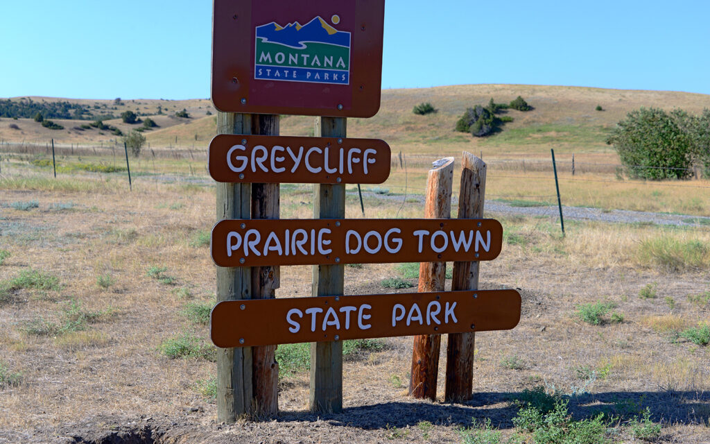
Just outside of Big Timber is a Prairie Dog Town. I’d never seen the critters before and found them quite adorable.

Prairie dogs live in large communities, digging hundreds of burrows in the flat grassland.

Prairie dogs look almost exactly like squirrels, but a little larger and without the bushy tail.
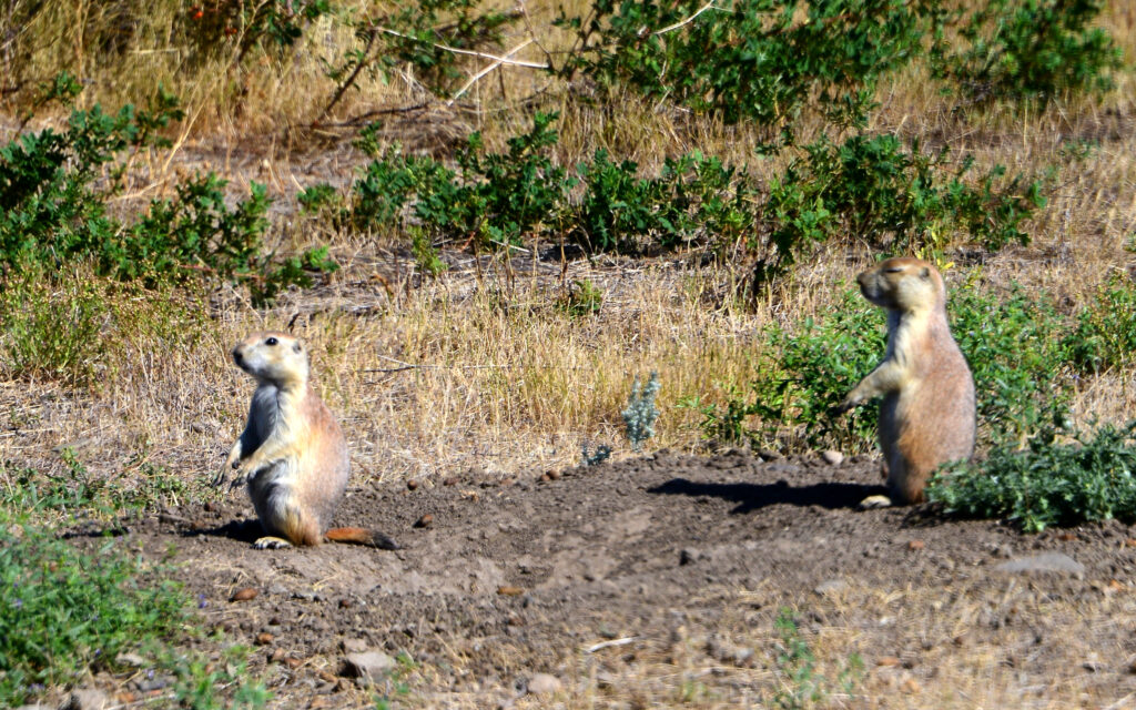
They have a highly developed emergency warning system. Any who perceive a threat will hop and bark to warn the others, although their bark is more like a squeak. Think of your dog’s squeaky toy.
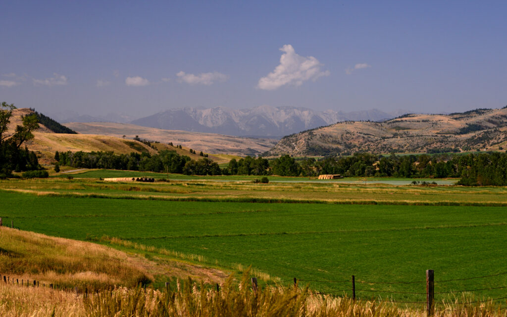
From Big Timber, I drove another 25 miles south to the waterfall I’d been told about. The scenery along the way was equally as beautiful…

Ford ad.
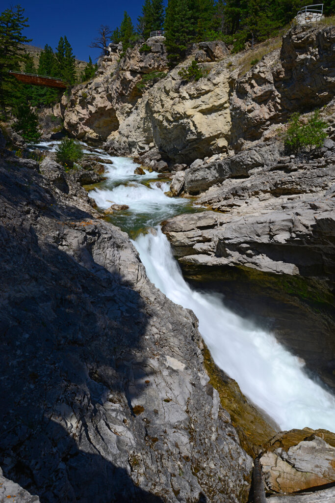
Natural Bridge Falls


Beartooth Scenic Highway
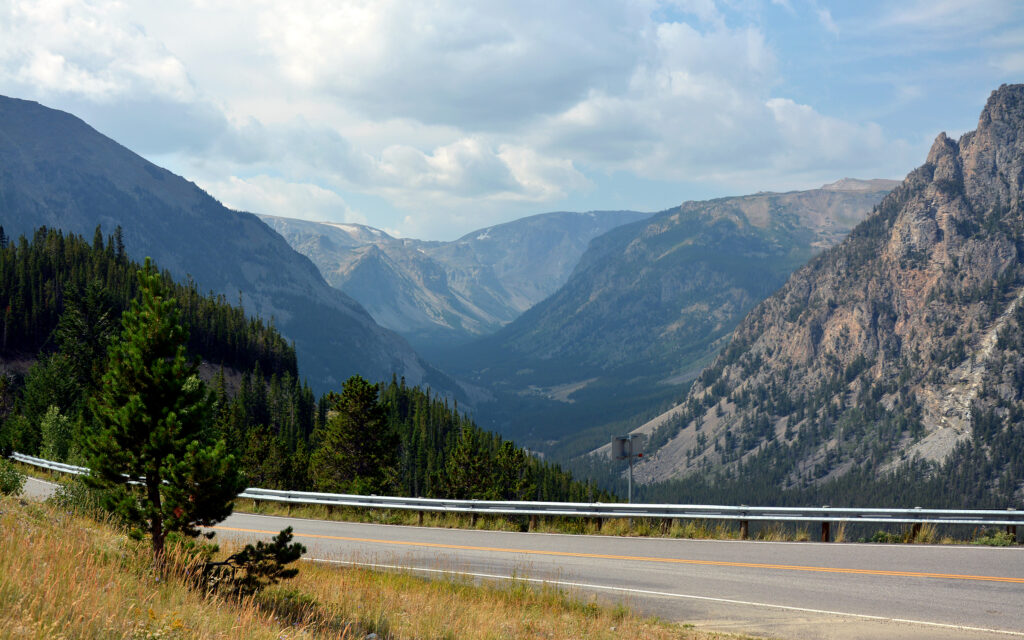
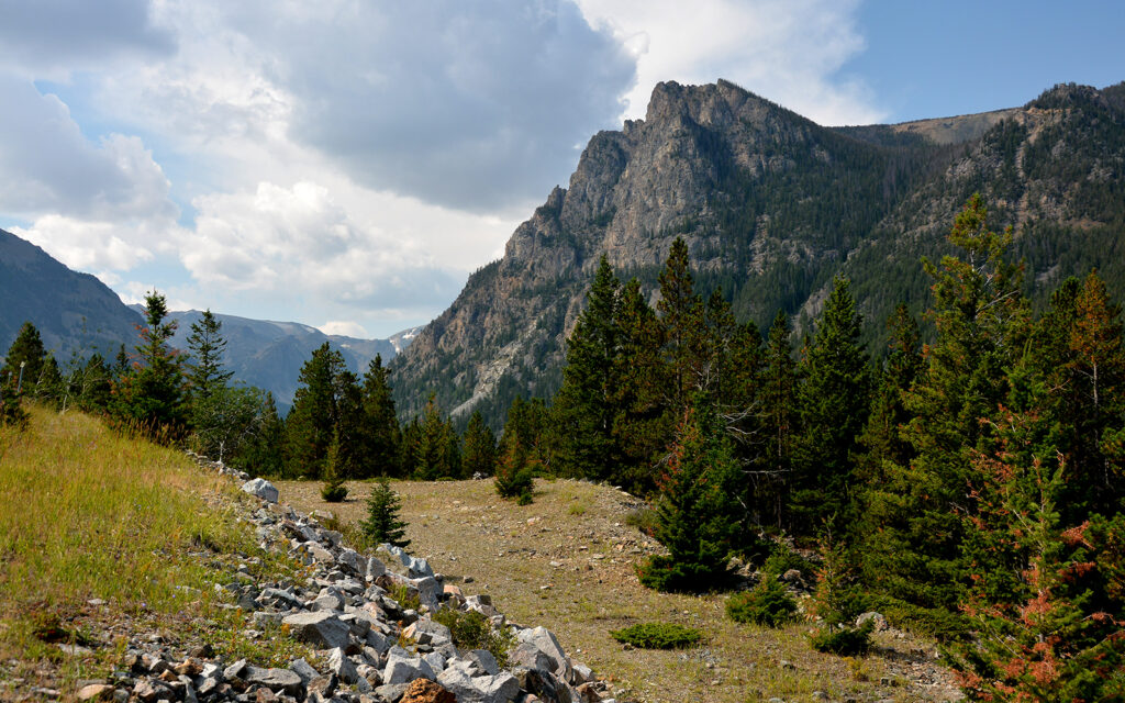
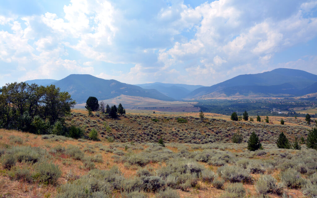
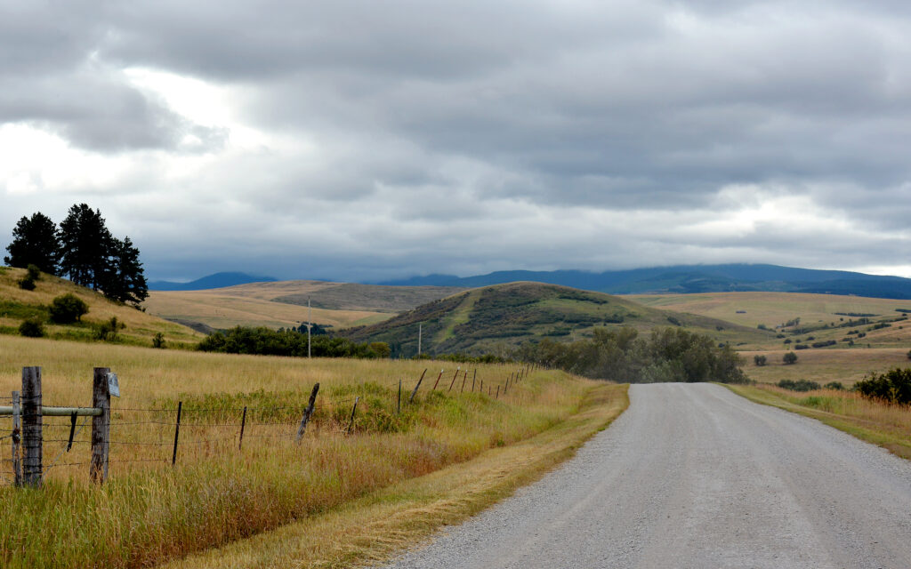
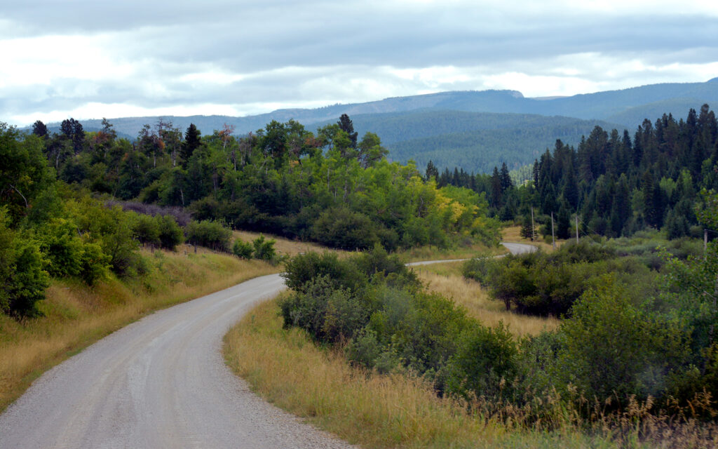
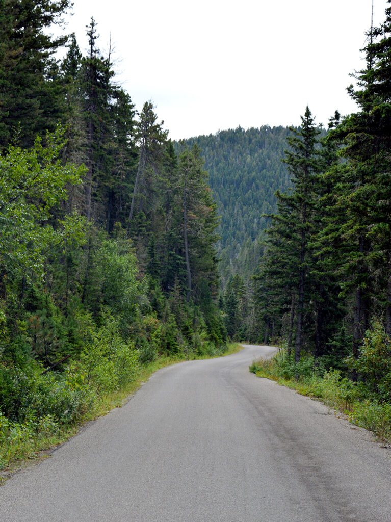
South of Reed Point on US-212 are the Beartooth Mountains, which cross into Wyoming on the northern edge of Yellowstone National Park and the section of highway that runs through the mountains is known as Beartooth Scenic Highway. I had the opportunity to drive some it before meeting up with others for a trail ride in Red Lodge and I can say that it’s worth the detour if you’re ever in Southern Montana.
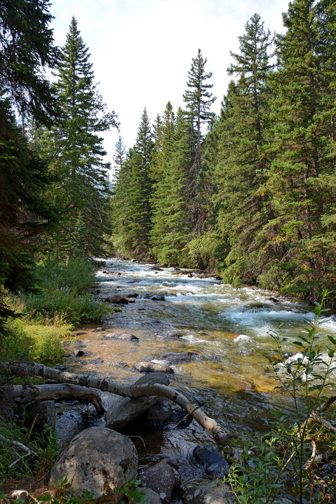
Rock Creek

Ford ad.
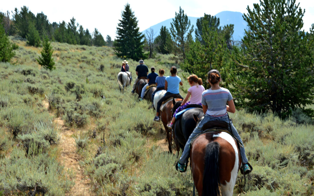
Trail ride in Red Lodge, Montana
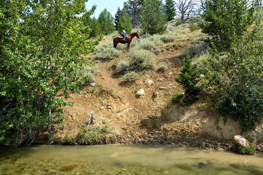
I took a two-hour trail ride out of Red Lodge, Montana with Elk River Outfitters into the foothills about 15 miles from the Wyoming border and the northern edge of Yellowstone National Park. This was only my second time riding a horse but I seem to have gained some confidence and felt quite comfortable on my painted mare. We crossed some open cattle grazing land, then climbed into the hills. We crossed a swift stream where I tried hard to keep my boots dry and after an hour, we ended on a flat plateau with a wonderful view. There was beautiful scenery the entire way and I quickly mastered the art of holding the reins and a camera at the same time.

Downtown Red Lodge, Montana.
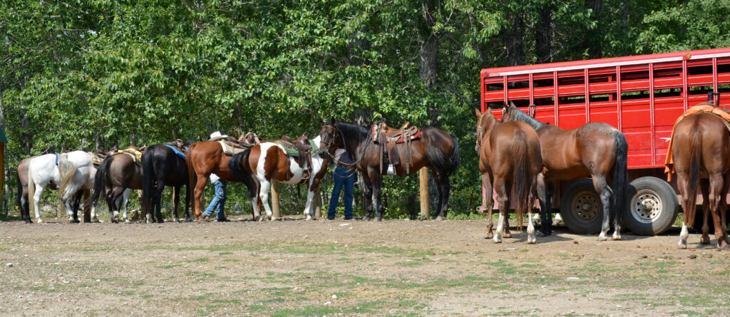
Saddling the horses.
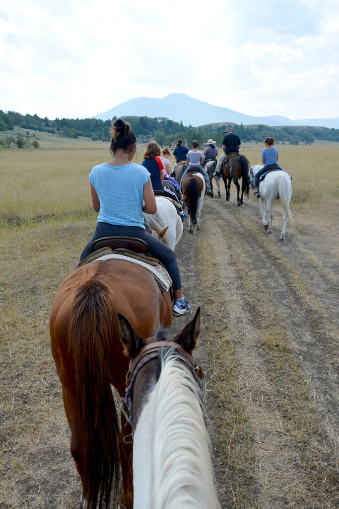
Heading out across a cattle pasture.
Getting strange looks from the locals.
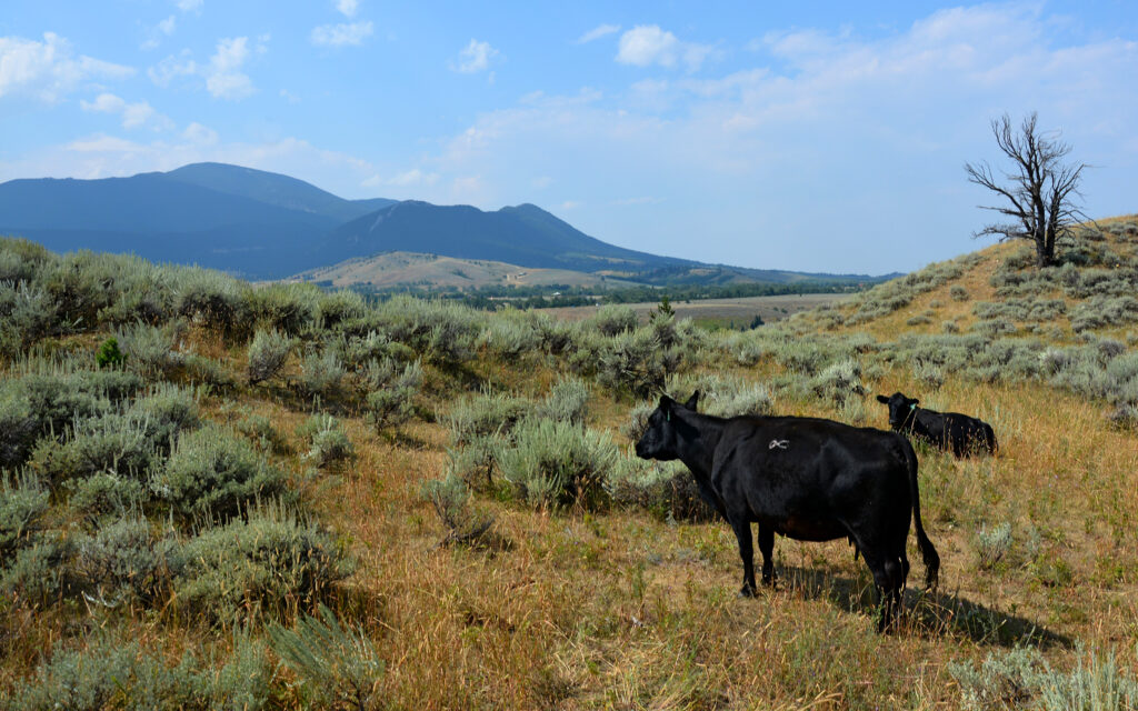
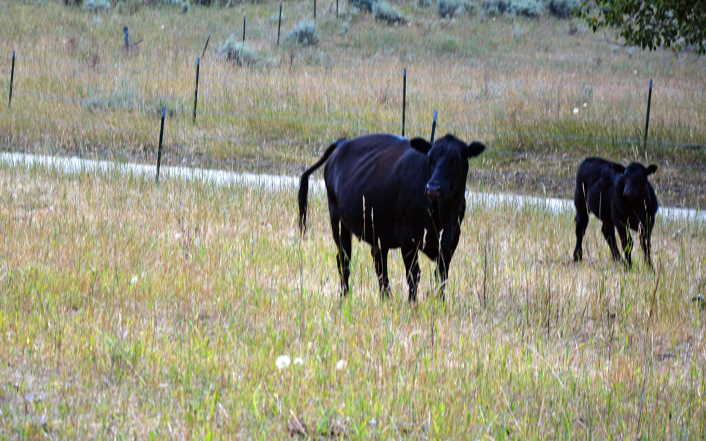
Even the cattle like to enjoy the view.
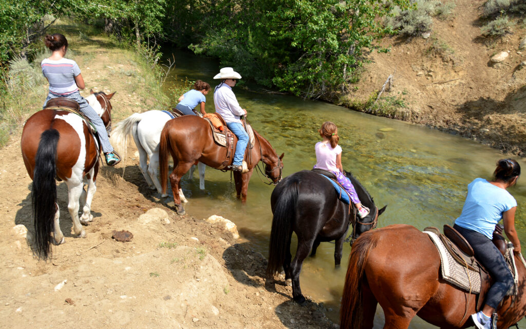
Watering our horses before crossing and climbing the opposite bank.
Yup, we had to get our horses across the stream and up this embankment.
Our reward was this spectacular view.
This trail across the plain is a permanent rut from an old stage coach route.
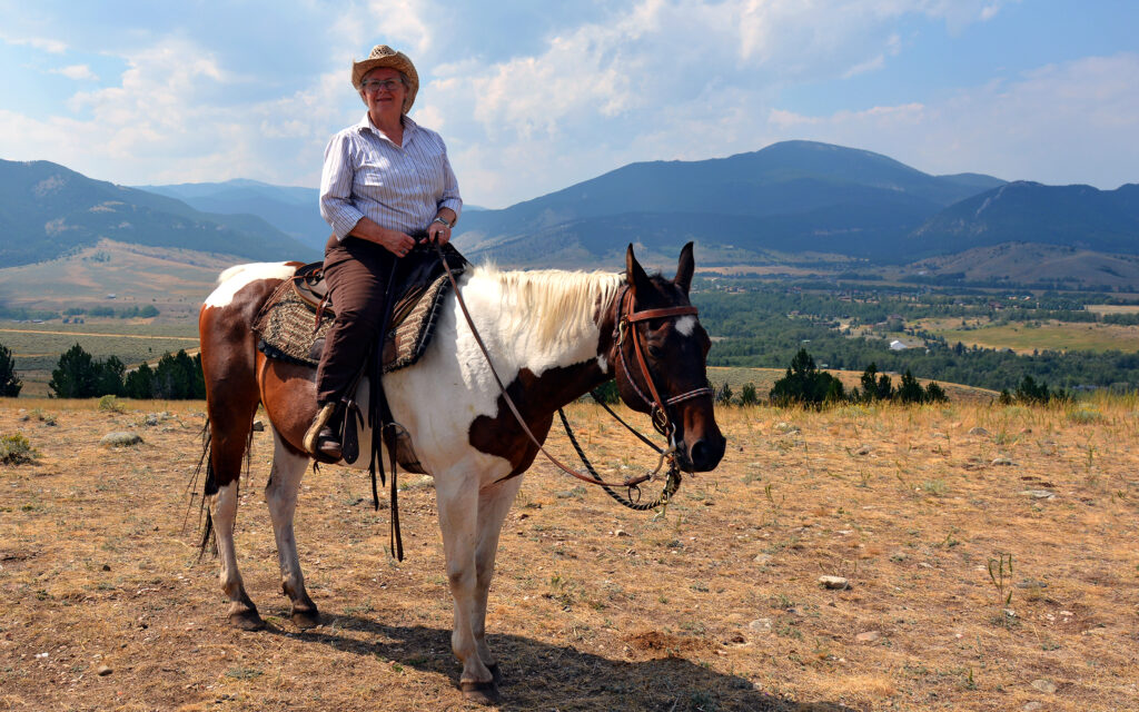
Here I am on my pretty painted mare.

Now it was time to head back downhill, which had its own challenges.

We crossed the stream at a deeper spot this time, causing riders to work hard at keeping their feet dry. I suppose a real cowboy would just let ’em get wet.
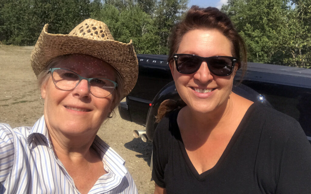
I made friends with Patricia from Georgia on the trail ride. We were both riding solo and stayed to the back of the line and chatted the whole time.
The night before I left Reed Point, I joined several other campers for drinks around a campfire. I had made friends with a few people during my stay here. There was the camp host who gave me tips on the waterfall and Beartooth Highway, a woman who chased after my truck as I returned from riding because she’d heard through the grapevine where I’d gone off to and wanted to hear all about it and how she wished she’d known I was going so she could join me. And then there was Joshua, or as I liked to call him, Big Foot. We spent a lot of time sitting outside my trailer swapping travel stories and comparing notes on the places we’ve been, using the sticker map on the side of my trailer as a reference.
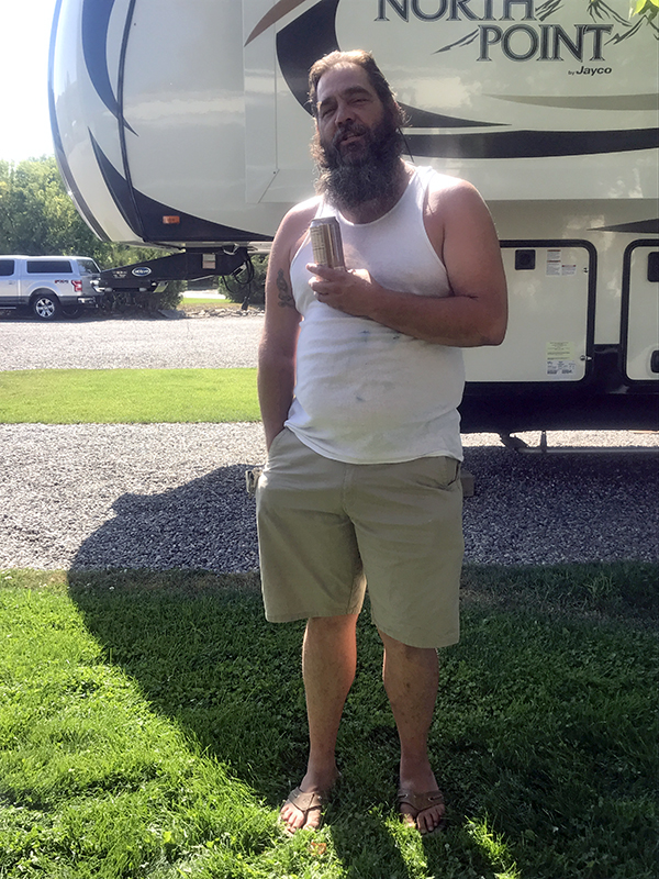
I found Big Foot! AKA Joshua.

A farewell campfire with friends the night before leaving Reed Point.
LEWISTOWN, MONTANA
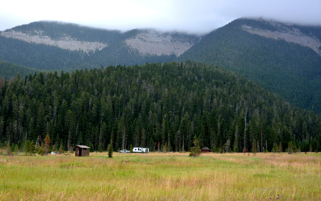
From Reed Point, I made a clockwise loop to Northern Montana and eventually back east to North Dakota. My next stop was Lewistown, not for any particular reason, just because it was “there.” But after doing a little online research, I found a nearby lake that I thought would make for some nice photos. By nearby, I mean 30 miles and an hour’s driving on a winding narrow mountain road. Distance is a relative thing out here.
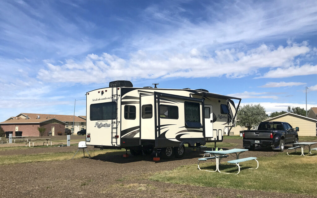
My spot at Mountain Acres Campground in Lewistown, Montana.

Entering Lewistown on Main Street.
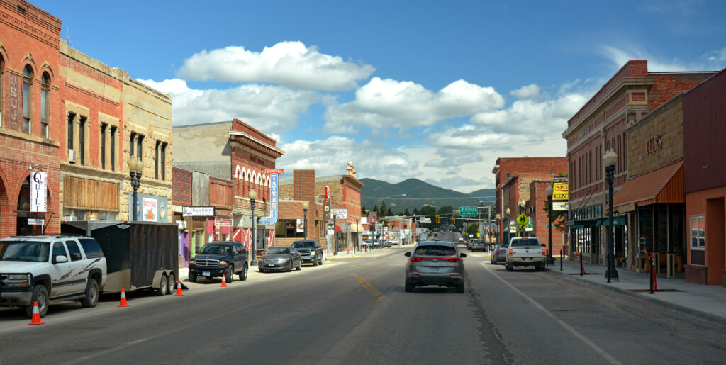
Downtown Lewistown.
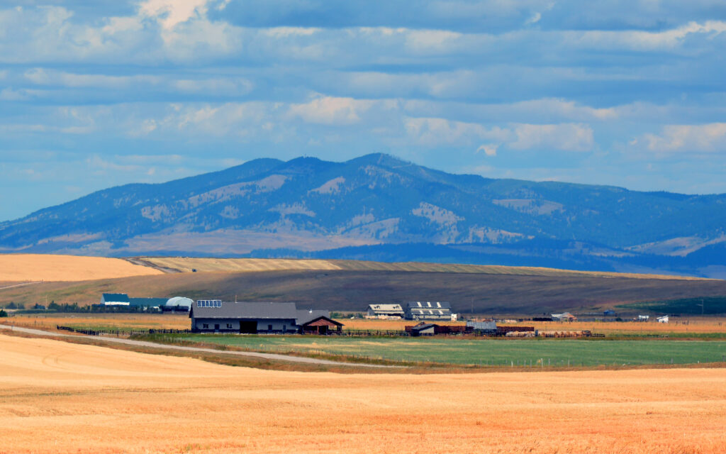
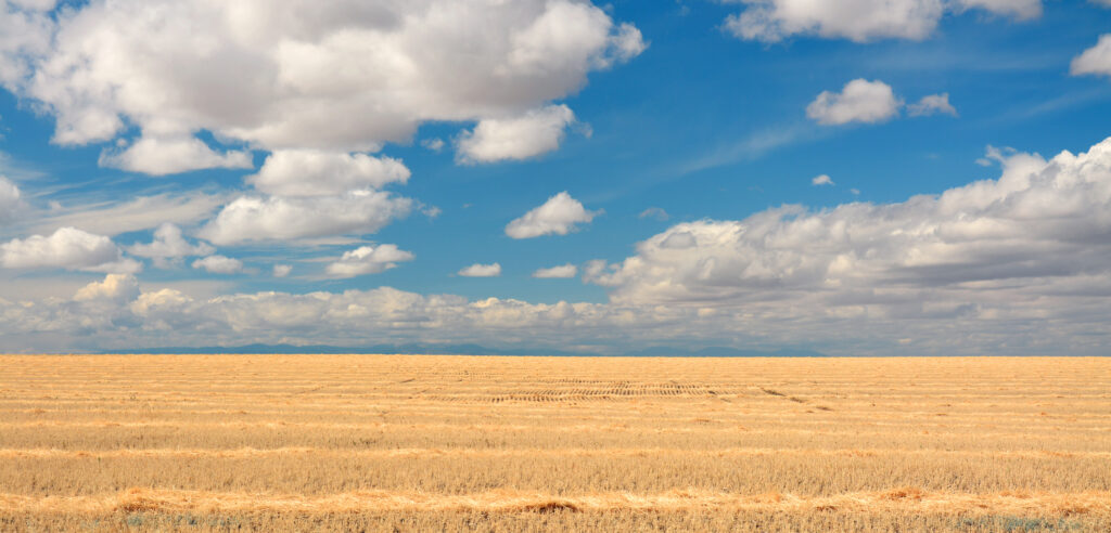
The eastern half of Montana is relatively flat farmland, similar to North Dakota. Here are some views from the outskirts of Lewistown:
My drive to Crystal Lake at Helena-Lewis & Clark National Forest:
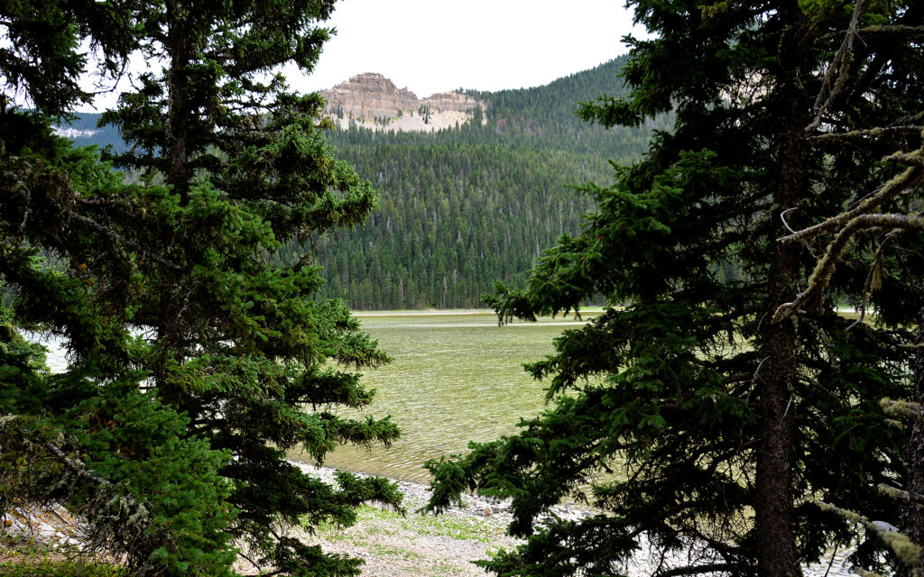
This mountain lake is at 6000 feet elevation.

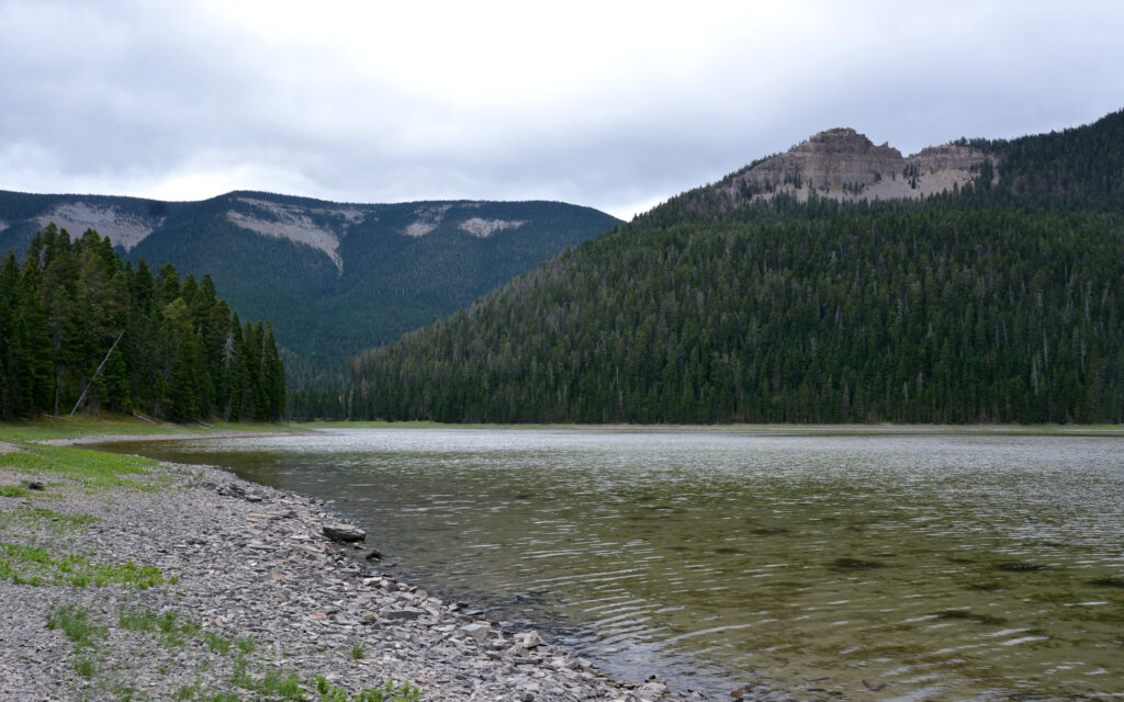
It was 60º at the campground but 40º and drizzling when I got to Crystal Lake.
Operated by the U.S. Forest Service, Crystal Lake Campground is a dry campground (no hookups) at the edge of the lake and at the base of the mountains. It costs only $10 a night and would be a beautiful location if it hadn’t been such a gloomy day.
GLASGOW, MONTANA
On August 31, I moved 200 miles east to Glasgow, Montana. Being of Scottish descent, I thought this was as good a place as any to spend a couple nights. The salesman at the Ford dealer in Laurel told me about a picturesque dam and reservoir here so that’s where I headed on the one full day I had here.

I stopped for a glamor shot on my drive on US-191 between Lewistown and Glasgow, Montana.

Scenery along US-191.
My site at Cottonwood Inn and RV Park. Yes, I’m parked behind a motel!

Spectacular sunset from behind the motel.
Fort Peck Dam
Fort Peck Dam on the Missouri River creates the largest body of water in Montana. Fort Peck Lake is a quarter million acres of prime fresh water recreation for boating, fishing and camping. The earthen dam is four miles long and 250 feet high with a spillway to allow the Missouri River to continue on its path east. There’s an Art Deco power plant and the Fort Peck Interpretive Center was another free gem in the wilderness. The museum has exhibits about the building of the dam, as well as local wildlife, geology and, of course, dinosaurs.
Dinosaurs are big business in Montana since one of the richest fossil areas in the world is located here. Over 75 million years ago, there was an inland sea between the Rocky and Appalachian mountain chains. As the continents shifted, the mountains rose, causing the sea to drain and creating a floodplain of sediment that buried the remains of creatures from long ago. T-Rex was common across North America, especially Montana. The first T-Rex fossil was found in 1903 in the Hell Creek Formation in Montana. T-Rex has never been found on any other continent but North America.
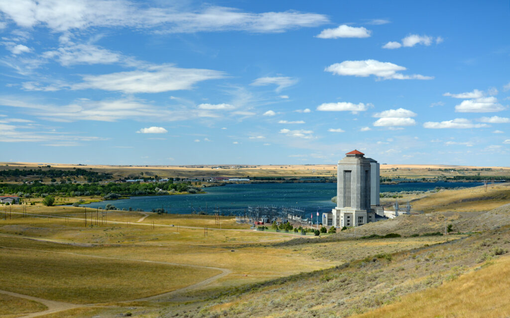
The Art Decor-style power plant was built by the Army Corps of Engineers in the 1930s.

The Fort Peck Interpretive Center was another of my free finds.
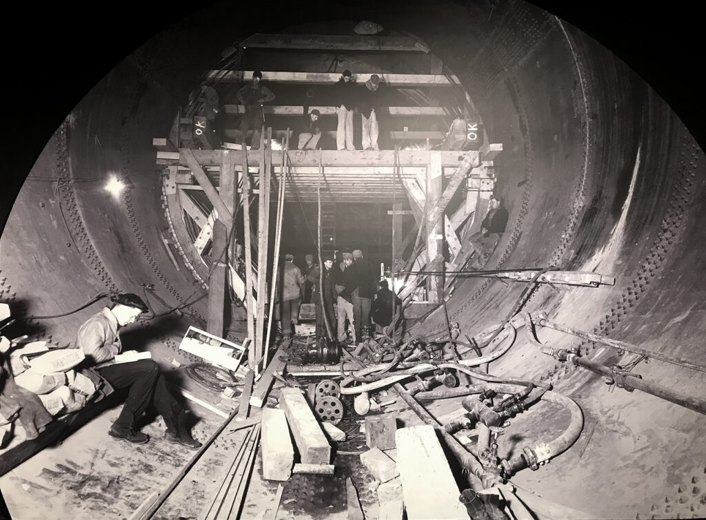
Workers building the dam in the 1930s.
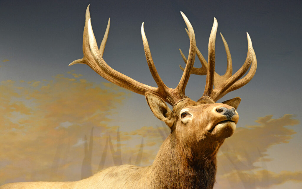
Elk are prevalent in Montana.

Museum workers displaying their COVID humor with their prairie dog exhibit.

Dinosaur display at the Fort Peck Interpretive Center.
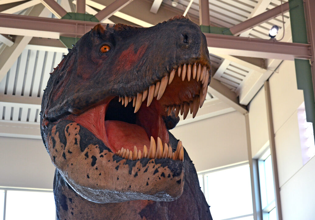
The first T-Rex fossil was found in Montana in 1903.
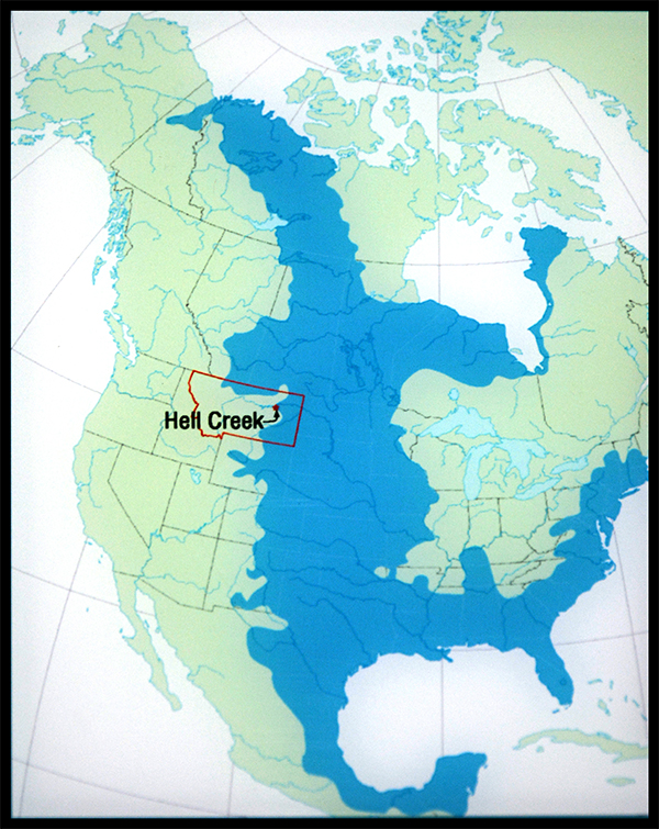
When the ancient inland sea drained, it created a perfect environment for preserving fossils. The Hell Creek Formation in Montana is one of the richest fossil areas in the world.

This is the intake side of the spillway.

The spillway into the continuation of the Missouri River.
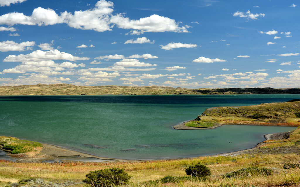
Fort Peck Lake is the largest body of water in Montana.
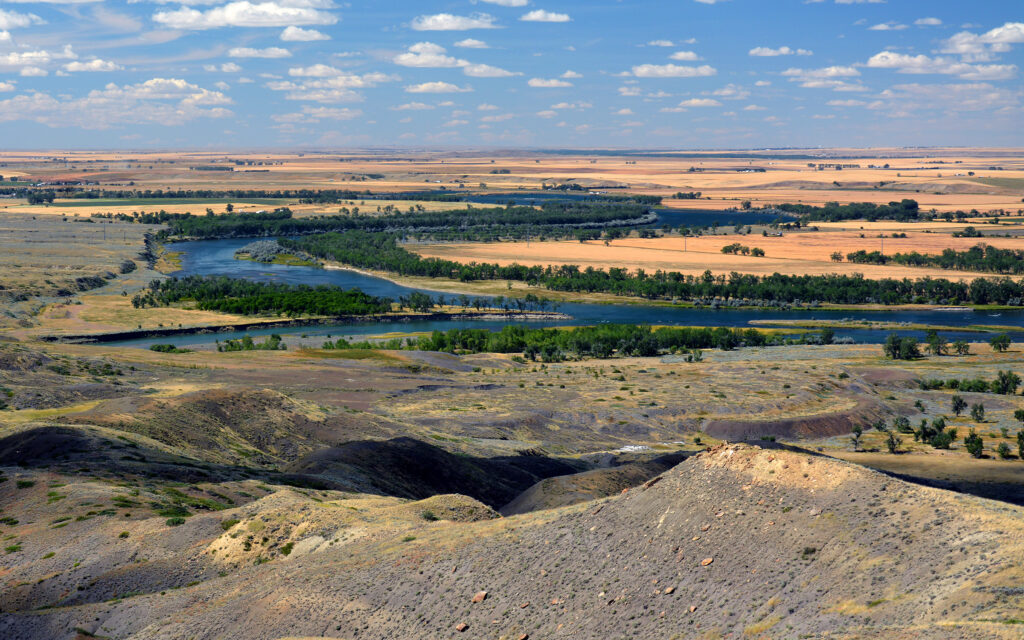
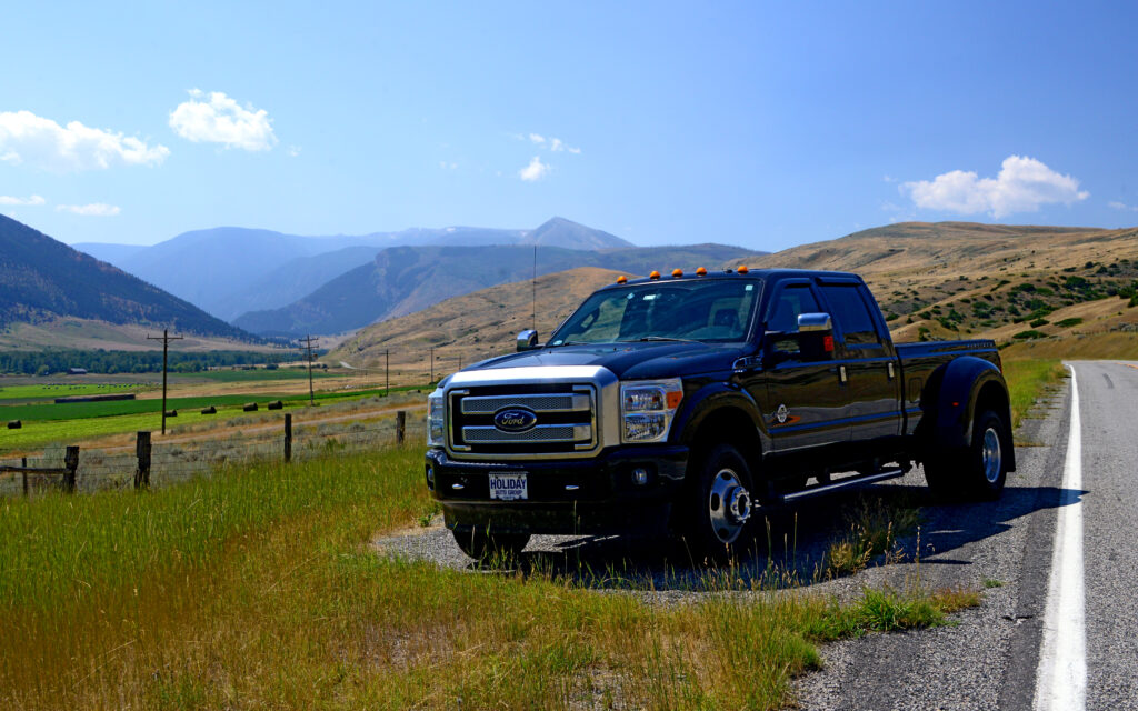
View of the confluence of the Missouri and Milk rivers from atop a nearby hill, the tallest point in Eastern Montana.
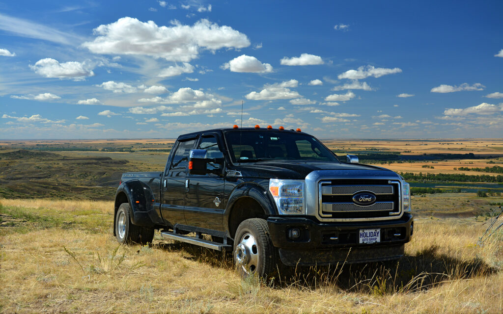
Getting “Big Ass Truck” to the top of the hill for this “Ford ad” shot required 4W/2H Drive—four-wheel and two-hand drive, otherwise there would be video for your viewing pleasure.
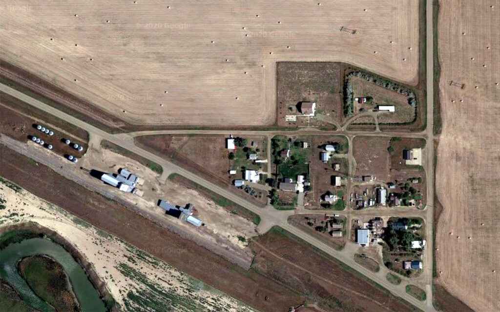
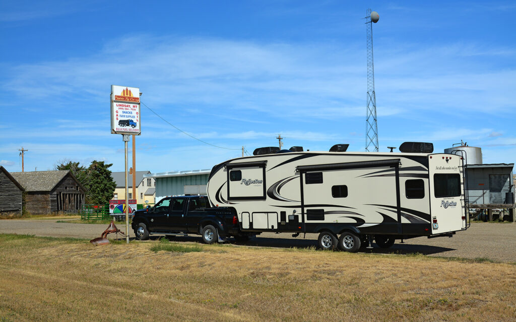
LINDSAY, MONTANA
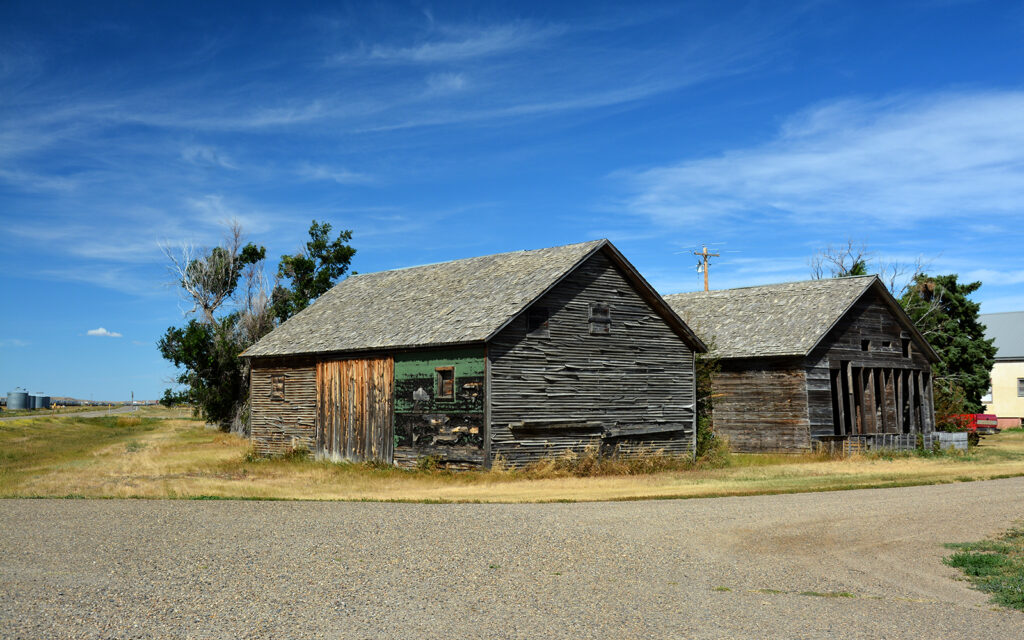
On September 2, I headed back to North Dakota and Theodore Roosevelt National Park. On my way, I passed through the tiny town of Lindsay, Montana and just had to stop and take it all in—all four blocks! I couldn’t find the official size of this hamlet in Eastern Montana but the population is a surprising 162.
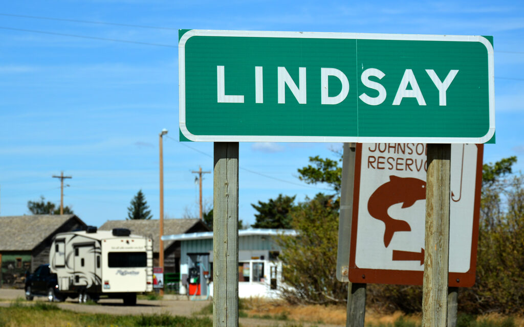
Welcome to Lindsay!
You’d be hard-pressed to find a smaller town than Lindsay, Montana. Evidently, there’s a lot of farmland included in the town to account for 162 people.

Grain elevators along the railroad tracks.

I bet I could buy this bar pretty cheap.
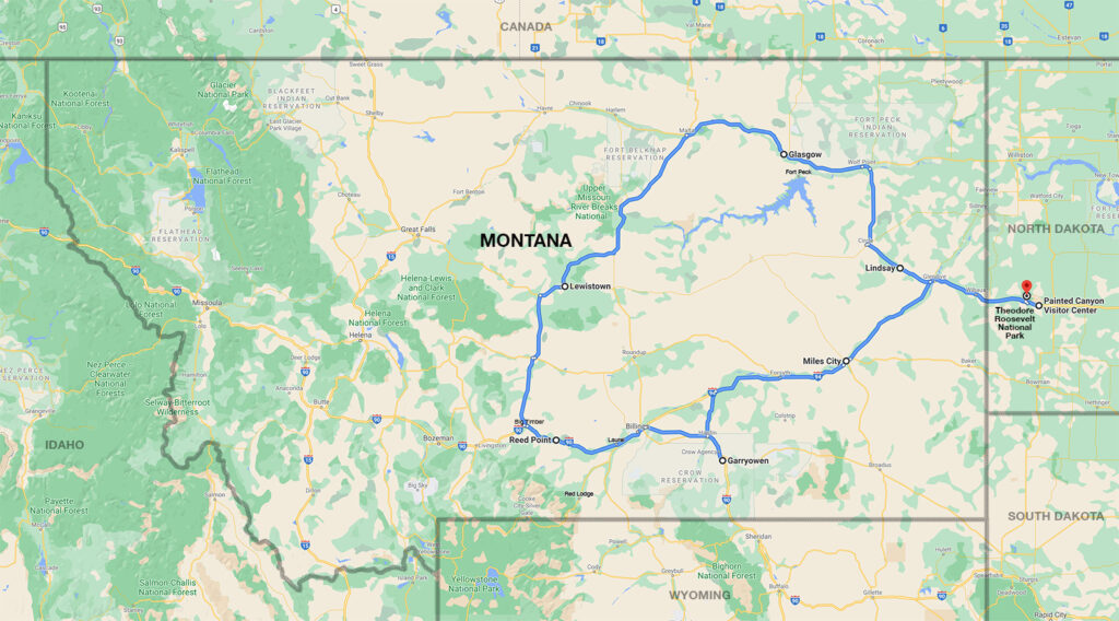
My 950-mile loop through Eastern Montana.
Next post: The Dakotas and Wyoming.
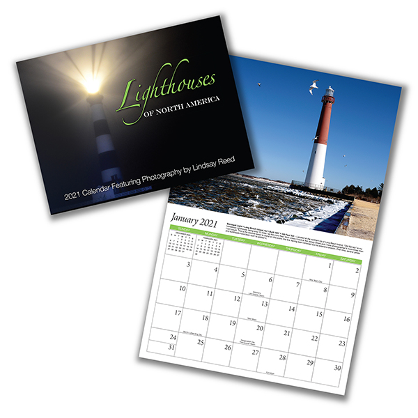
My 2021 Lighthouse Calendar
is available for sale.
Click image for online ordering.

My name is Lindsay Reed and I’m a photographer and retired graphic artist with a passion for both lighthouses and road trips. I am living as a full-time solo RVer in my 33 foot Grand Design Reflection Fifth Wheel trailer and plan to spend the next few years traveling the U.S. and Canada photographing not only lighthouses, but everything else there is to see in this wonderful land. I hope you enjoy my blog and will follow my adventures in the months and years ahead.
3 thoughts on “Eastern Montana”
I think its so great what you are doing on your own…simply amazing!
Hi Lindsay!
We met you this summer at a restaurant in Pipestone, MN and just wondered what you were up to! 🙂
Glad you are doing well. Enjoyed your photos a LOT! Made us want to go to Montana.
Take care.
God bless,
Bridget & Scott from Minnesota
It was great meeting you in Pipestone and I’m thrilled you’re following my blog. Thank you.