Northern New Mexico
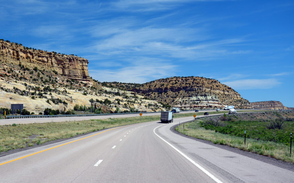
DRIVING EAST ON I-40 TO GRANTS, NEW MEXICO:
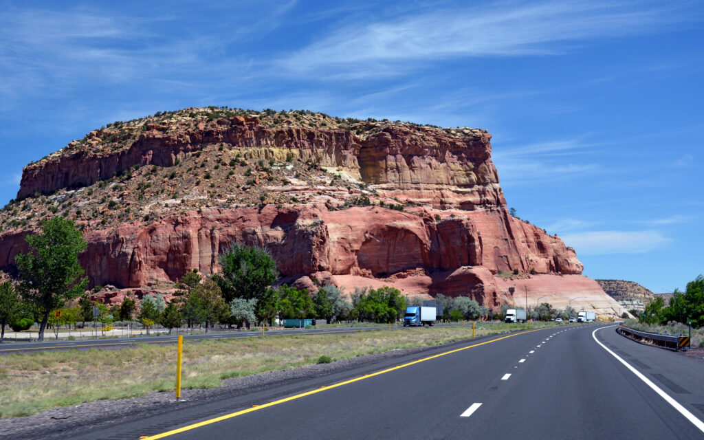
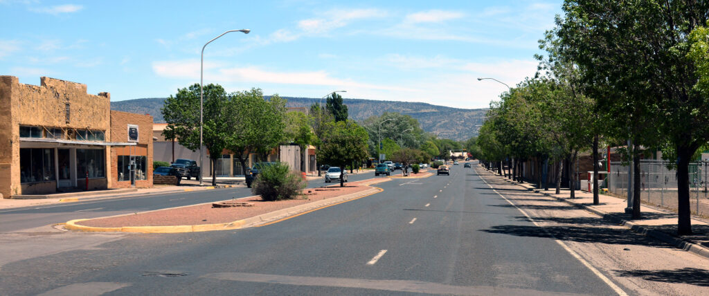
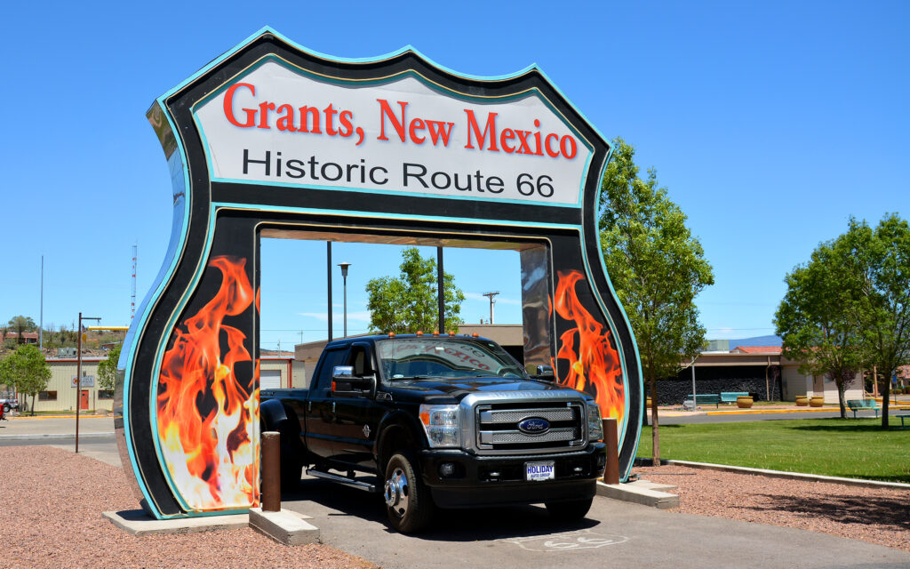
GRANTS, NEW MEXICO
In mid-May, I drove east from Holbrook, Arizona to Grants in northern New Mexico, spending 10 days at the KOA Kampground. I had chosen this location because it was near El Malpais National Monument, which looked to have some interesting landscapes for hiking. To my surprise and delight, I discovered from the campground staff that the area is surrounded by 29 dormant volcanoes and miles of lava flows. The geology turned out to be remarkably diverse and 10 days weren’t enough to see it all. I will need to come back.
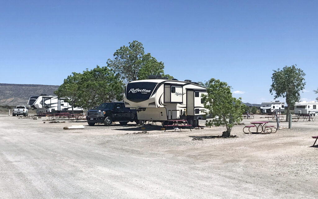
Grants KOA does most of its business with people hopping off the interstate for the night so it filled up every evening and emptied every morning. Since I was staying longer than most, they gave me their only double site with side-by-side parking for my truck.
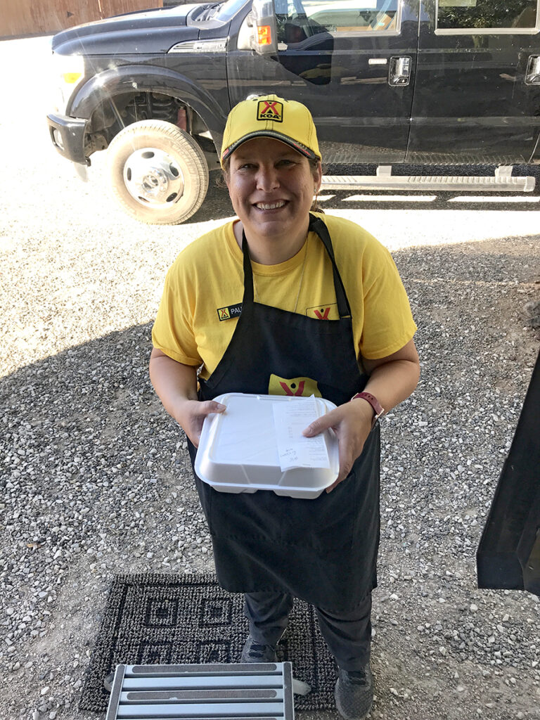
Owner, Paula, prepares and delivers dinners to campers.

My KOA turkey dinner was delicious and cost $14, delivered hot to my door.
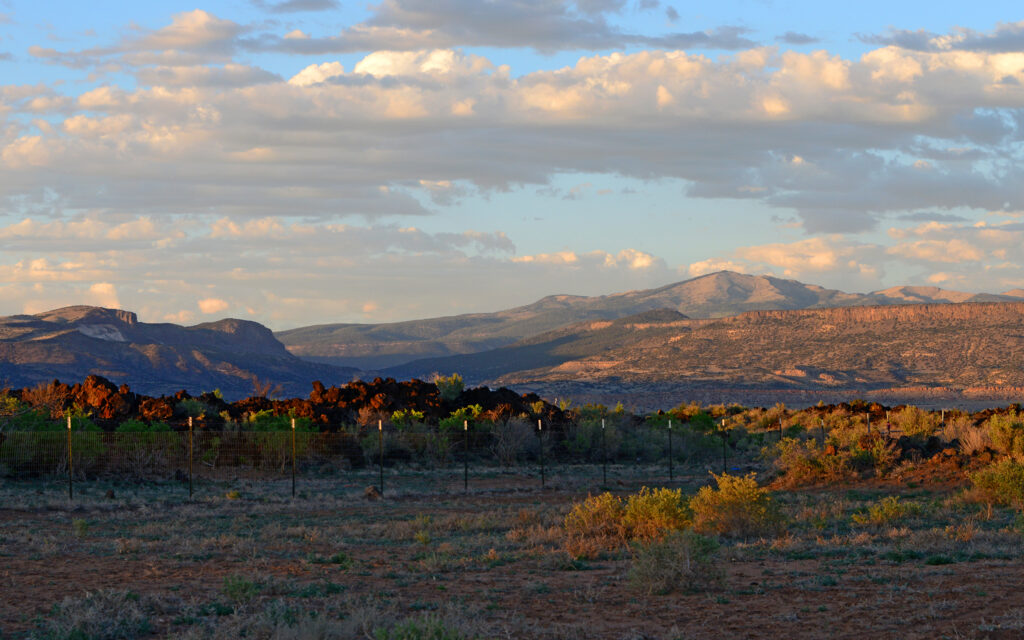
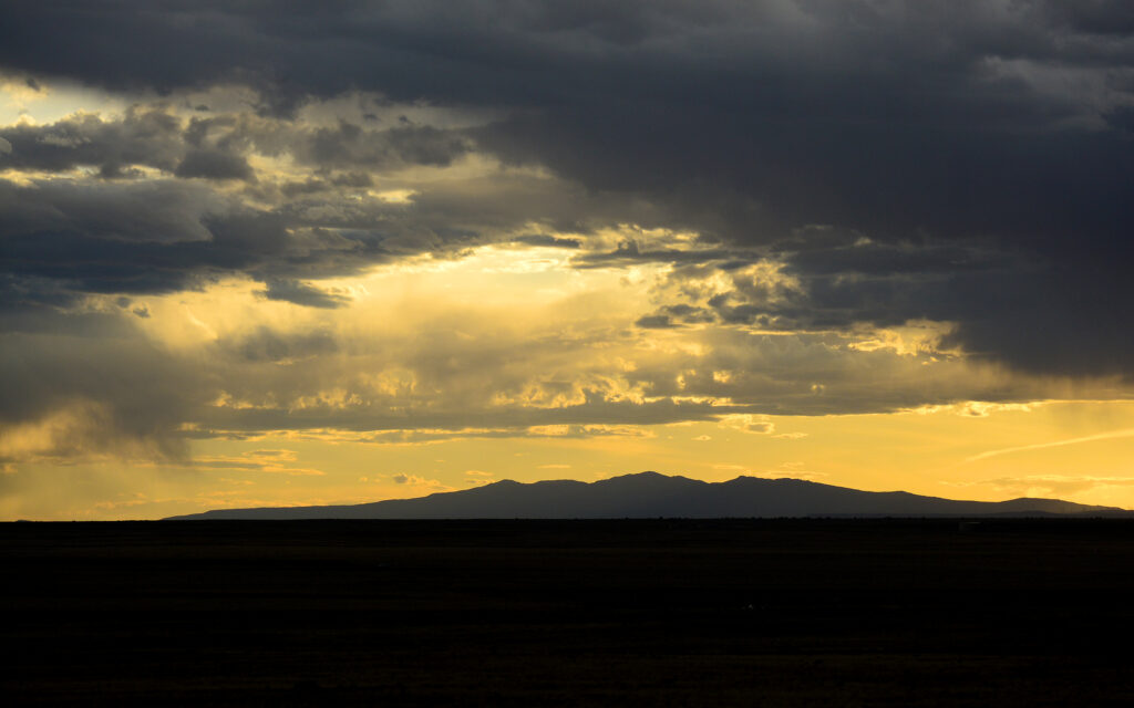
The view of Mt. Taylor from the campground.
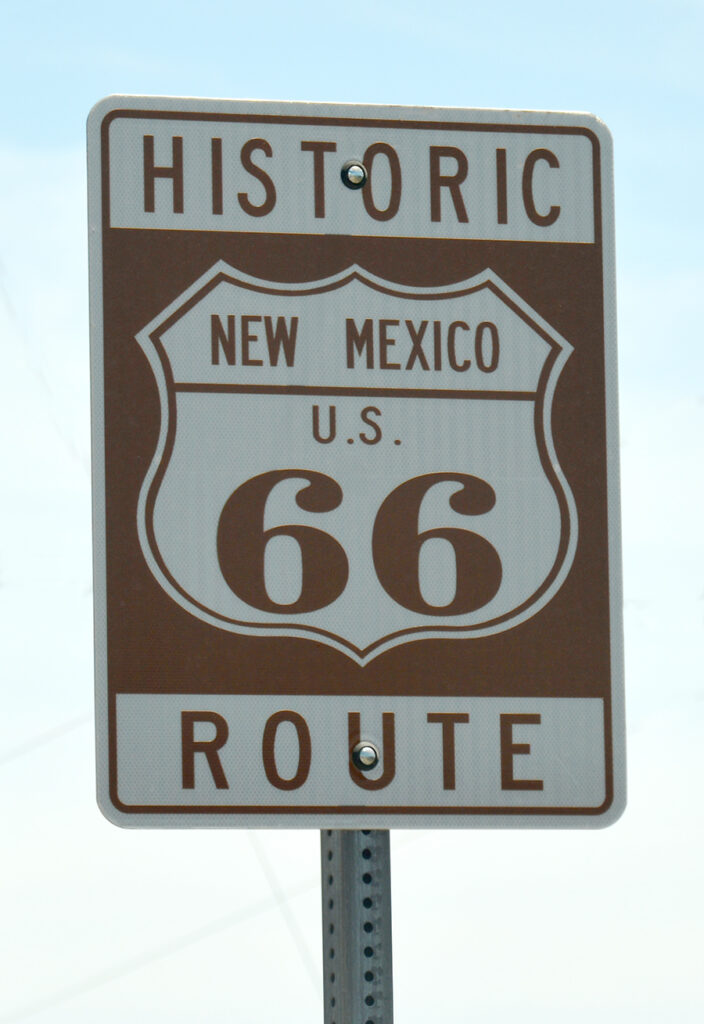
Historic Route 66 runs through Grants, New Mexico.
There were no remaining relics from the heyday of the “Mother Road” in town but there was this sign for photos.
Mt. Taylor:
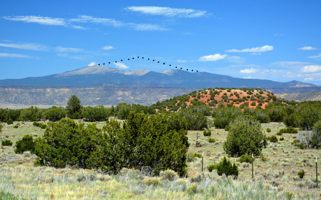
Mt. Taylor is a volcano that was active more than 1.5 million years ago. It is estimated to have been almost twice as tall (dotted line) before it blew its top like Mount Saint Helens did in 1980.
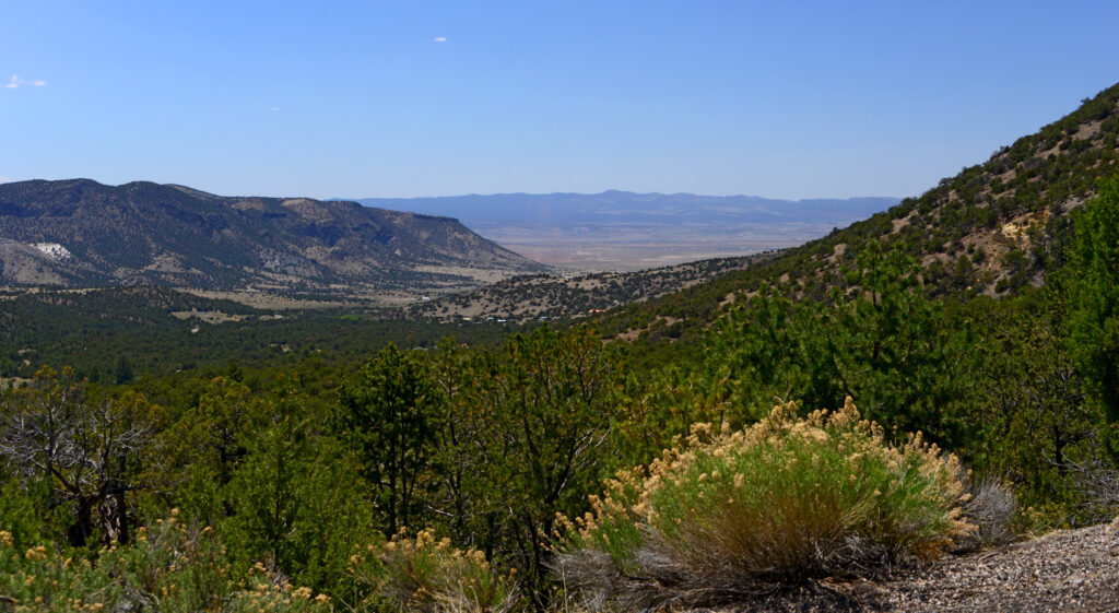
The view from the scenic drive up Mt. Taylor.
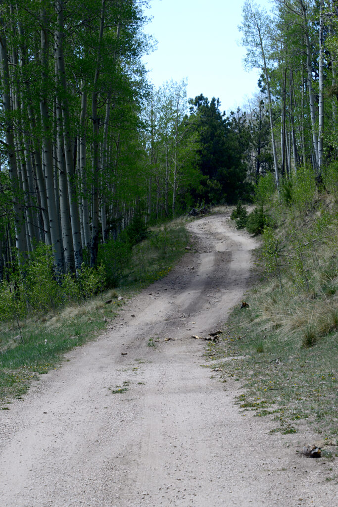
Only the lower half of the road is paved and after a while, even the dirt road got really sketchy so I decided to turn around.
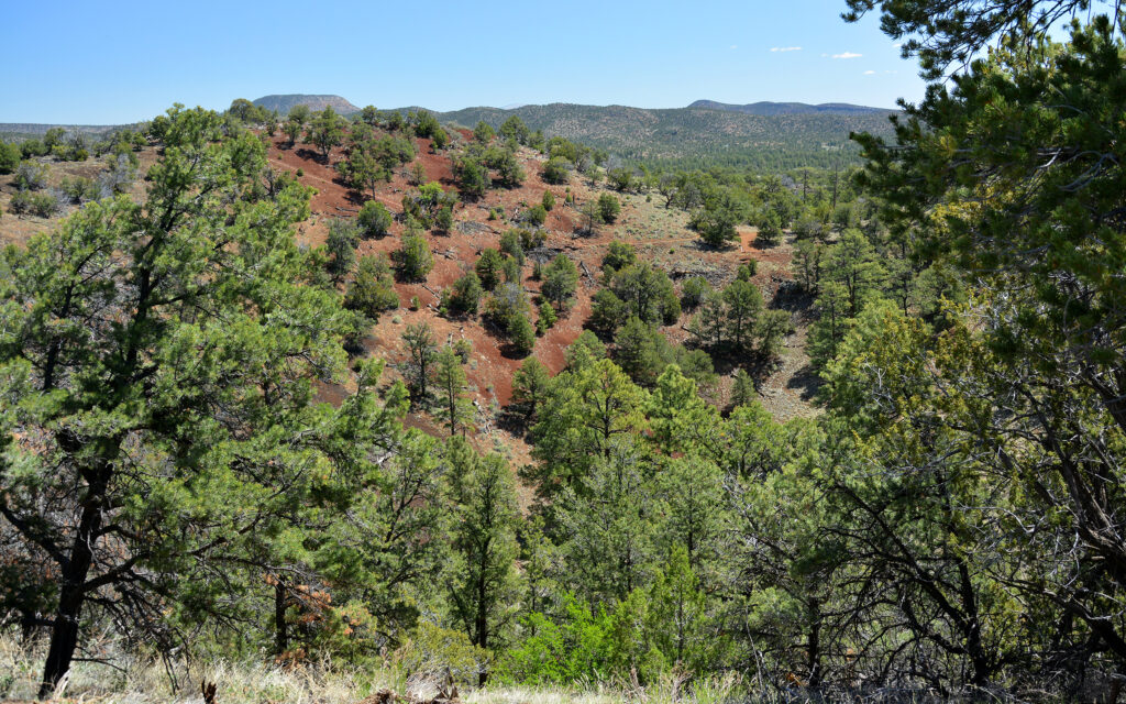
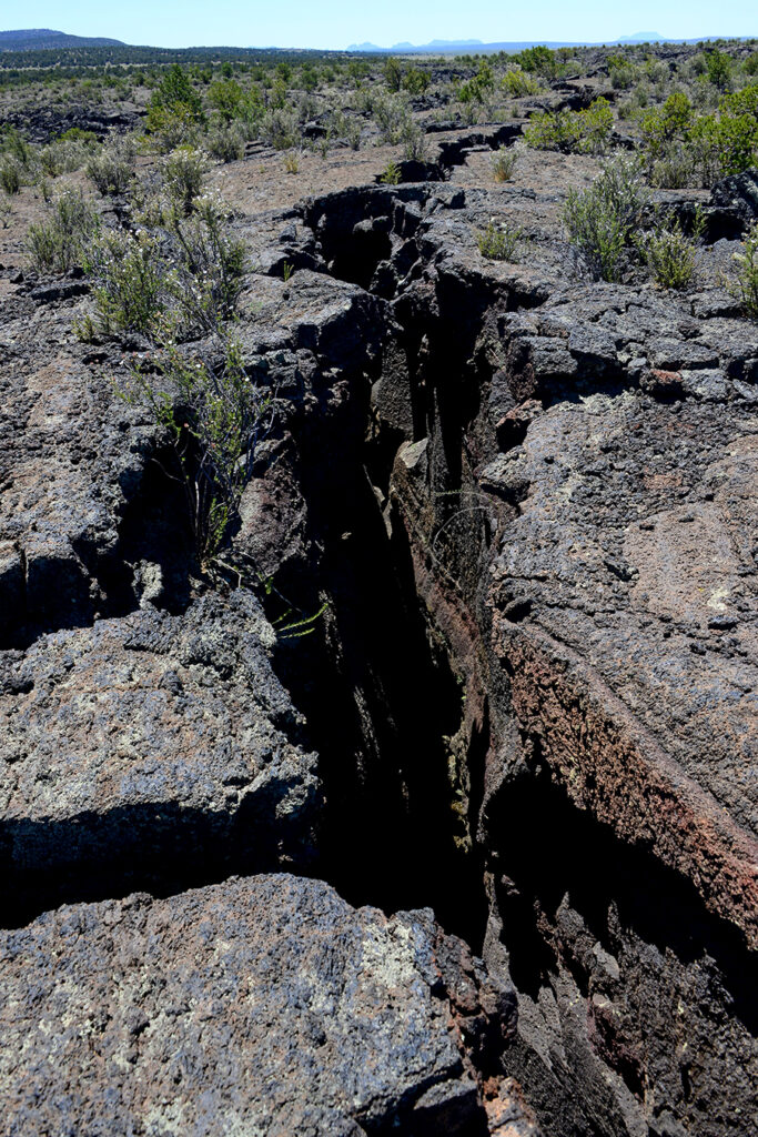
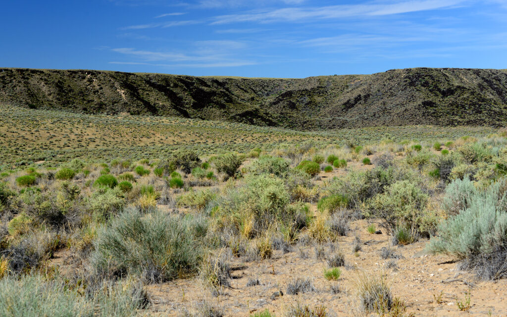
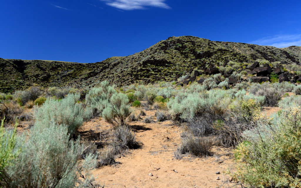
The other volcanoes in the area are known as cinder cones. These are volcanic vents that spew lava into the air and it lands as granular particles that build up around the vent much like a giant ant hill. Occasionally, lava will break through one side of the cone and pour downhill, covering everything in its path. There is 133 square miles of lava flow in El Malpais National Monument.
El Malpais means “the badlands” in Spanish and was named that by Spanish explorers in the sixteenth century when they tried to ride through here but found the jagged lava flows impossible to cross on horseback.
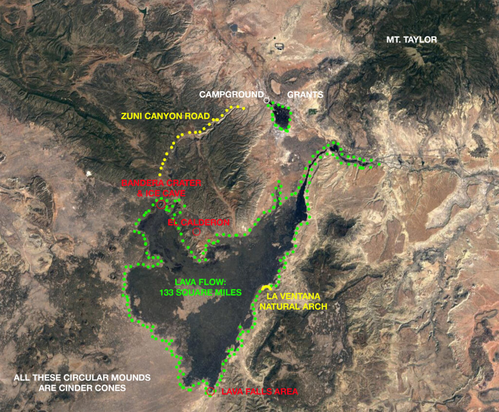
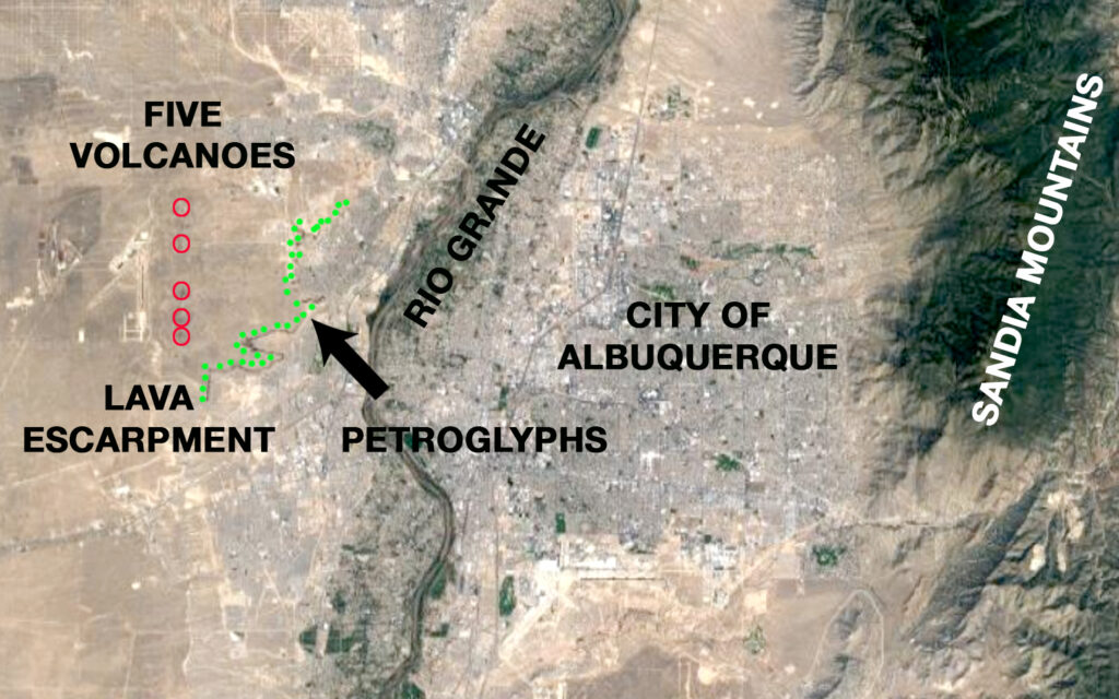
Map of things I saw during my stay in Grants, New Mexico. The green outline of the lava flow is also nearly the entire El Malpais National Monument.
El Calderon:
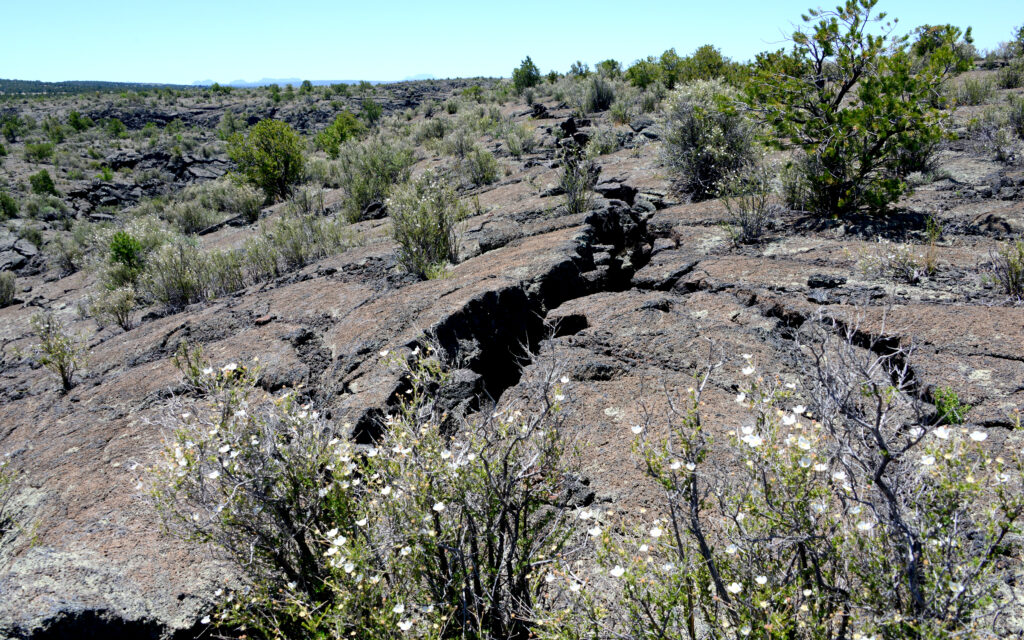
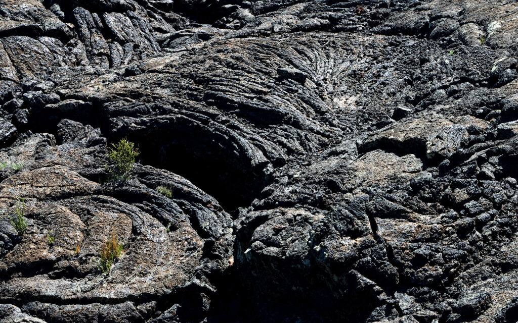
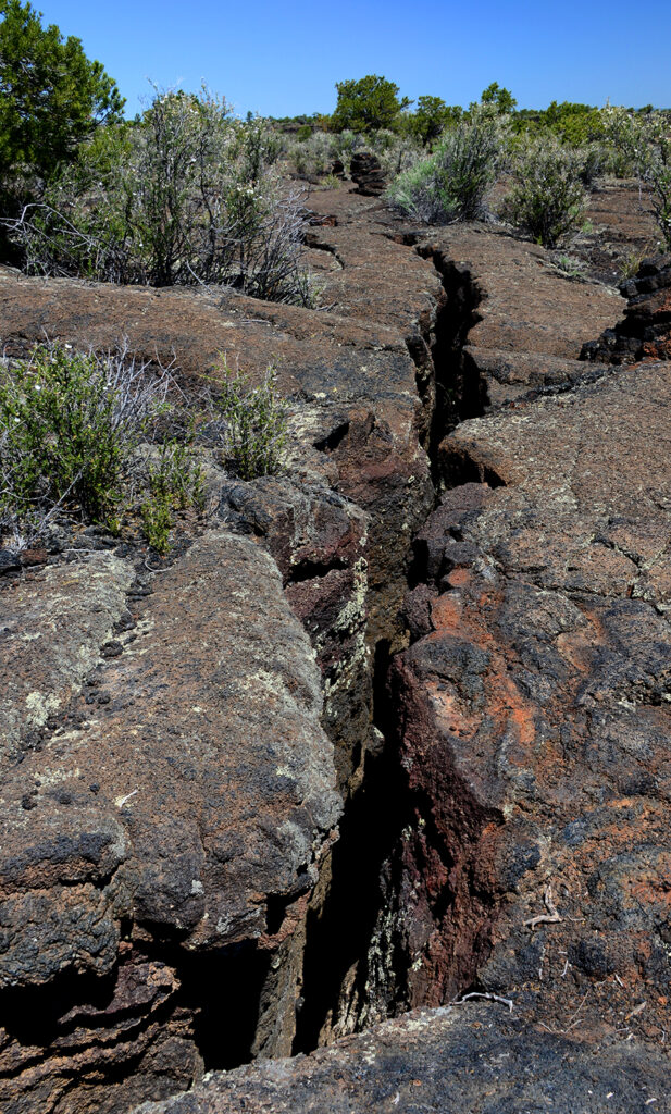
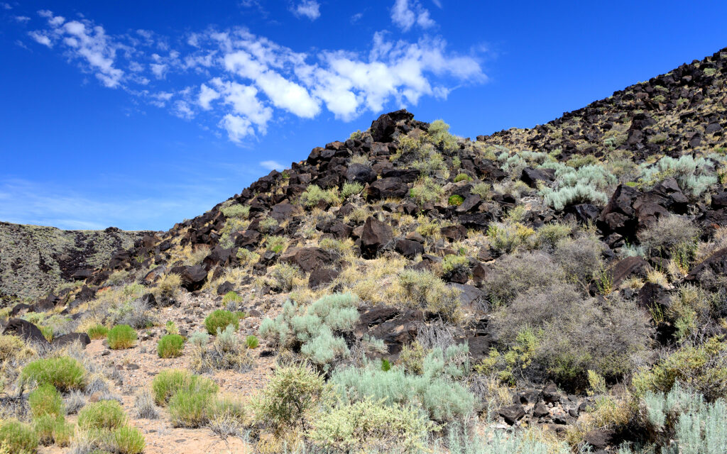
El Calderon is a large cinder cone within the park and a looping 4-mile trail takes you to the open side where lava poured out into the valley. The trail takes you across lava rock and past caves that are the remnants of collapsed lava tubes.
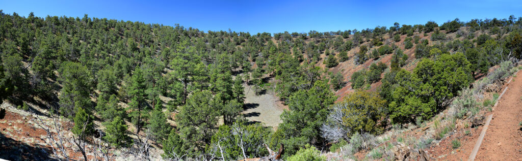
A panoramic view of El Calderon.
Looking across El Calderon from the top of the rim.
The trail is cut into the lava rock in some areas.
Bandera Crater and the nearby Ice Cave are privately owned and cost $12 to see. Bandera Crater is the largest cinder cone in the area, erupting 10,000 years ago and when the lava broke through the south wall it spread 23 miles. The crater is 1400 feet from rim to rim and 800 feet deep.
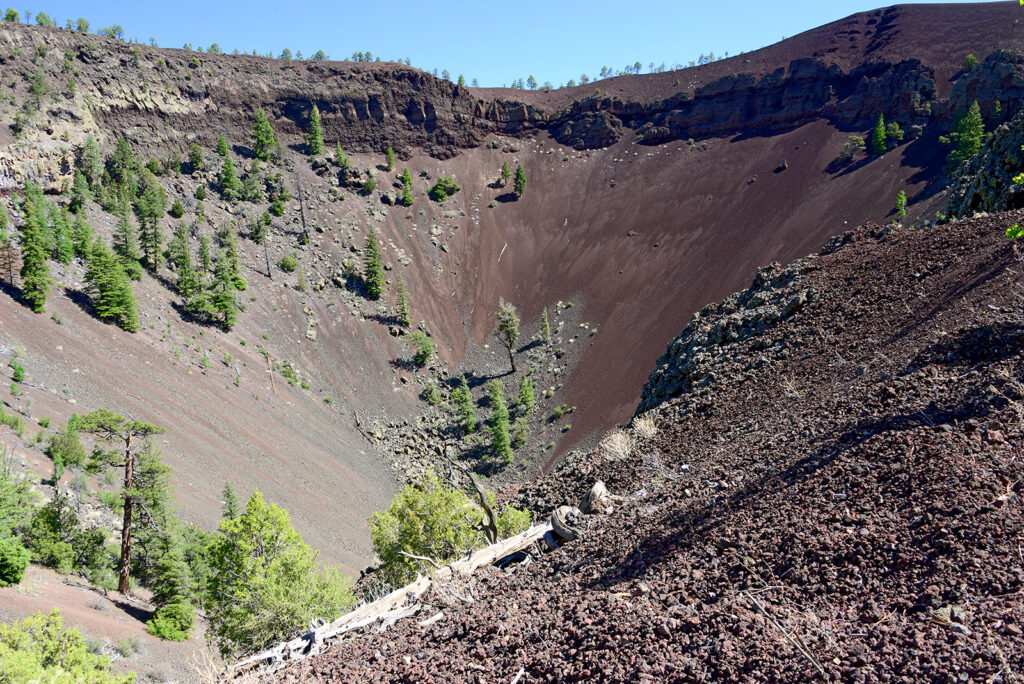
The trail to the rim of Bandera Crater is a gradual climb around the perimeter so its not too difficult.
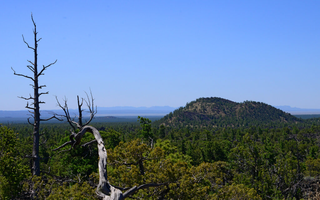
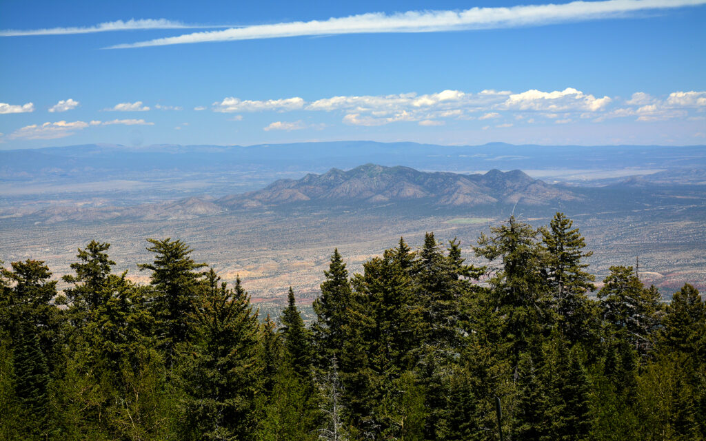
View from the trail at Bandera Crater. Every hilltop—even the distant ones—are volcanoes.
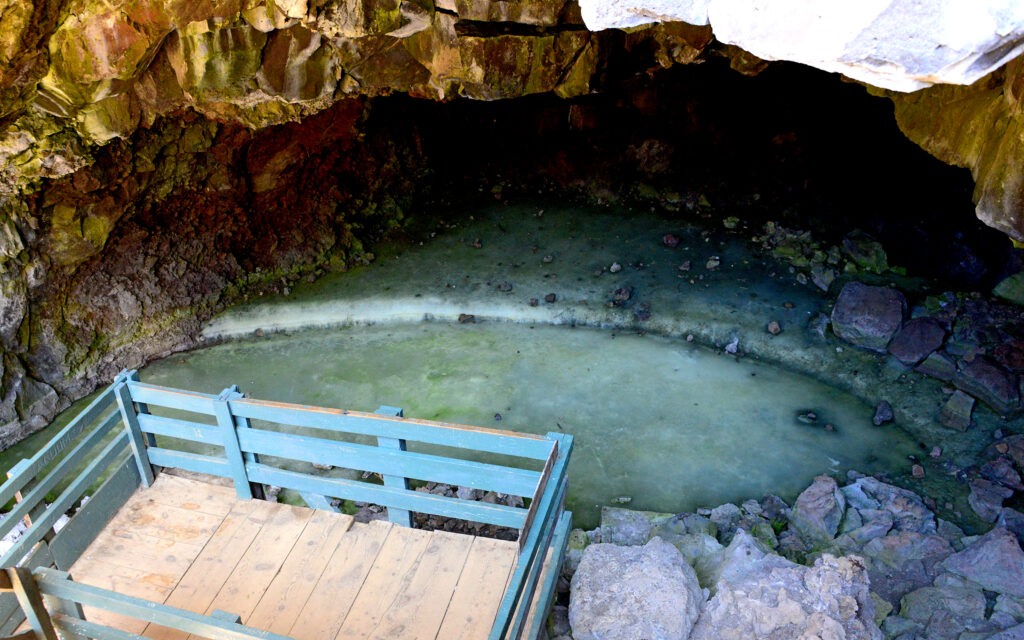
Due to the unique structure of the Ice Cave, the temperature never gets above 31° F. As rainwater collects, it adds to the ice floor, estimated to be 20 feet thick.
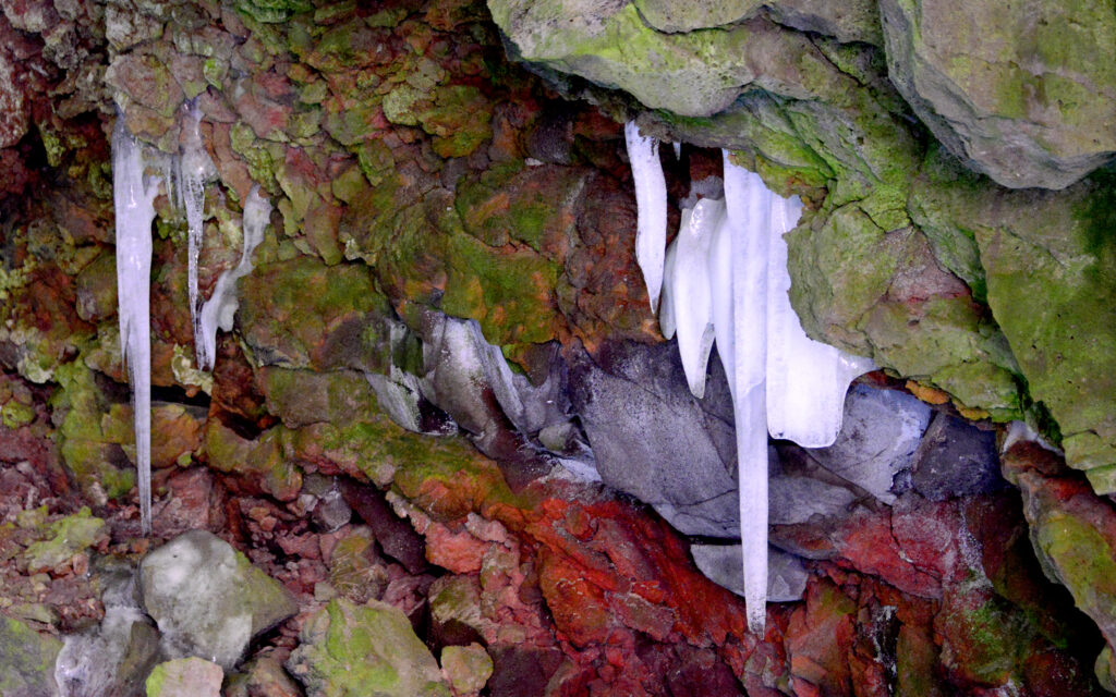
Icicles form on the roof of the cave.
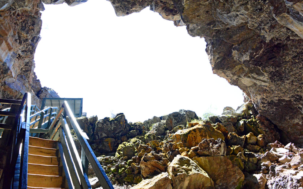
Looking up from the bottom of the cave, you get a better sense of the shape of the cave that allows it to trap cold air and keep the ice year-round.
Lava Falls Trail:
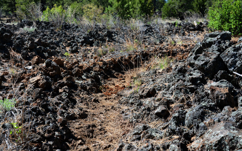
The lava flows are quite an inhospitable environment and most of the lava surface here is off limits for hiking due to the danger of injury or getting lost. However, there are several official trails in the park and at the far southern end of the park is the Lava Falls Area where you can hike the surface of the 3000 year-old flow. The trail is clearly marked with stone cairns.
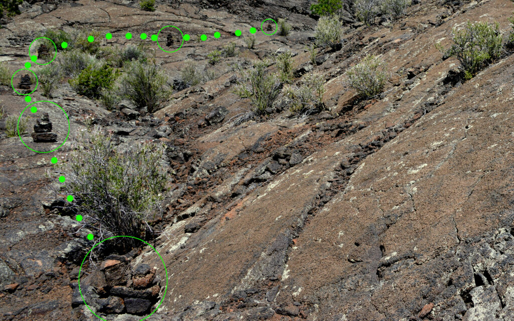
Stone cairns mark the hiking trail at Lava Falls Area.
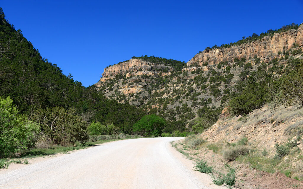
Zuni Canyon Road:
To the west of my campground is a small canyon with a road running along the dry riverbed. Its like driving at the bottom of a mini Grand Canyon.
Zuni Canyon Road.
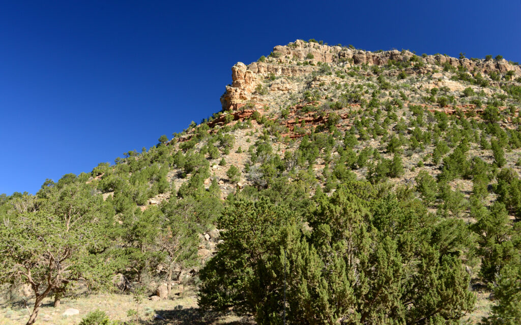
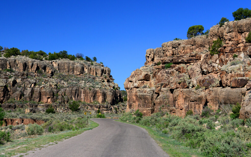
To the east side of the park is State Highway 117 with lava flows on one side and sandstone cliffs on the other. The contrast makes for a beautiful drive with several places to stop and view the landscape and some hiking trails into El Malpais National Monument.
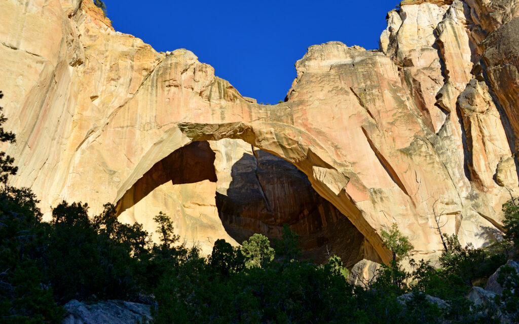
La Ventana Natural Arch:
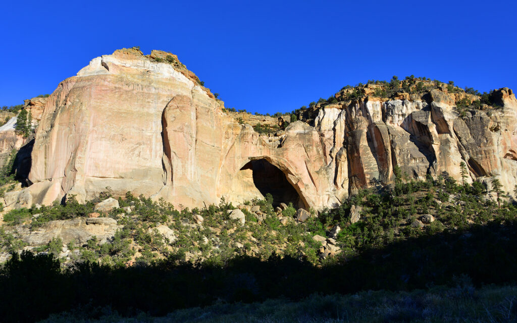
La Ventana Natural Arch is best viewed and photographed late in the day, just before sunset.
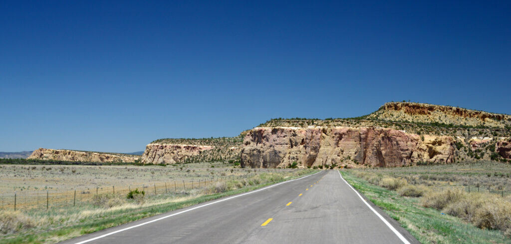
State Highway 117 south of Grants, New Mexico.
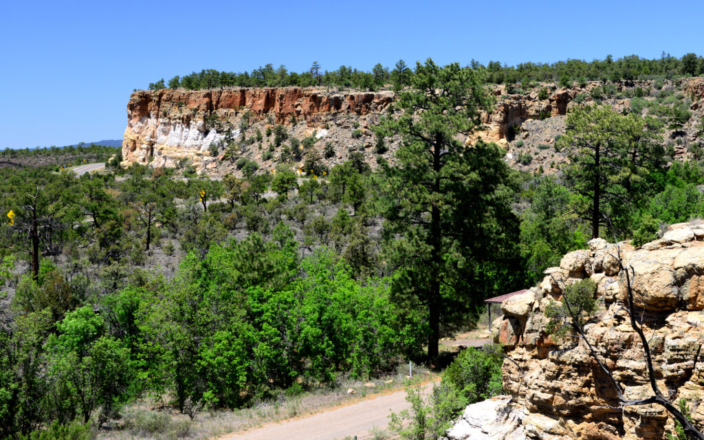
A picnic area on State Highway 117 has a trail leading to the top of the cliff. I ate my lunch up here.
ALBUQUERQUE, NEW MEXICO
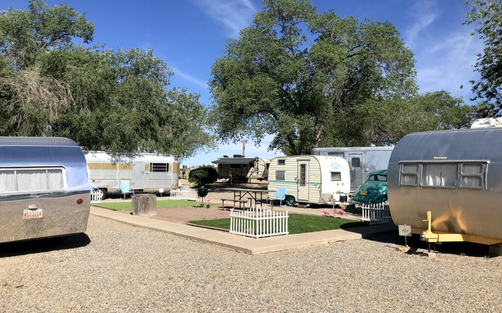
On May 23, I moved to Enchanted Trails RV Park, a charming little spot in Albuquerque, New Mexico that has vintage cars and campers on display. Historic Route 66 runs through downtown Albuquerque and everyone here takes advantage of the marketing opportunities it provides.
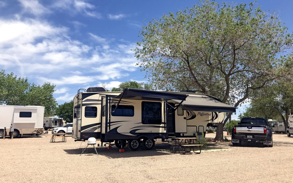
My site at Enchanted Trails RV Park.
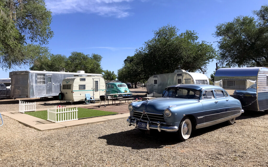
The vintage cars and trailers on display at the RV park hearken back to the glory days of Route 66.
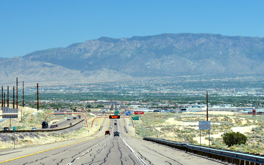
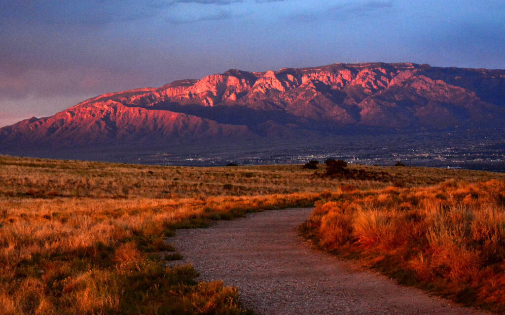
The view of Albuquerque and the Sandia Mountains looking east on I-40.
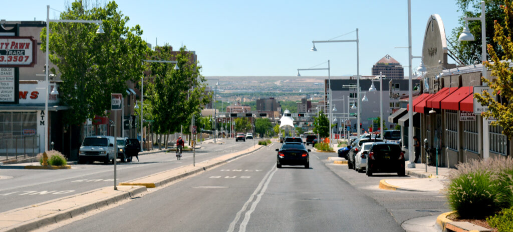
Old Route 66 passes through downtown Albuquerque.
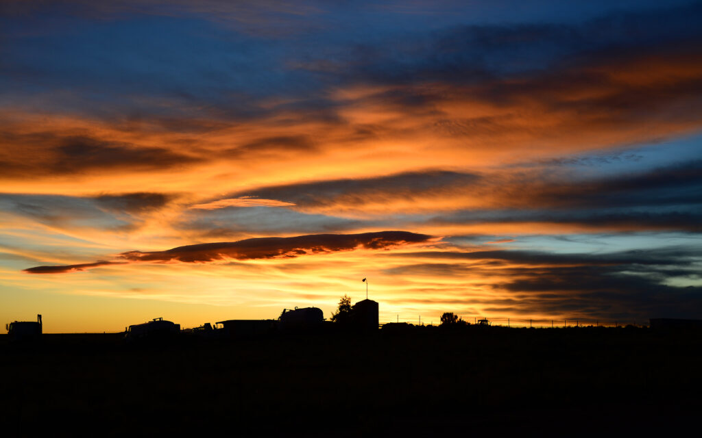
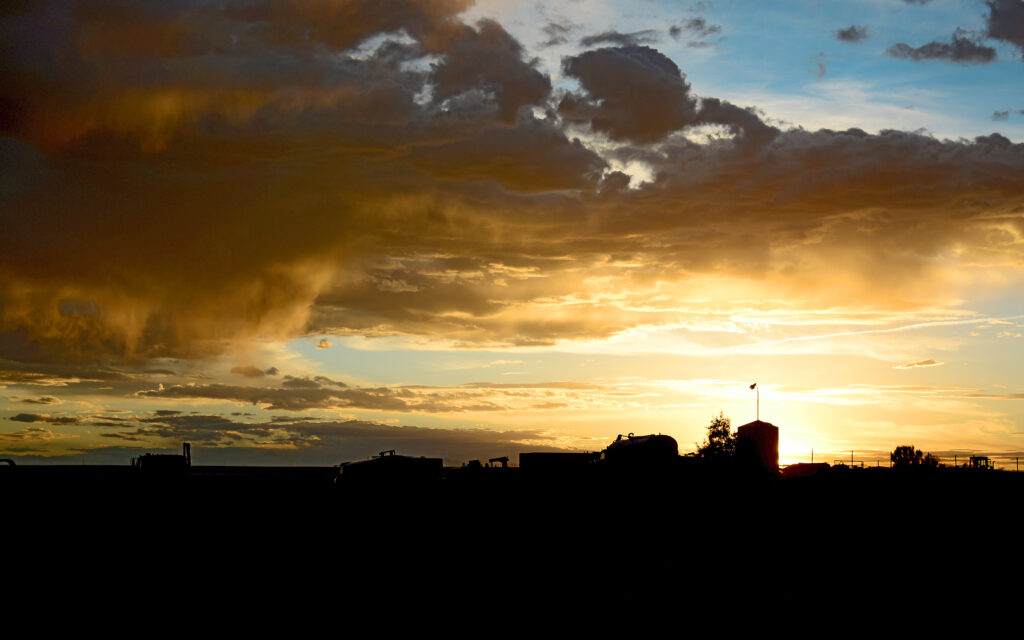
The back of my trailer had a western view and I was treated to several spectacular sunsets. These photos were taken through an open window right from my recliner.
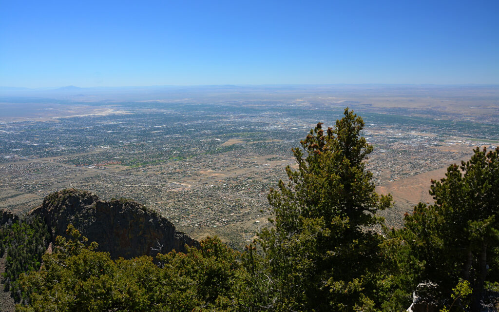
There’s a beautiful drive up to the top of Sandia Peak, the summit of the Sandia Mountains. The view of the city from there almost seems like a satellite image.
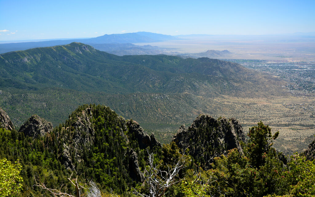
Looking south over the Sandia Mountain Range from the summit.
Looking east from the Sandia Peak summit.
Also here in Albuquerque is Petroglyph National Monument where you can hike a trail along and ancient lava flow and view hundreds of Indian rock carvings. In the park are also a line of five volcanoes that offer the only break in the flat desert landscape.
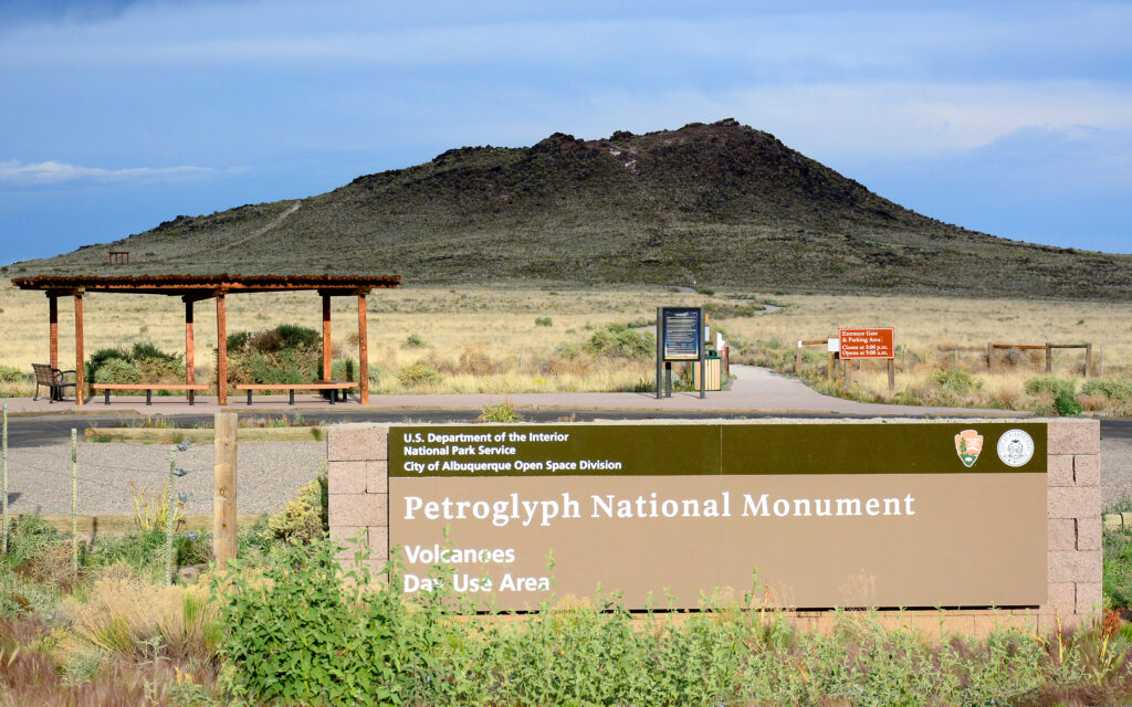
The volcano section of Petroglyph National Monument.
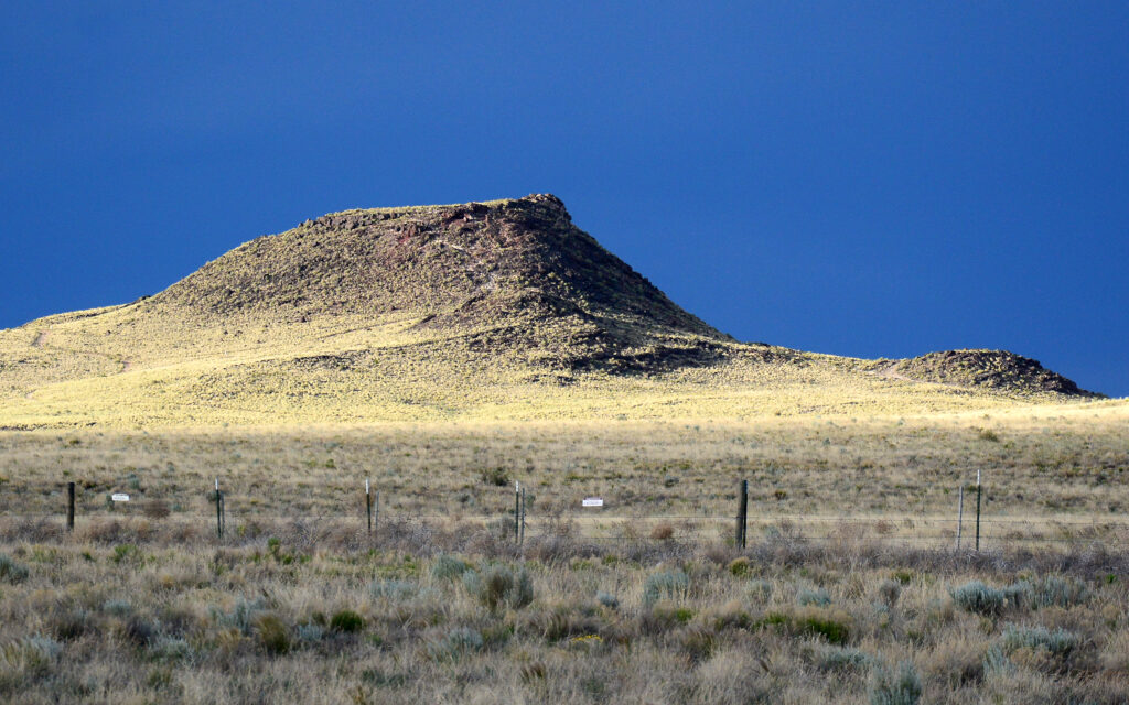
There are five of these small volcanoes, perfectly aligned in a row on the west side of the city.
Looking west from the volcanoes as the sun was setting.
I turned around to see the orange light of the setting sun reflecting off the Sandia Mountains to the east as the lights were coming on in the city of Albuquerque.
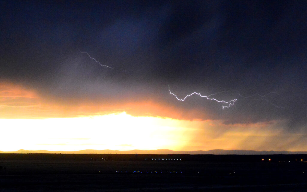
During this sunset, a thunderstorm passed far to the west, giving me a rare opportunity to photograph lightning. Lightning is hard to capture and I shot 600 frames to get 4 with lightning.
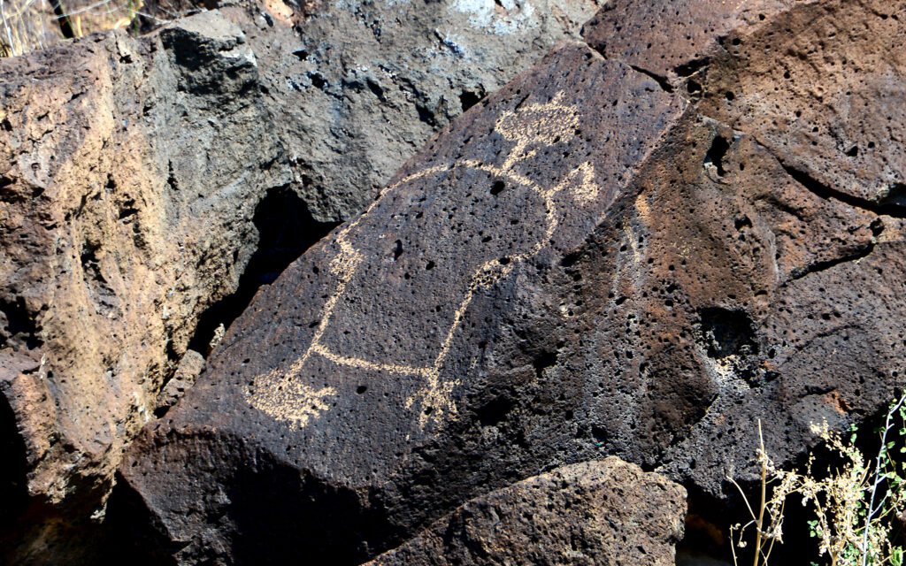
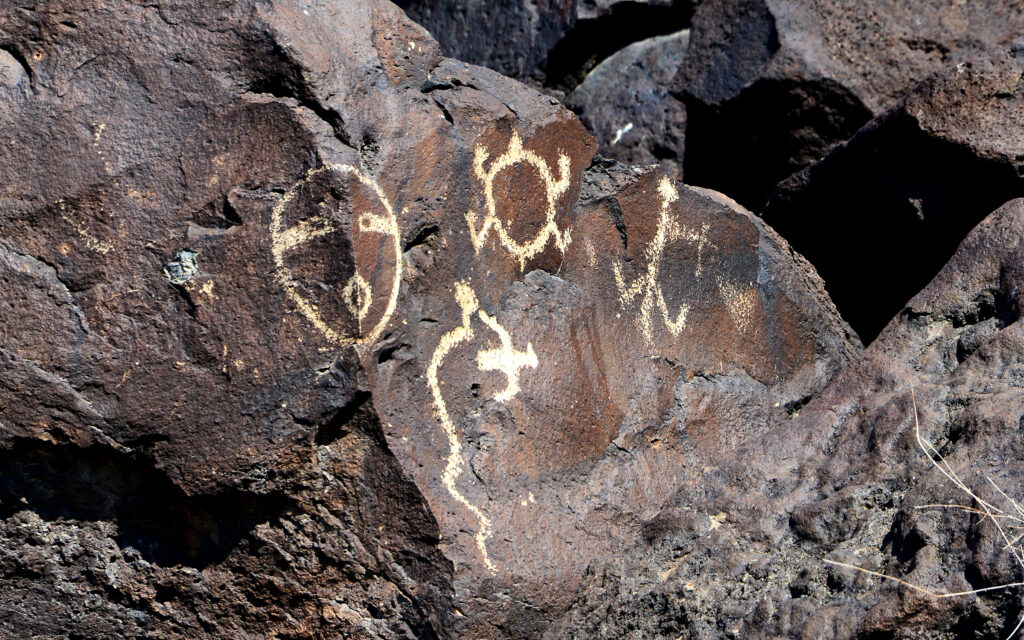
The edge of a lava escarpment on the west side of Albuquerque has hundreds of ancient Indian rock carvings (petroglyphs).
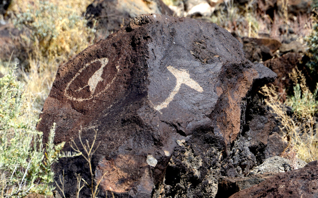
These carvings would have started out white but darken to beige and tan over time. That is how archaeologists know their age.
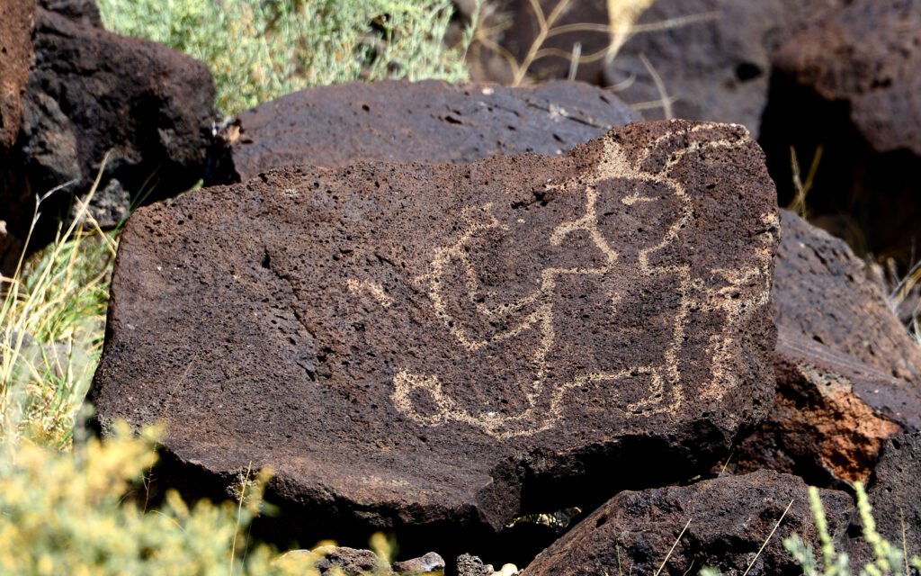
This one looks like E.T.
Walking the trail along the bottom of the lava escarpment to view the petroglyphs.
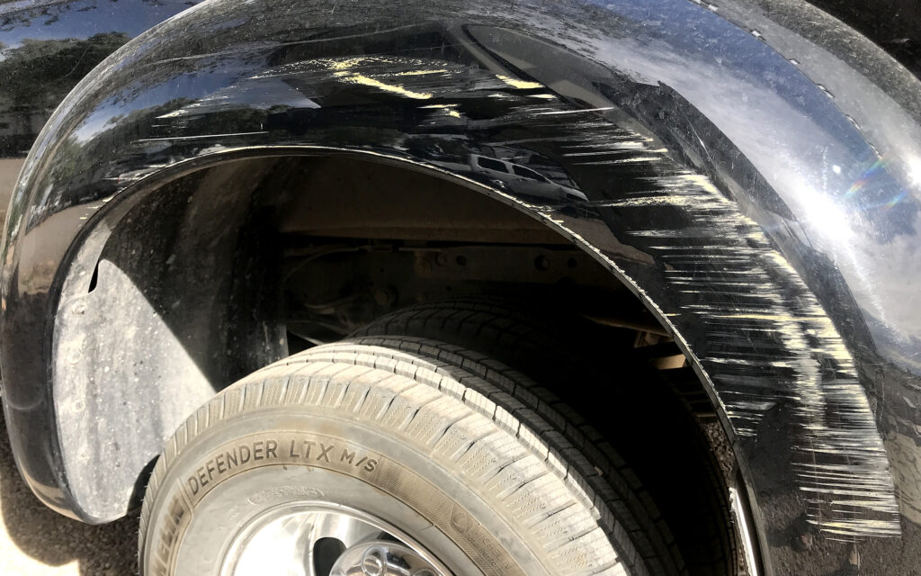
Oops! My wide fenders didn’t quite make it through the bank’s narrow drive-thru.
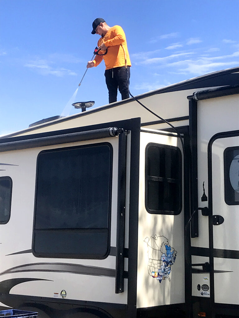
The trailer was in need of a good wash and wax so I hired Tony’s Mobile Auto Detailing because I’d seen them working on the motorhome next to me. Two men spent an entire day washing and hand-waxing the trailer and truck.
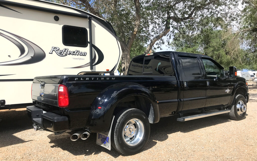
It’s hard to tell in this photo but Tony did a great job on both my vehicles.
By now it was the beginning of June and time to move again. This time I’m headed north to Colorado.
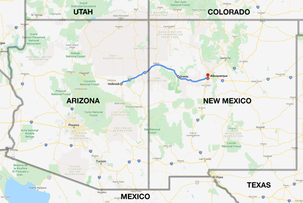
My 235-mile route from Holbrook, Arizona to Albuquerque, New Mexico.
Next post: Minor surgery in Colorado and nothing to see in Kansas.

My name is Lindsay Reed and I’m a photographer and retired graphic artist with a passion for both lighthouses and road trips. I am living as a full-time solo RVer in my 33 foot Grand Design Reflection Fifth Wheel trailer and plan to spend the next few years traveling the U.S. and Canada photographing not only lighthouses, but everything else there is to see in this wonderful land. I hope you enjoy my blog and will follow my adventures in the months and years ahead.
One thought on “Northern New Mexico”
Great pics…wish I could do this!